MyTopo
Snook Texas US Topo Map
Couldn't load pickup availability
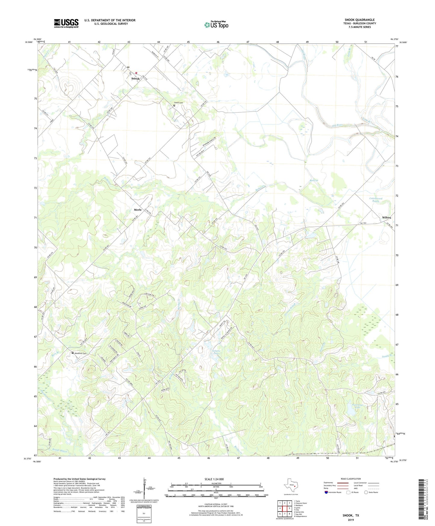
2019 topographic map quadrangle Snook in the state of Texas. Scale: 1:24000. Based on the newly updated USGS 7.5' US Topo map series, this map is in the following counties: Burleson. The map contains contour data, water features, and other items you are used to seeing on USGS maps, but also has updated roads and other features. This is the next generation of topographic maps. Printed on high-quality waterproof paper with UV fade-resistant inks.
Quads adjacent to this one:
West: Lyons
Northwest: Tunis
North: Chances Store
Northeast: Wellborn
East: Clay
Southeast: Independence
South: Gay Hill
Southwest: Somerville
Contains the following named places: Bare Branch, Bare Branch Church, Bethel Creek, Burleson County Constable's Office Precinct 2, City of Snook, Cottonwood Bayou, Czech Church, Gourd Branch, Grassy Slough, Hutchings Dam, Hutchings Lake, Koontz Bayou Drain, Little Flock, Little Flock Church, Long Branch, Merle, Money Chapel, Old River Division, Red Cut, Rough Bayou, Sandy Branch, Schutte Lake, Schutte Lake Dam, Snock Cemetery, Snook, Snook Post Office, Snook Volunteer Fire Department, Wilcox, Woodfork Cemetery, ZIP Codes: 77878, 77879