MyTopo
Gay Hill Texas US Topo Map
Couldn't load pickup availability
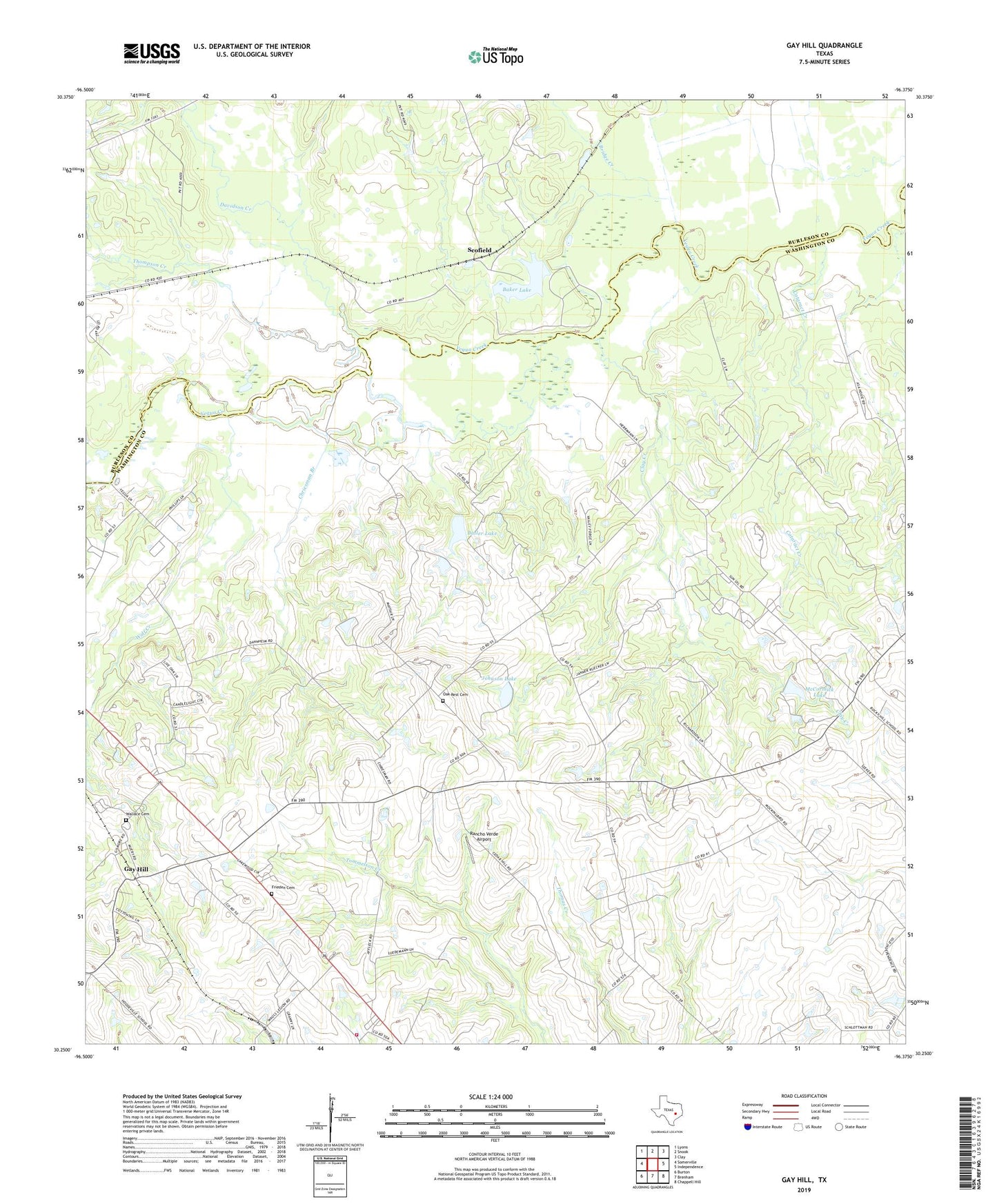
2022 topographic map quadrangle Gay Hill in the state of Texas. Scale: 1:24000. Based on the newly updated USGS 7.5' US Topo map series, this map is in the following counties: Washington, Burleson. The map contains contour data, water features, and other items you are used to seeing on USGS maps, but also has updated roads and other features. This is the next generation of topographic maps. Printed on high-quality waterproof paper with UV fade-resistant inks.
Quads adjacent to this one:
West: Somerville
Northwest: Lyons
North: Snook
Northeast: Clay
East: Independence
Southeast: Chappell Hill
South: Brenham
Southwest: Burton
This map covers the same area as the classic USGS quad with code o30096c4.
Contains the following named places: Baker Lake, Baker Lake Dam, Bridge Creek, Butler Lake, Butler Lake Dam, Cataract Creek, Chriesman Branch, Clay Creek, Clay Creek Oil Field, Dallas Oil Field, Davidson Creek, Frieden Cemetery, Frieden Church, Gay Hill, Gay Hill-Independence Division, Johnson Lake, Johnson Lake Dam, McCormick Lake, McCormick Lake Dam, Oak Rest Cemetery, Old Gay Hill Church, Old Yegua Creek, Prairie Hill School, Rancho Verde Airport, Red House, Saint Peter Church, Scofield, Thompson Creek, Wallace Cemetery, Wolf Creek