MyTopo
Somerville Texas US Topo Map
Couldn't load pickup availability
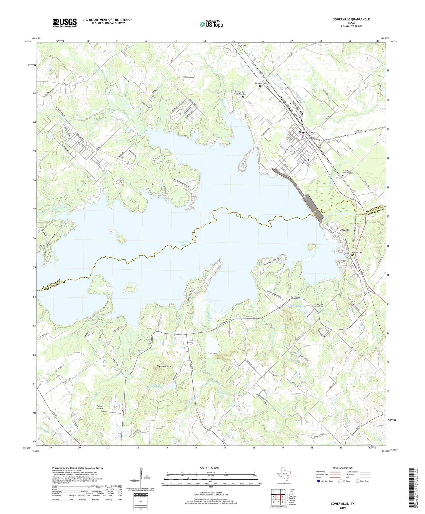
2019 topographic map quadrangle Somerville in the state of Texas. Scale: 1:24000. Based on the newly updated USGS 7.5' US Topo map series, this map is in the following counties: Washington, Burleson. The map contains contour data, water features, and other items you are used to seeing on USGS maps, but also has updated roads and other features. This is the next generation of topographic maps. Printed on high-quality waterproof paper with UV fade-resistant inks.
Quads adjacent to this one:
West: Flag Pond
Northwest: Frenstat
North: Lyons
Northeast: Snook
East: Gay Hill
Southeast: Brenham
South: Burton
Southwest: Carmine
Contains the following named places: Big Creek, Big Creek Park, Birch Creek, Brushy Creek, Burns Creek, City of Somerville, Gay Hill Farm Airport, Graveyard Crossing Cemetery, Green Mountain, Hopewell Church, Jerdelle Creek, Johnsons Mountain Lake, Johnsons Mountain Lake Dam, Little Big Creek, Lucky Star Ranch Airport, Mexican Cemetery Association Cemetery, Mount Zion Church, Oak Lawn Cemetery, Old Rocky Creek, Overlook Park, Quarry, Rehburg, Robbins Lake, Robbins Lake Dam, Rocky Creek Park, Rocky Creek Volunteer Fire Department, Rocky Park, Saint Josephs EMS Medic 22 Station, Salty Creek, Sandy Branch, Schoppe Cemetery, Shepherd Mountain, Somerville, Somerville City Hall, Somerville Dam, Somerville Division, Somerville Lake, Somerville Police Department, Somerville Post Office, Sommerville Volunteer Fire Department, Sweet Home Church, Sweet Water Creek, Twisted T Field, Welch Park, Williams Cemetery, Yegua Creek Park, Yegua Creek Park Nature Trail, Zion Hill Church