MyTopo
South Bend Texas US Topo Map
Couldn't load pickup availability
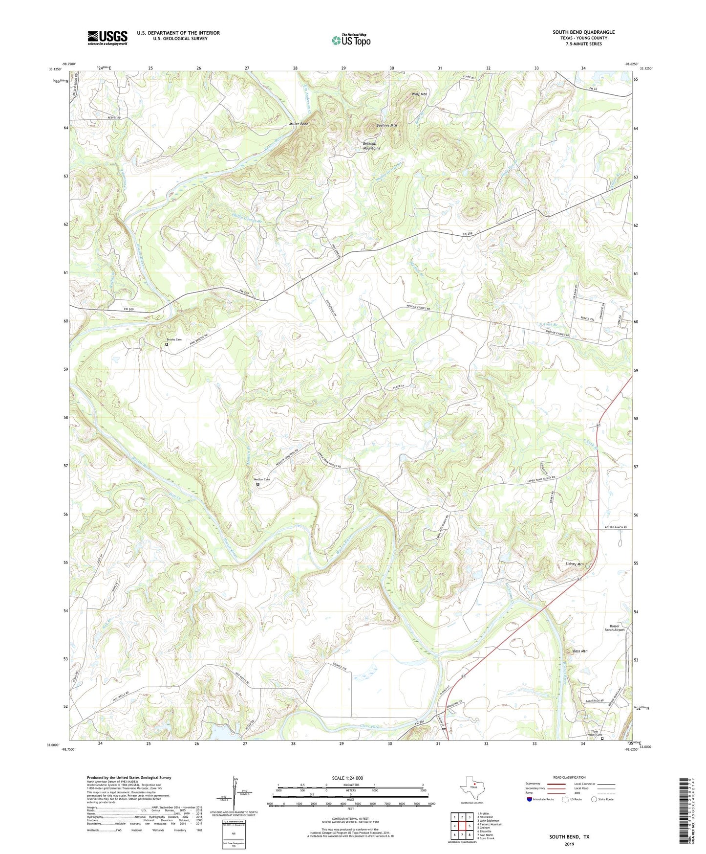
2019 topographic map quadrangle South Bend in the state of Texas. Scale: 1:24000. Based on the newly updated USGS 7.5' US Topo map series, this map is in the following counties: Young. The map contains contour data, water features, and other items you are used to seeing on USGS maps, but also has updated roads and other features. This is the next generation of topographic maps. Printed on high-quality waterproof paper with UV fade-resistant inks.
Quads adjacent to this one:
West: Tackett Mountain
Northwest: Proffitt
North: Newcastle
Northeast: Lake Eddleman
East: Graham
Southeast: Cove Creek
South: Ivan North
Southwest: Eliasville
Contains the following named places: Bass Mountain, Beehive Mountain, Belknap Mountains, Brooks Cemetery, Clear Fork Brazos River, Fish Creek, Graham Division, Graham Lake, Graham Lake Dam, Jim Anderson Creek, Kickapoo Creek, Medlan Branch, Medlan Cemetery, Medlan Chapel, Miller Bend, Phillip George Branch, Ratliff Branch, Rosser Ranch Airport, Salt Branch, Sidney Mountain, South Bend, South Bend Post Office, Timmons Creek, Tonk Valley Church, Wolf Mountain