MyTopo
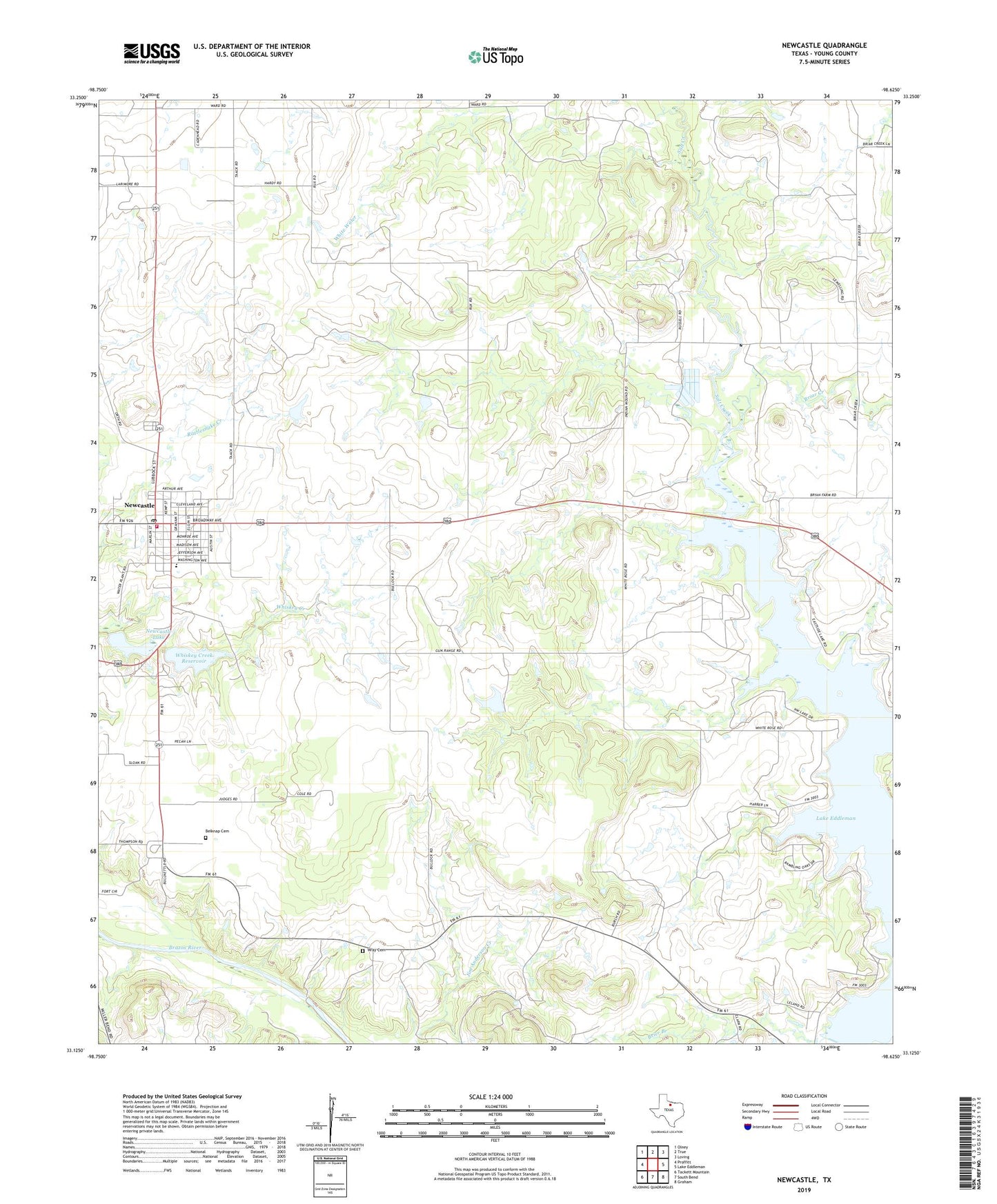
Newcastle Texas US Topo Map
Couldn't load pickup availability
2022 topographic map quadrangle Newcastle in the state of Texas. Scale: 1:24000. Based on the newly updated USGS 7.5' US Topo map series, this map is in the following counties: Young. The map contains contour data, water features, and other items you are used to seeing on USGS maps, but also has updated roads and other features. This is the next generation of topographic maps. Printed on high-quality waterproof paper with UV fade-resistant inks.
Quads adjacent to this one:
West: Proffitt
Northwest: Olney
North: TRUE
Northeast: Loving
East: Lake Eddleman
Southeast: Graham
South: South Bend
Southwest: Tackett Mountain
This map covers the same area as the classic USGS quad with code o33098b6.
Contains the following named places: Belknap, Belknap Cemetery, Belknap Mine Number 1, Belknap Mine Number 2, Belknap Mine Number 3, Belknap Mine Number 4, Belknap Mine Number 5, Briar Creek, Brier Branch, City of Newcastle, Fort Belknap State Park, Indian Mound Cemetery, Johnston Lake, Johnston Lake Dam, Little Salt Creek, Mule Pen Branch, Newcastle, Newcastle City Hall, Newcastle Dam, Newcastle Lake, Newcastle Post Office, Whiskey Creek Dam, Whiskey Creek Reservoir, Wray Cemetery, Young County, Young County Rural Volunteer Fire Department Station 1