MyTopo
Spohn Ranch Texas US Topo Map
Couldn't load pickup availability
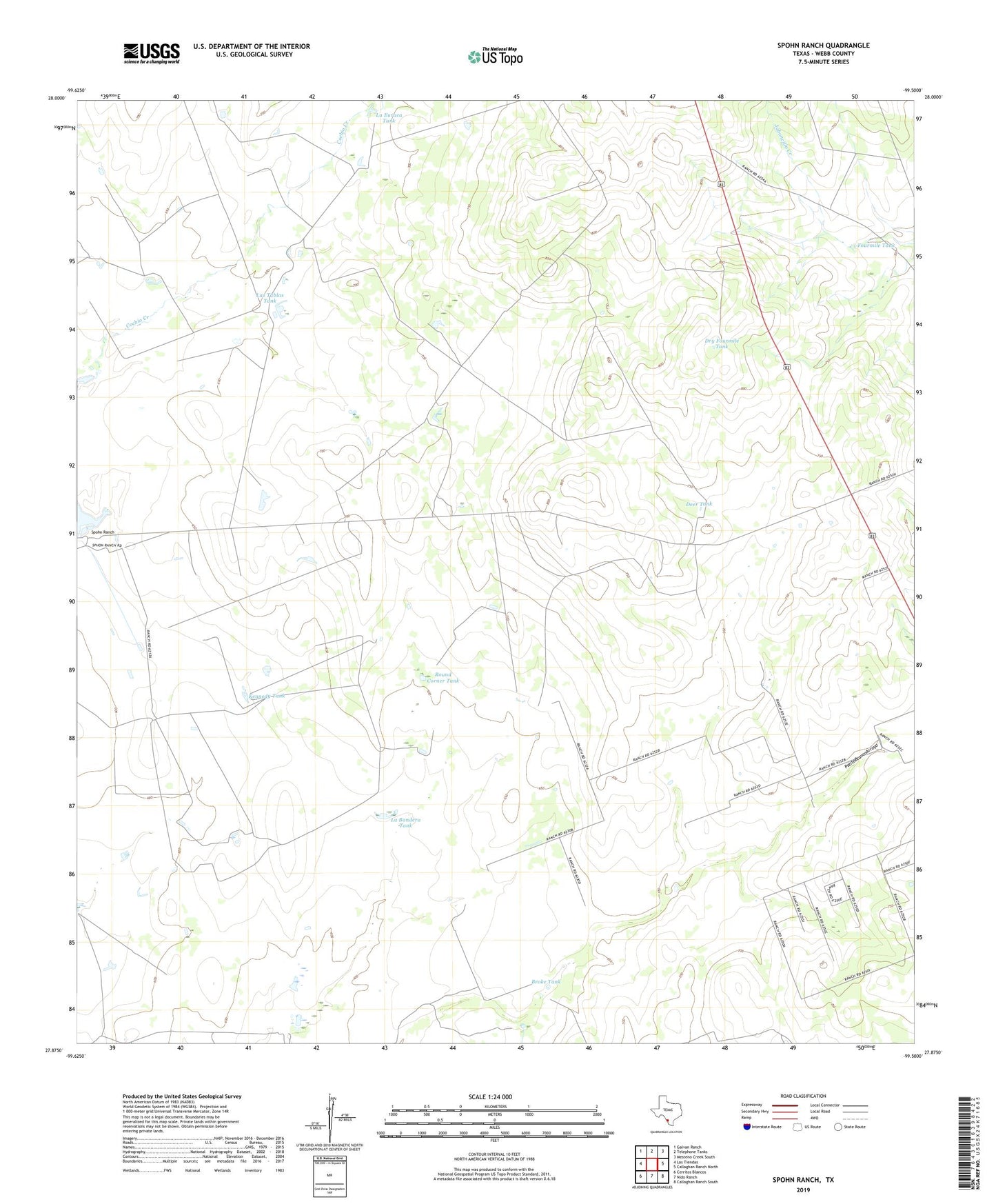
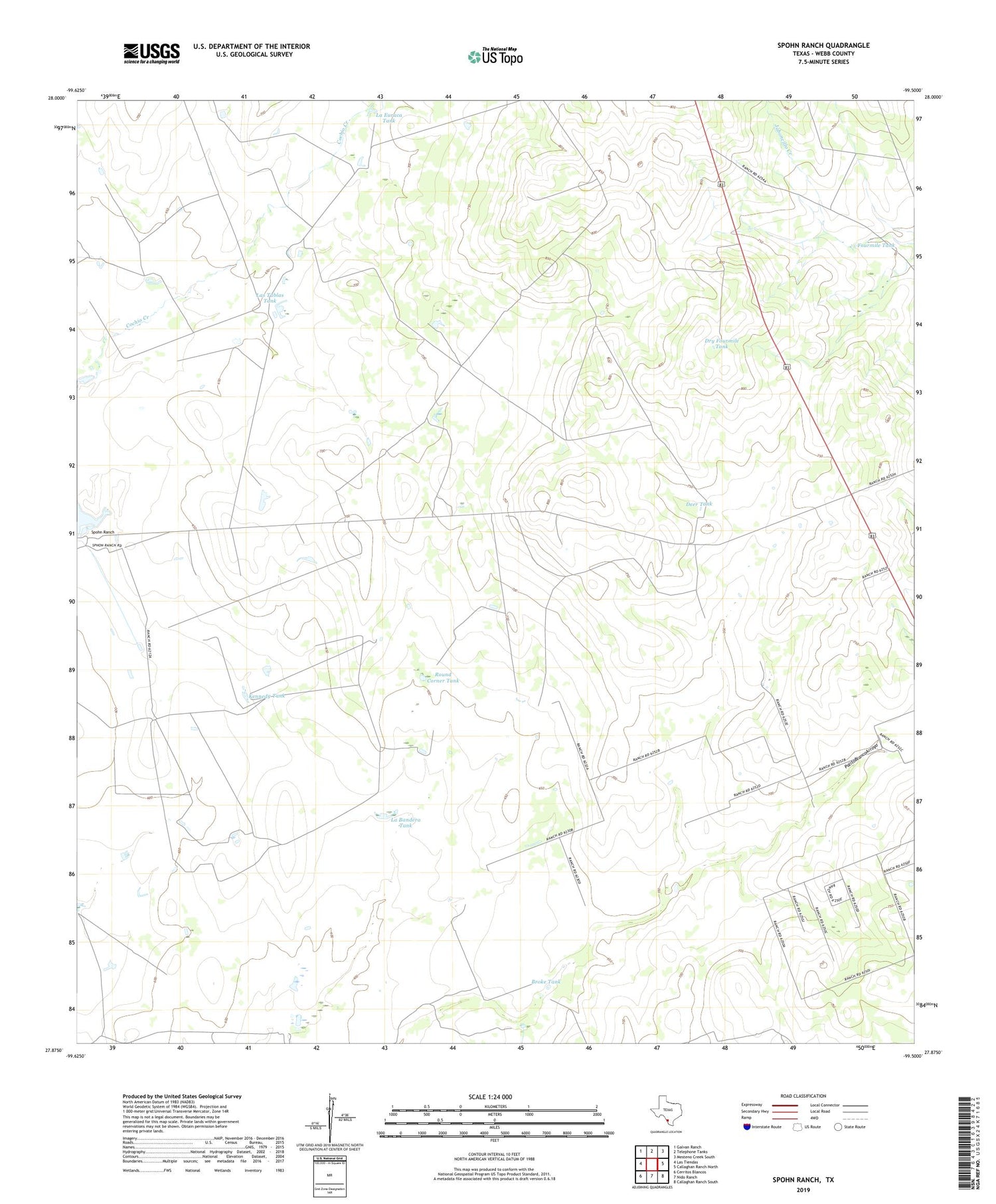
2019 topographic map quadrangle Spohn Ranch in the state of Texas. Scale: 1:24000. Based on the newly updated USGS 7.5' US Topo map series, this map is in the following counties: Webb. The map contains contour data, water features, and other items you are used to seeing on USGS maps, but also has updated roads and other features. This is the next generation of topographic maps. Printed on high-quality waterproof paper with UV fade-resistant inks.
Quads adjacent to this one:
West: Las Tiendas
Northwest: Galvan Ranch
North: Telephone Tanks
Northeast: Mesteno Creek South
East: Callaghan Ranch North
Southeast: Callaghan Ranch South
South: Nido Ranch
Southwest: Cerritos Blancos
Contains the following named places: Broke Tank, Coleman Windmill, Deer Tank, Dry Fourmile Tank, Florete Windmill, Fourmile Tank, Jefferies Ranch, Kennedy Ranch, Kennedy Tank, La Bandera Tank, La Euraca Tank, La Moca Ranch Census Designated Place, La Moca Ranch Colonia, Las Tablas Tank, Round Corner Tank, Spohn Ranch