
MyTopo
Star Mountain Texas US Topo Map
Couldn't load pickup availability
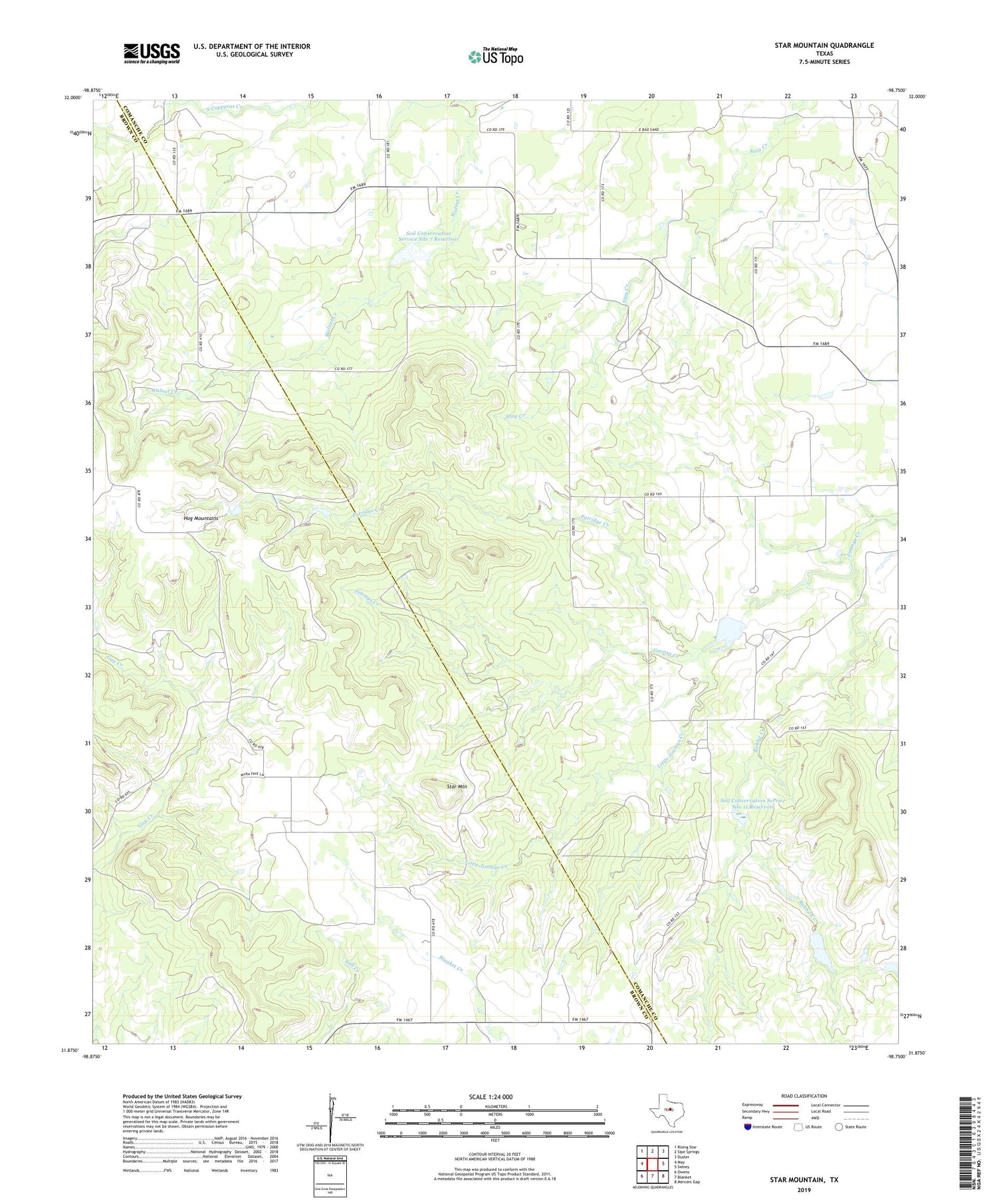
2019 topographic map quadrangle Star Mountain in the state of Texas. Scale: 1:24000. Based on the newly updated USGS 7.5' US Topo map series, this map is in the following counties: Comanche, Brown. The map contains contour data, water features, and other items you are used to seeing on USGS maps, but also has updated roads and other features. This is the next generation of topographic maps. Printed on high-quality waterproof paper with UV fade-resistant inks.
Quads adjacent to this one:
West: May
Northwest: Rising Star
North: Sipe Springs
Northeast: Duster
East: Sidney
Southeast: Mercers Gap
South: Blanket
Southwest: Owens
Contains the following named places: Hog Mountains, Little Jimmys Creek, Patridge Creek, Rabbit Creek, Soil Conservation Service Site 10 Dam, Soil Conservation Service Site 10 Reservoir, Soil Conservation Service Site 11 Dam, Soil Conservation Service Site 11 Reservoir, Soil Conservation Service Site 7 Dam, Soil Conservation Service Site 7 Reservoir, Stag Creek Community Center, Star Mountain, ZIP Code: 76474


