MyTopo
Mercers Gap Texas US Topo Map
Couldn't load pickup availability
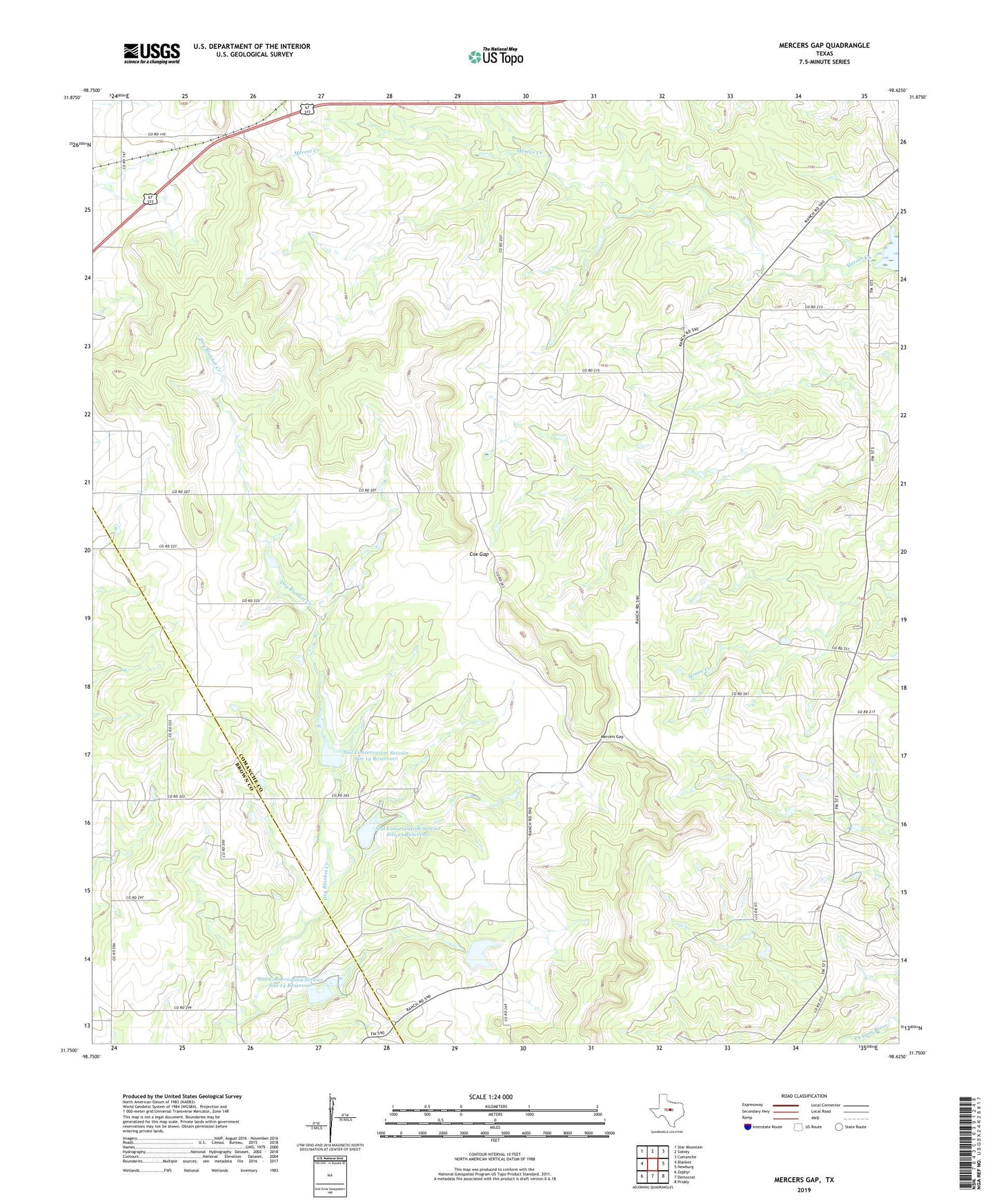
2022 topographic map quadrangle Mercers Gap in the state of Texas. Scale: 1:24000. Based on the newly updated USGS 7.5' US Topo map series, this map is in the following counties: Comanche, Brown. The map contains contour data, water features, and other items you are used to seeing on USGS maps, but also has updated roads and other features. This is the next generation of topographic maps. Printed on high-quality waterproof paper with UV fade-resistant inks.
Quads adjacent to this one:
West: Blanket
Northwest: Star Mountain
North: Sidney
Northeast: Comanche
East: Newburg
Southeast: Priddy
South: Democrat
Southwest: Zephyr
This map covers the same area as the classic USGS quad with code o31098g6.
Contains the following named places: Cox Gap, Mercers Gap, Soil Conservation Service Site 12 Dam, Soil Conservation Service Site 12 Reservoir, Soil Conservation Service Site 13 Dam, Soil Conservation Service Site 13 Reservoir, Soil Conservation Service Site 14 Dam, Soil Conservation Service Site 14 Reservoir, Watson, White Point Church, White Point Church Cemetery, Willis Lake, Willis Lake Dam