MyTopo
Duster Texas US Topo Map
Couldn't load pickup availability
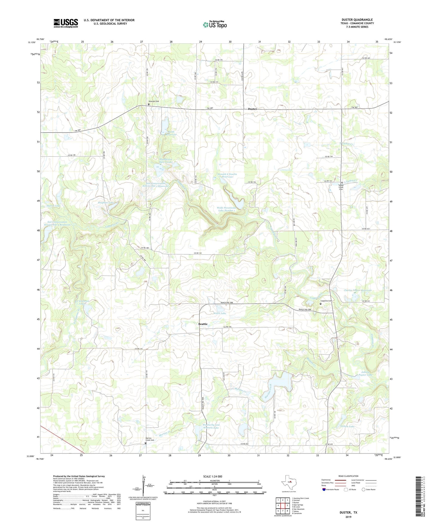
2022 topographic map quadrangle Duster in the state of Texas. Scale: 1:24000. Based on the newly updated USGS 7.5' US Topo map series, this map is in the following counties: Comanche. The map contains contour data, water features, and other items you are used to seeing on USGS maps, but also has updated roads and other features. This is the next generation of topographic maps. Printed on high-quality waterproof paper with UV fade-resistant inks.
Quads adjacent to this one:
West: Sipe Springs
Northwest: Hunting Shirt Creek
North: Gorman
Northeast: Rucker
East: De Leon
Southeast: Comanche
South: Sidney
Southwest: Star Mountain
This map covers the same area as the classic USGS quad with code o32098a6.
Contains the following named places: A T Gilchrest Dam, A T Gilchrest Lake, Beattie, Bethel Church, Bingham Dam, Bingham Lake, Charles Taylor Dam, Charles Taylor Reservoir, Copperas Cemetery, Donald A Nowlin Dam, Donald A Nowlin Reservoir, Duster, Dutton Dam, Dutton Lake, Huddleston Dam A, Huddleston Dam A Lake, Johnny Poynor Dam, Johnny Poynor Lake, Keith Dam, Keith Reservoir, Martins Creek, Martins Creek Cemetery, Nichols Dam, Nichols Lake, Ninevah Cemetery, Sand Hill Church, Soda Springs Community Hall, Soil Conservation Service Site 4 Dam, Soil Conservation Service Site 4 Reservoir, Soil Conservation Service Site 5 Reservoir, Soil Conservation Service Site 9 Dam, Soil Conservation Service Site 9 Reservoir, Soil Conservation Service Site Number 5 Dam, South Copperas Creek, Taylors Chapel, Turkey Creek Cemetery, Weatherby and Womack Dam, Weatherby and Womack Lake, Welch Lake, Welch Lake Dam, Wolfe Pecanlands Lake Number 1, Wolfe Pecanlands Lake Number 1 Dam