MyTopo
Stoneburg Texas US Topo Map
Couldn't load pickup availability
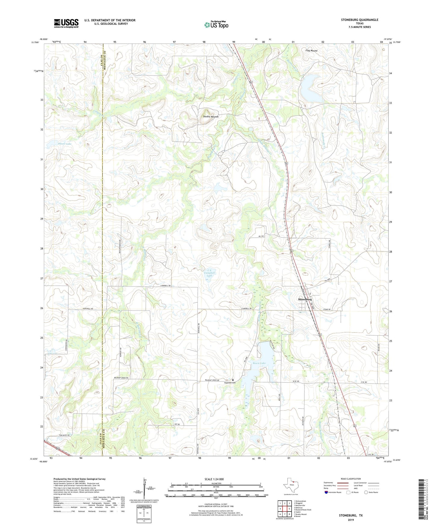
2019 topographic map quadrangle Stoneburg in the state of Texas. Scale: 1:24000. Based on the newly updated USGS 7.5' US Topo map series, this map is in the following counties: Montague, Clay. The map contains contour data, water features, and other items you are used to seeing on USGS maps, but also has updated roads and other features. This is the next generation of topographic maps. Printed on high-quality waterproof paper with UV fade-resistant inks.
Quads adjacent to this one:
West: Bellevue
Northwest: Dickworsham
North: Ringgold
Northeast: Belcherville
East: Buzzard Roost Knob
Southeast: Bowie
South: Brushy Mound
Southwest: Vashti
Contains the following named places: Bowie Lake, Bowie Lake Dam, C E Campbell Lake, C E Campbell Lake Dam, Canyon Creek, Double Mounds, Flag Mound, Hopewell Cemetery, Karnes City Public Library, Middle Belknap Creek, Plaxco Lake, Plaxco Lake Dam, Stoneburg, Underwood Ray Oil Field, West Belknap Creek