MyTopo
Brushy Mound Texas US Topo Map
Couldn't load pickup availability
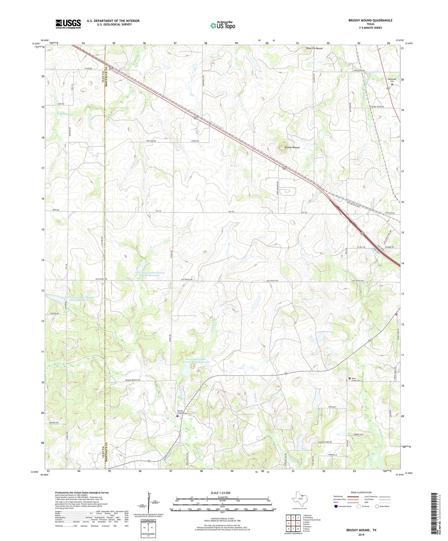
2022 topographic map quadrangle Brushy Mound in the state of Texas. Scale: 1:24000. Based on the newly updated USGS 7.5' US Topo map series, this map is in the following counties: Montague, Clay. The map contains contour data, water features, and other items you are used to seeing on USGS maps, but also has updated roads and other features. This is the next generation of topographic maps. Printed on high-quality waterproof paper with UV fade-resistant inks.
Quads adjacent to this one:
West: Vashti
Northwest: Bellevue
North: Stoneburg
Northeast: Buzzard Roost Knob
East: Bowie
Southeast: Sunset
South: Selma
Southwest: Newport
This map covers the same area as the classic USGS quad with code o33097e8.
Contains the following named places: Anson Oil Field, Boedeker Oil Field, Bowie Rural Volunteer Fire Department, Brier Creek Cemetery, Brushy Mound, Dead Ox Mound, East Prairie Branch, McDonald Cemetery, Prairie Branch Cemetery, Soil Conservation Service Site 5a Dam, Soil Conservation Service Site 5a Reservoir, Soil Conservation Service Site 5b Dam, Soil Conservation Service Site 5b Reservoir, Soil Conservation Service Site 6 Dam, Soil Conservation Service Site 6 Reservoir, ZIP Code: 76230