MyTopo
Stowell Texas US Topo Map
Couldn't load pickup availability
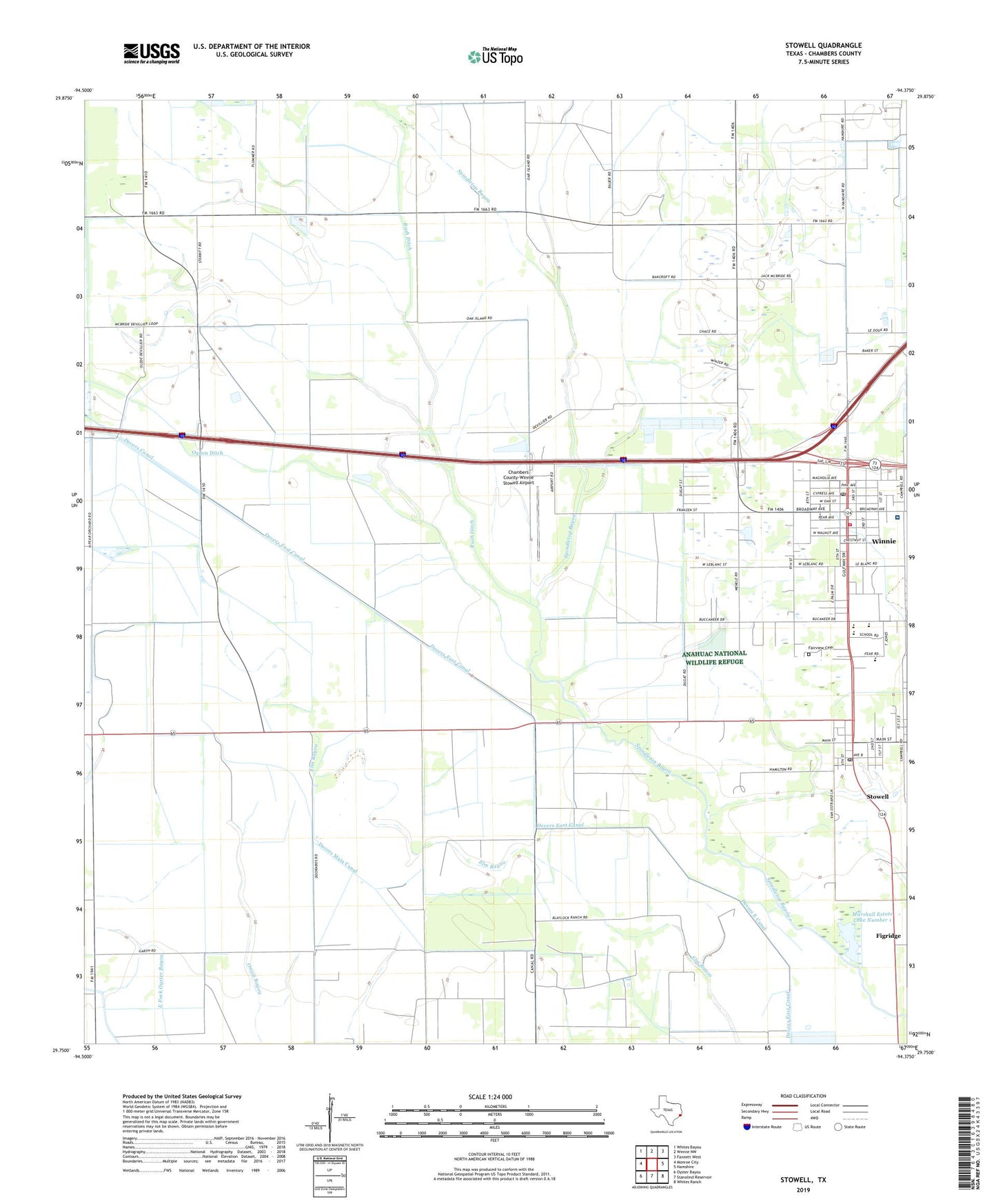
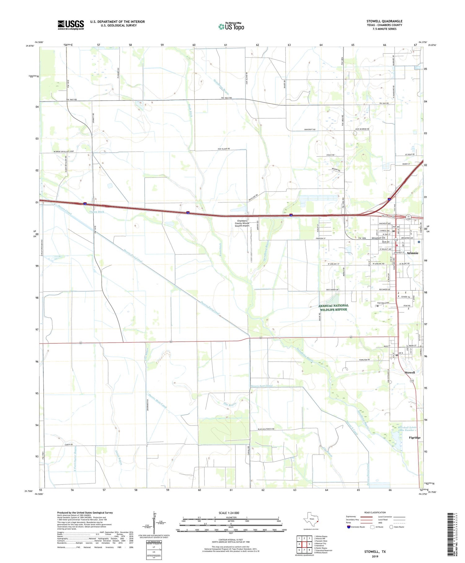
2019 topographic map quadrangle Stowell in the state of Texas. Scale: 1:24000. Based on the newly updated USGS 7.5' US Topo map series, this map is in the following counties: Chambers. The map contains contour data, water features, and other items you are used to seeing on USGS maps, but also has updated roads and other features. This is the next generation of topographic maps. Printed on high-quality waterproof paper with UV fade-resistant inks.
Quads adjacent to this one:
West: Monroe City
Northwest: Whites Bayou
North: Winnie NW
Northeast: Fannett West
East: Hamshire
Southeast: Whites Ranch
South: Stanolind Reservoir
Southwest: Oyster Bayou
Contains the following named places: Chambers County Constable's Office Precinct 1, Chambers County Park, Chambers County-Winnie Stowell Airport, Devers East Canal, Fairview Cemetery, Figridge, M and M Winnie Airport, Marshall Estate Dam Number 1, Marshall Estate Lake Number 1, Ogden Ditch, Riceland Medical Center, Rush Ditch, Saint Luke Church, Sea Breeze Oil Field, Stowell, Stowell Census Designated Place, Stowell Post Office, Winnie, Winnie - Stowell Volunteer Fire Department, Winnie Census Designated Place, Winnie Post Office, Winnie-Stowell Division, ZIP Codes: 77661, 77665