MyTopo
Swiss Alp Texas US Topo Map
Couldn't load pickup availability
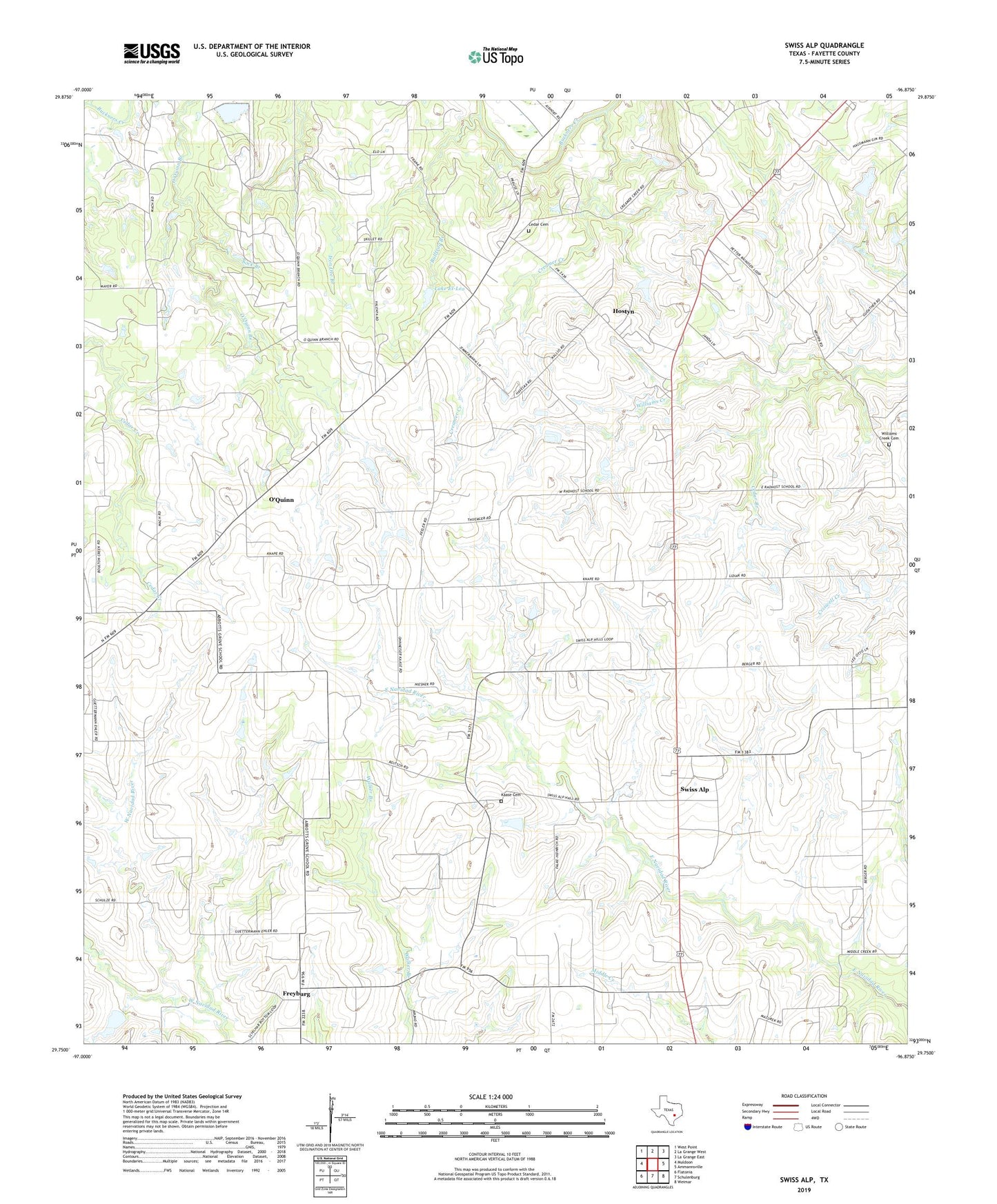
2019 topographic map quadrangle Swiss Alp in the state of Texas. Scale: 1:24000. Based on the newly updated USGS 7.5' US Topo map series, this map is in the following counties: Fayette. The map contains contour data, water features, and other items you are used to seeing on USGS maps, but also has updated roads and other features. This is the next generation of topographic maps. Printed on high-quality waterproof paper with UV fade-resistant inks.
Quads adjacent to this one:
West: Muldoon
Northwest: West Point
North: La Grange West
Northeast: La Grange East
East: Ammannsville
Southeast: Weimar
South: Schulenburg
Southwest: Flatonia
Contains the following named places: Bullfrog Branch, Carrollton Public Library, Cedar Branch, Cedar Cemetery, Cockrell Hill Public Library, Creamer Creek, Duncanville Public Library, East Branch Library, Freyburg, Hostyn, Kaase Cemetery, Lake El-Leo, Lake El-Leo Dam, Mount Eliza Building, O'Quinn, Philadelphia Church, Prairie Creek, Sock Branch, Swiss Alp, Trinity Church, Williams Creek Cemetery