MyTopo
Ammannsville Texas US Topo Map
Couldn't load pickup availability
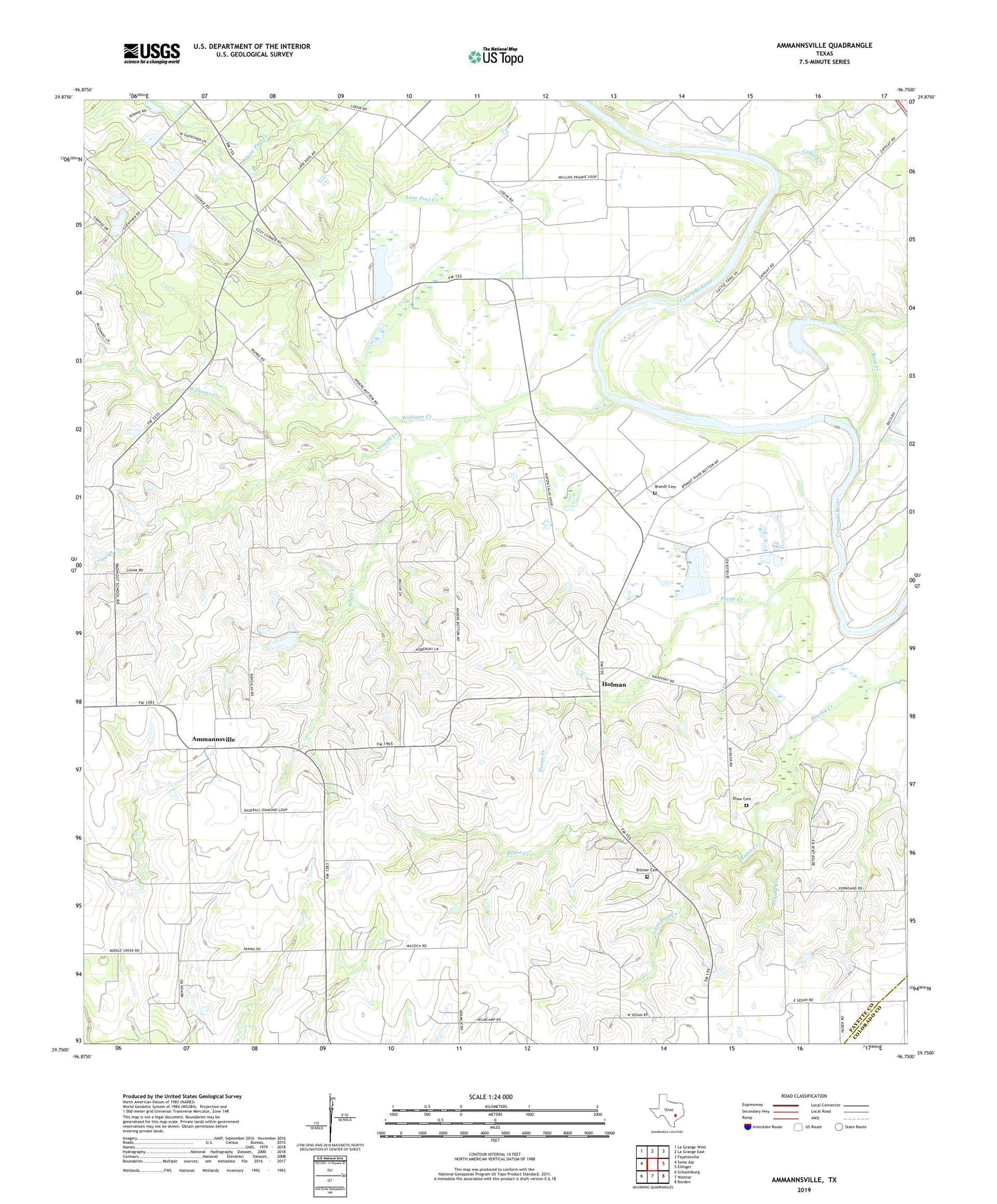
2022 topographic map quadrangle Ammannsville in the state of Texas. Scale: 1:24000. Based on the newly updated USGS 7.5' US Topo map series, this map is in the following counties: Fayette, Colorado. The map contains contour data, water features, and other items you are used to seeing on USGS maps, but also has updated roads and other features. This is the next generation of topographic maps. Printed on high-quality waterproof paper with UV fade-resistant inks.
Quads adjacent to this one:
West: Swiss Alp
Northwest: La Grange West
North: La Grange East
Northeast: Fayetteville
East: Ellinger
Southeast: Borden
South: Weimar
Southwest: Schulenburg
This map covers the same area as the classic USGS quad with code o29096g7.
Contains the following named places: Ammannsville, Baylor Creek, Bethlehem Church, Bittner Cemetery, Brandt Cemetery, Cedar Creek, Cozy Corner, Criswell Creek, Dallas West Branch Library, DeSoto Public Library, Farmers Branch Manske Public Library, Fretz Park Branch Library, Hampton - Illinois Branch Library, Highland Hills Branch Library, Highland Park Library, Holman, Hostyn School, Lakewood Branch Library, Lane Pool Creek, Mullins Prairie, Pecan Creek, Pecan School, Roper Creek, Ross Creek, Saint John the Baptist Catholic Church, Saint Paul Church, Saint Paul Creek, Saint Wenceslaus Church, Shaw Cemetery, White Creek, Williams Creek