MyTopo
Tankersley Texas US Topo Map
Couldn't load pickup availability
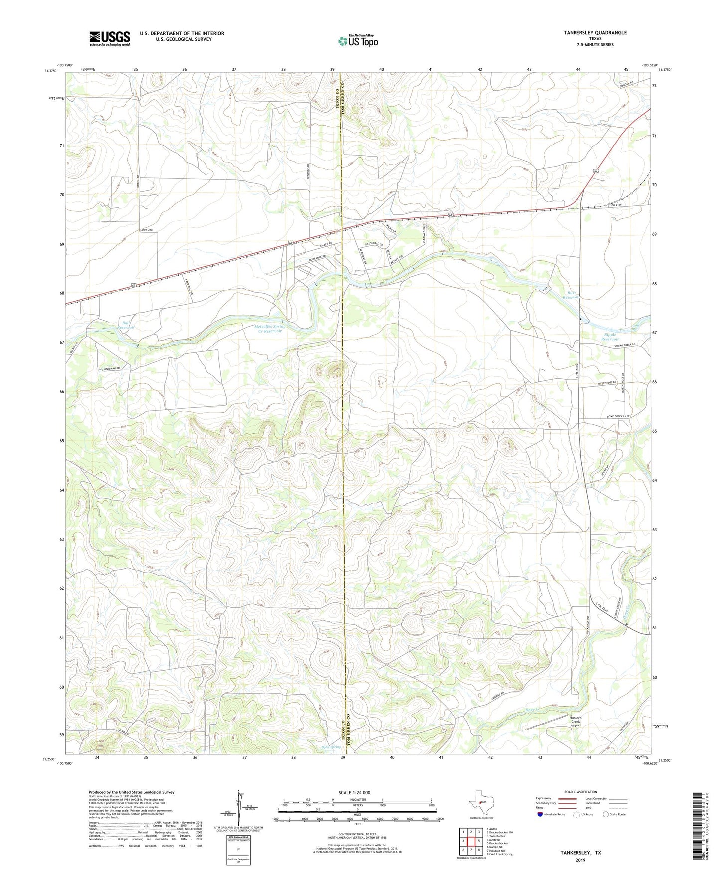
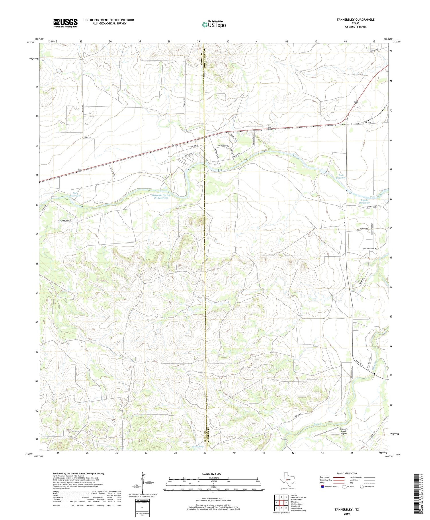
2019 topographic map quadrangle Tankersley in the state of Texas. Scale: 1:24000. Based on the newly updated USGS 7.5' US Topo map series, this map is in the following counties: Tom Green, Irion. The map contains contour data, water features, and other items you are used to seeing on USGS maps, but also has updated roads and other features. This is the next generation of topographic maps. Printed on high-quality waterproof paper with UV fade-resistant inks.
Quads adjacent to this one:
West: Mertzon
Northwest: Arden
North: Knickerbocker NW
Northeast: Twin Buttes
East: Knickerbocker
Southeast: Cold Creek Spring
South: Hulldale NW
Southwest: Noelke NE
Contains the following named places: Ball Dam, Ball Reservoir, Bryant Ranch, Bull Run Creek, Byler Spring, Hughes Ranch, Hunter's Creek Airport, Metcalfes Spring Creek Dam, Metcalfes Spring Creek Reservoir, Rust Dam, Rust Reservoir, Tankersley, Tankersley-Twin Mountain School, Tweedy Ranch