MyTopo
Twin Buttes Texas US Topo Map
Couldn't load pickup availability
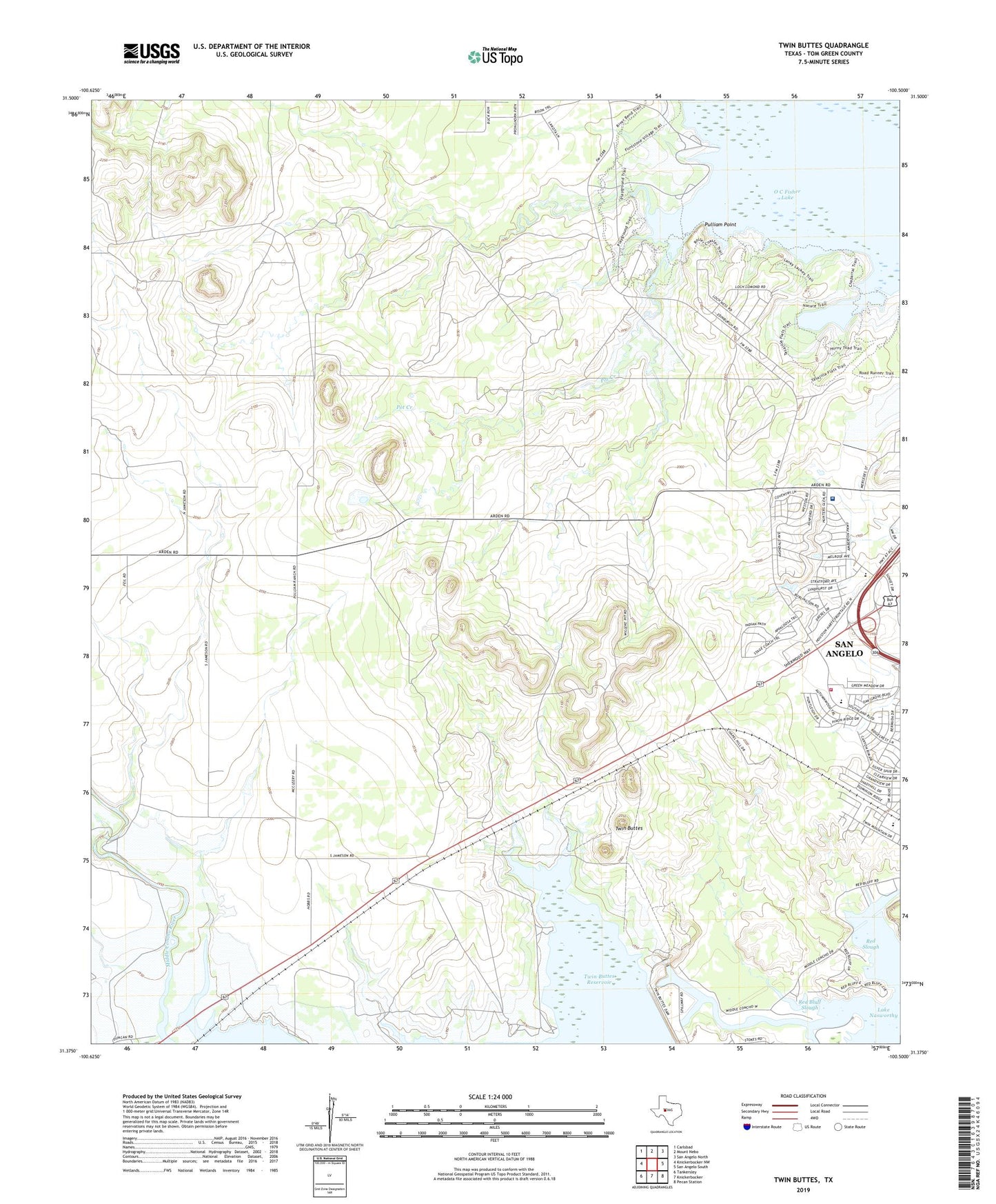
2022 topographic map quadrangle Twin Buttes in the state of Texas. Scale: 1:24000. Based on the newly updated USGS 7.5' US Topo map series, this map is in the following counties: Tom Green. The map contains contour data, water features, and other items you are used to seeing on USGS maps, but also has updated roads and other features. This is the next generation of topographic maps. Printed on high-quality waterproof paper with UV fade-resistant inks.
Quads adjacent to this one:
West: Knickerbocker NW
Northwest: Carlsbad
North: Mount Nebo
Northeast: San Angelo North
East: San Angelo South
Southeast: Pecan Station
South: Knickerbocker
Southwest: Tankersley
This map covers the same area as the classic USGS quad with code o31100d5.
Contains the following named places: Bonham Elementary School, Chapel-on-the-Hill, KBIL-FM (San Angelo), KSJT-FM (San Angelo), Lincoln Park, Middle Concho River, O C Fisher Lake, Pot Creek, Pulliam Oil Field, Pulliam Point, Red Bluff Park, Red Bluff Slough, Red Slough, River Crest Hospital, San Angelo Fire Department Station 2, San Angelo State Park - South Shore, San Angelo State Park Trail, Twin Buttes, Twin Buttes Dam, West Tom Green Division