MyTopo
Knickerbocker Texas US Topo Map
Couldn't load pickup availability
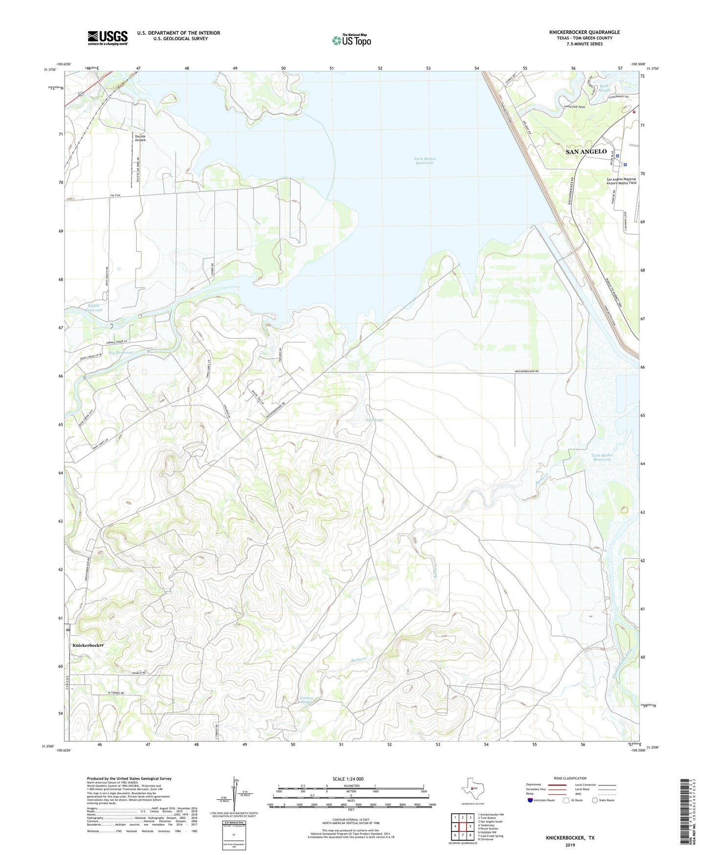
2022 topographic map quadrangle Knickerbocker in the state of Texas. Scale: 1:24000. Based on the newly updated USGS 7.5' US Topo map series, this map is in the following counties: Tom Green. The map contains contour data, water features, and other items you are used to seeing on USGS maps, but also has updated roads and other features. This is the next generation of topographic maps. Printed on high-quality waterproof paper with UV fade-resistant inks.
Quads adjacent to this one:
West: Tankersley
Northwest: Knickerbocker NW
North: Twin Buttes
Northeast: San Angelo South
East: Pecan Station
Southeast: Christoval
South: Cold Creek Spring
Southwest: Hulldale NW
This map covers the same area as the classic USGS quad with code o31100c5.
Contains the following named places: Boys Ranch West Texas, Dove Creek, Ducote Airpark, Fry Dam, Fry Reservoir, Ketchum Spring, Knickerbocker, Knickerbocker Post Office, Negro Crossing, Ripple Dam, Ripple Reservoir, Rock Slough, San Angelo Airport Police Department, San Angelo Army Air Field, San Angelo Fire Department Station 8, San Angelo Police Department Lake Police Division, San Angelo Regional Airport/Mathis Field, Spring Creek, Twin Buttes Reservoir, United States Border Patrol Station, XQZ Lake, XQZ Lake Dam, XQZ Ranch, ZIP Code: 76939