MyTopo
The Basin Texas US Topo Map
Couldn't load pickup availability
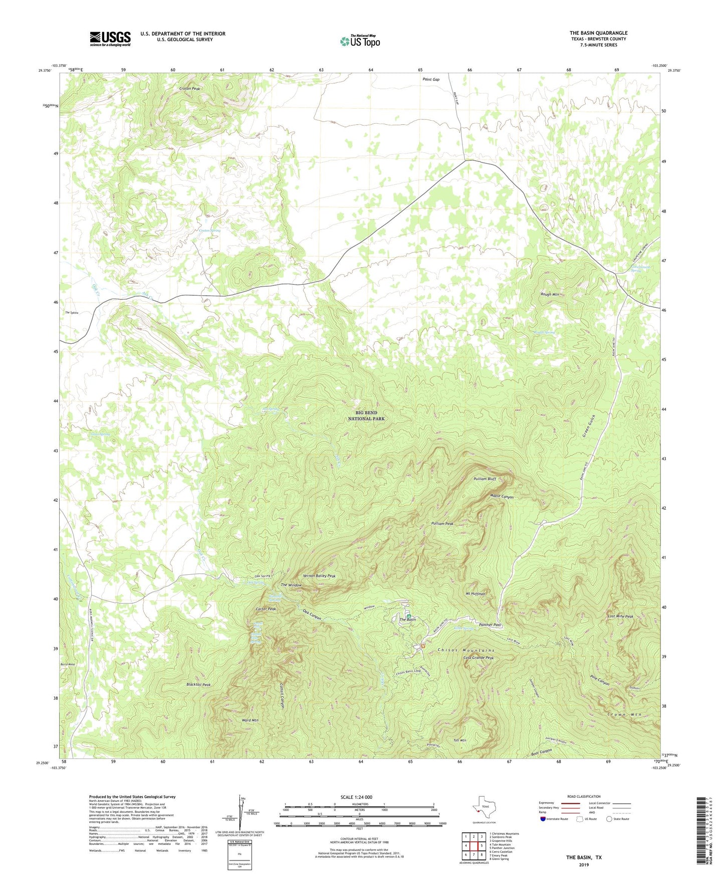
2019 topographic map quadrangle The Basin in the state of Texas. Scale: 1:24000. Based on the newly updated USGS 7.5' US Topo map series, this map is in the following counties: Brewster. The map contains contour data, water features, and other items you are used to seeing on USGS maps, but also has updated roads and other features. This is the next generation of topographic maps. Printed on high-quality waterproof paper with UV fade-resistant inks.
Quads adjacent to this one:
West: Tule Mountain
Northwest: Christmas Mountains
North: Sombrero Peak
Northeast: Grapevine Hills
East: Panther Junction
Southeast: Glenn Spring
South: Emory Peak
Southwest: Cerro Castellan
Contains the following named places: Ash Creek, Ash Spring, Basin Junction, Basin Loop, Blacktail Peak, Boot Canyon, Carter Peak, Casa Grande Peak, Cattail Canyon, Cattail Falls, Cattail Falls Spring, Chisos Mountain Lodge, Croton Peak, Croton Spring, Crown Mountain, Gano Spring, Government Spring, Juniper Canyon Trail, Kibbe Spring, Lost Mine Peak, Lost Mine Trail, Maple Canyon, Mount Huffman, Oak Canyon, Oak Spring, Old Ranch, Paint Gap, Panther Pass, Pulliam Bluff, Pulliam Peak, Rough Mountain, Rough Spring, The Basin, The Window, The Window Trail, Toll Mountain, Vernon Bailey Peak, Ward Mountain, Window Springs