MyTopo
Sombrero Peak Texas US Topo Map
Couldn't load pickup availability
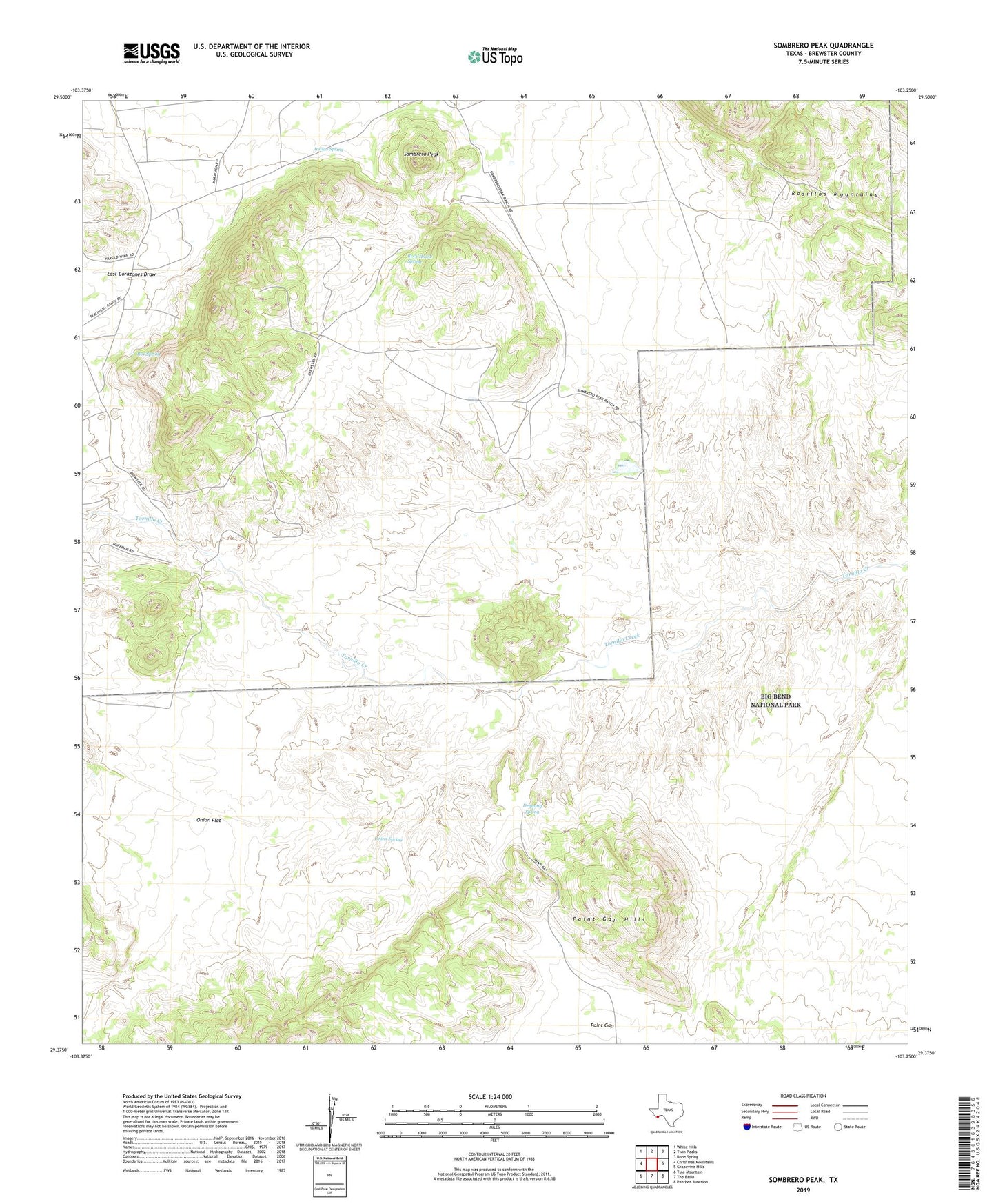
2022 topographic map quadrangle Sombrero Peak in the state of Texas. Scale: 1:24000. Based on the newly updated USGS 7.5' US Topo map series, this map is in the following counties: Brewster. The map contains contour data, water features, and other items you are used to seeing on USGS maps, but also has updated roads and other features. This is the next generation of topographic maps. Printed on high-quality waterproof paper with UV fade-resistant inks.
Quads adjacent to this one:
West: Christmas Mountains
Northwest: White Hills
North: Twin Peaks
Northeast: Bone Spring
East: Grapevine Hills
Southeast: Panther Junction
South: The Basin
Southwest: Tule Mountain
This map covers the same area as the classic USGS quad with code o29103d3.
Contains the following named places: Box Spring, Dripping Spring, Indian Spring, Matthews Ranch, Onion Flat, Onion Spring, Paint Gap Hills, Rock House Spring, Smallpox Well, Sombrero Peak, Sombrero Peak Ranch, Stillwell Ranch