MyTopo
Panther Junction Texas US Topo Map
Couldn't load pickup availability
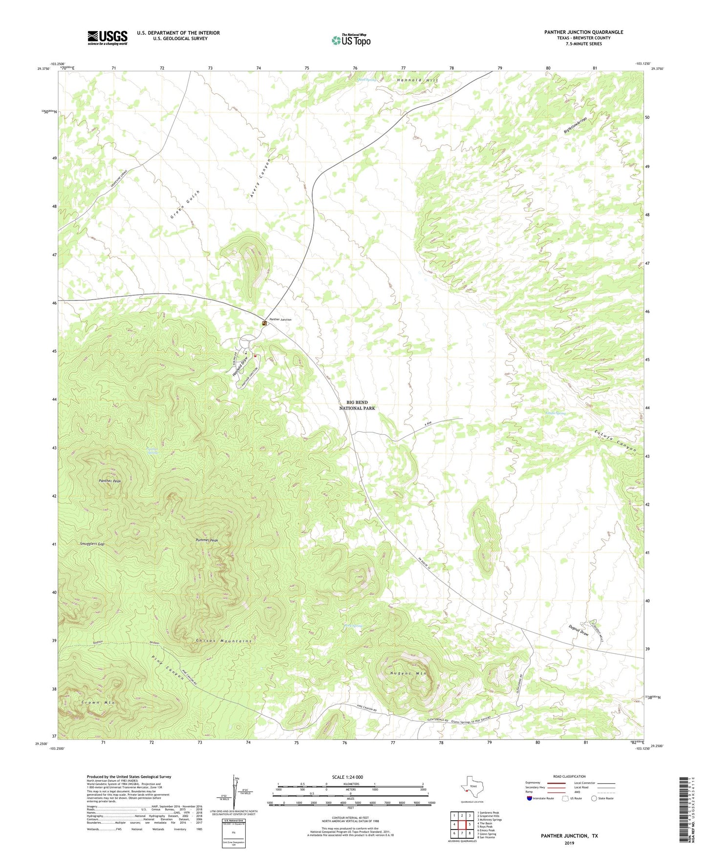
2022 topographic map quadrangle Panther Junction in the state of Texas. Scale: 1:24000. Based on the newly updated USGS 7.5' US Topo map series, this map is in the following counties: Brewster. The map contains contour data, water features, and other items you are used to seeing on USGS maps, but also has updated roads and other features. This is the next generation of topographic maps. Printed on high-quality waterproof paper with UV fade-resistant inks.
Quads adjacent to this one:
West: The Basin
Northwest: Sombrero Peak
North: Grapevine Hills
Northeast: McKinney Springs
East: Roys Peak
Southeast: San Vicente
South: Glenn Spring
Southwest: Emory Peak
This map covers the same area as the classic USGS quad with code o29103c2.
Contains the following named places: Big Bend National Park, Big Bend National Park Fire Department, Big Bend National Park Post Office, Chihuahuan Desert Nature Trail, Chihuahuan Desert Research Station, Dugout Wells, Estufa Spring, Green Gulch, Lone Mountain, Nina Marie Seawell Hannold Gravesite, Nugent Mountain, Panther Junction, Panther Peak, Panther Spring, Park Headquarters, Pine Canyon, Pine Canyon Trail, Pummel Peak, Quail Spring, Reynolds Well, Rock Spring, San Vicente School, Smugglers Gap, United States Border Patrol Substation, Wright Mountain