MyTopo
Thrall Texas US Topo Map
Couldn't load pickup availability
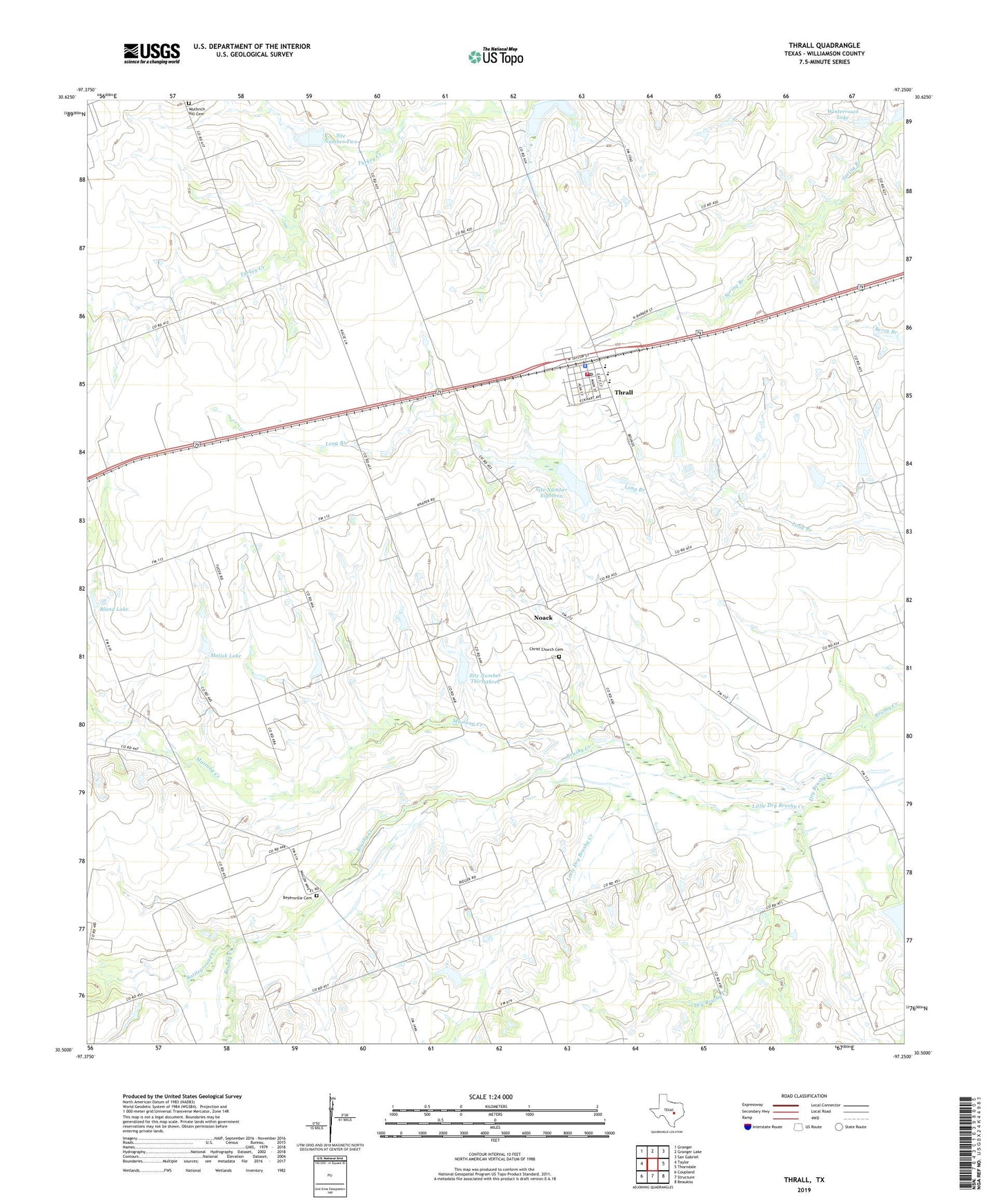
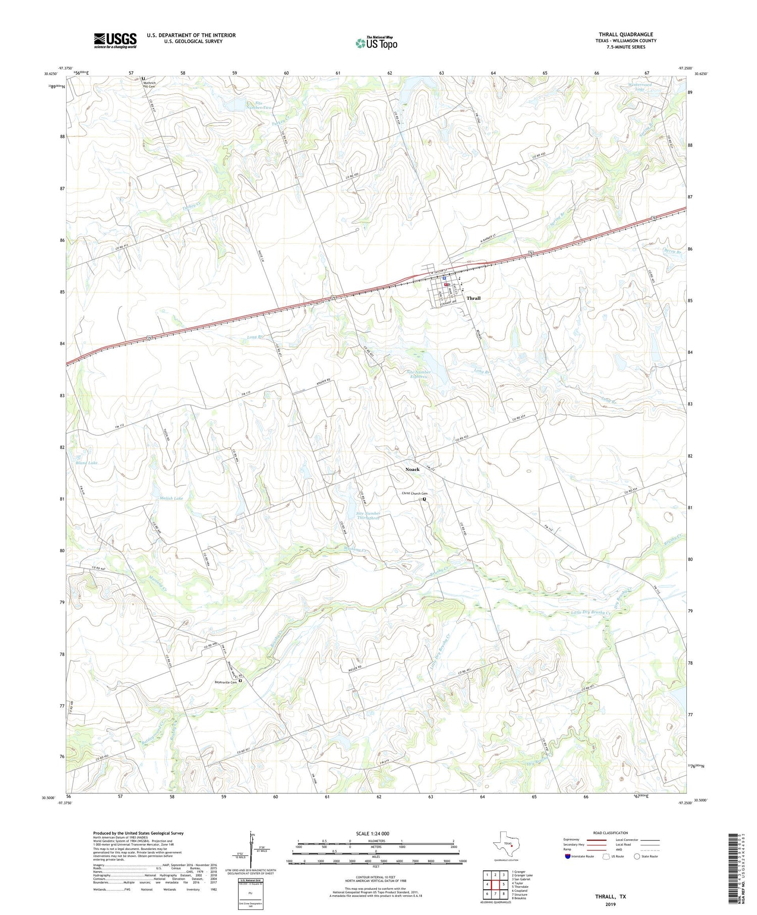
2019 topographic map quadrangle Thrall in the state of Texas. Scale: 1:24000. Based on the newly updated USGS 7.5' US Topo map series, this map is in the following counties: Williamson. The map contains contour data, water features, and other items you are used to seeing on USGS maps, but also has updated roads and other features. This is the next generation of topographic maps. Printed on high-quality waterproof paper with UV fade-resistant inks.
Quads adjacent to this one:
West: Taylor
Northwest: Granger
North: Granger Lake
Northeast: San Gabriel
East: Thorndale
Southeast: Beaukiss
South: Structure
Southwest: Coupland
Contains the following named places: Battleground Creek, Beyersville, Beyersville Cemetery, Beyersville Oil Field, Bland Lake, Bland Lake Dam, Brenni Lake Dam, Christ Church, Christ Church Cemetery, City of Thrall, Coupland Museum, Dry Brushy Creek, Little Dry Brushy Creek, Malish Lake, Malish Lake Dam, Mustang Creek, New Bern Hall, Noack, Noack Oil Field, Site Number Eighteen, Site Number Four A, Site Number Seventeen, Site Number Thirtythree, Site Number Two, Soil Conservation Service Site 17 Dam, Soil Conservation Service Site 17 Reservoir, Soil Conservation Service Site 18 Dam, Soil Conservation Service Site 2 Dam, Soil Conservation Service Site 33 Dam, Thrall, Thrall City Hall, Thrall Elementary School, Thrall High School, Thrall Oil Field, Thrall Police Department, Thrall Post Office, Thrall Volunteer Fire Department, Winterrowd Lake, Winterrowd Lake Dam, Wuthrich Hill Cemetery