MyTopo
Coupland Texas US Topo Map
Couldn't load pickup availability
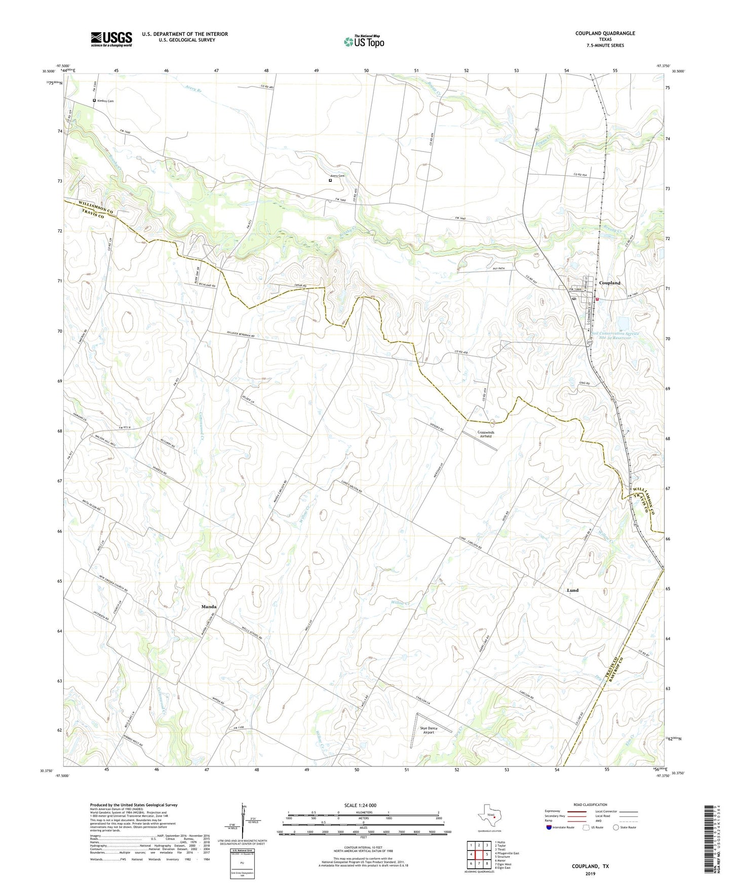
2022 topographic map quadrangle Coupland in the state of Texas. Scale: 1:24000. Based on the newly updated USGS 7.5' US Topo map series, this map is in the following counties: Travis, Williamson, Bastrop. The map contains contour data, water features, and other items you are used to seeing on USGS maps, but also has updated roads and other features. This is the next generation of topographic maps. Printed on high-quality waterproof paper with UV fade-resistant inks.
Quads adjacent to this one:
West: Pflugerville East
Northwest: Hutto
North: Taylor
Northeast: Thrall
East: Structure
Southeast: Elgin East
South: Elgin West
Southwest: Manor
This map covers the same area as the classic USGS quad with code o30097d4.
Contains the following named places: Avery Branch, Avery Cemetery, Carlson, City of Coupland, Coupland, Coupland Elementary School, Coupland Post Office, Coupland Volunteer Fire Department, Crosswinds Airfield, Kimbro Cemetery, Kimbro Church, Lund, Manda, Norman, Normans Crossing, Rices Crossing, Rices Crossing School, Skye Dance Airport, Soil Conservation Service Site 32 Dam, Soil Conservation Service Site 32 Reservoir, Willow Ranch School, ZIP Code: 78615