MyTopo
Granger Lake Texas US Topo Map
Couldn't load pickup availability
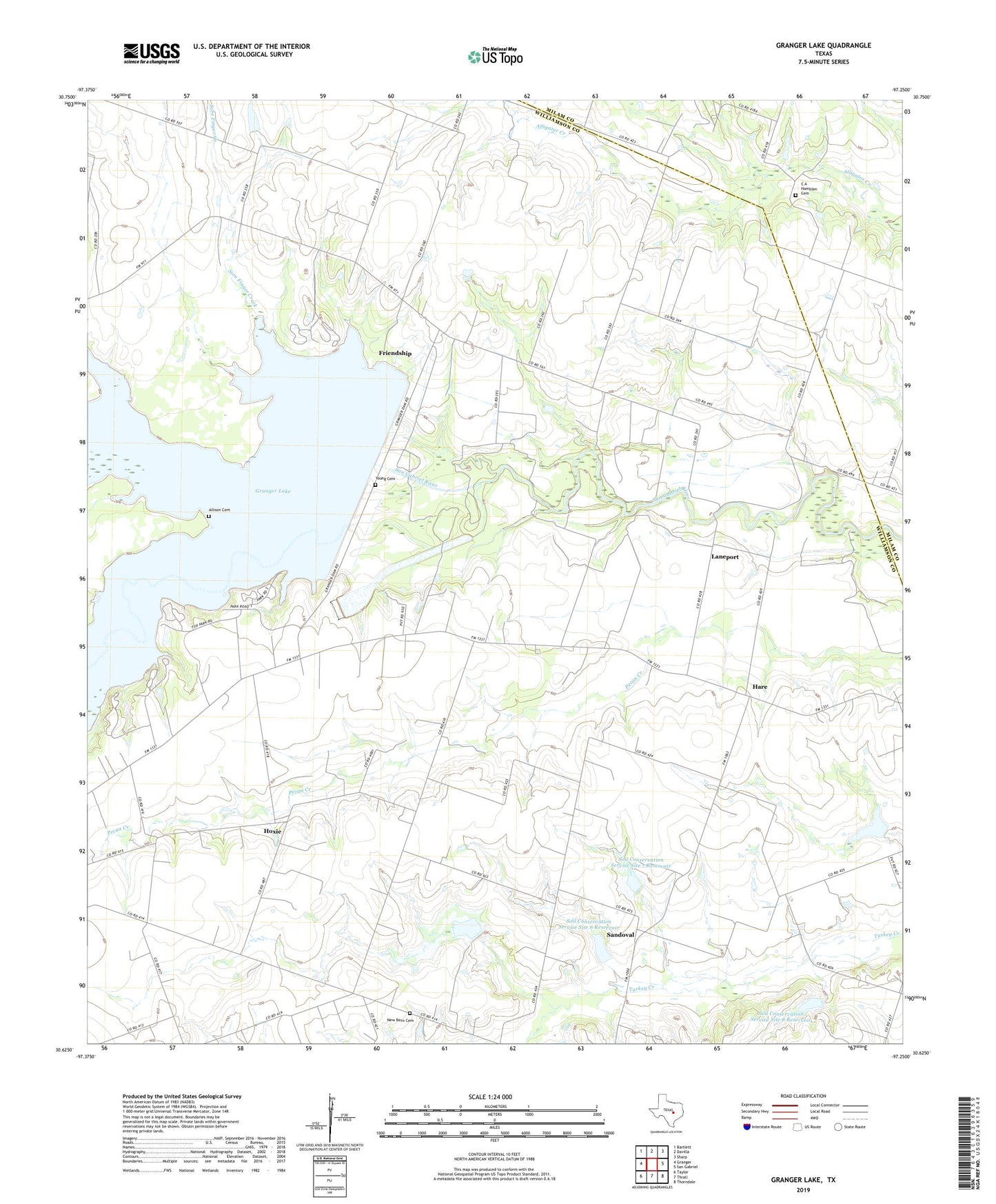
2022 topographic map quadrangle Granger Lake in the state of Texas. Scale: 1:24000. Based on the newly updated USGS 7.5' US Topo map series, this map is in the following counties: Williamson, Milam. The map contains contour data, water features, and other items you are used to seeing on USGS maps, but also has updated roads and other features. This is the next generation of topographic maps. Printed on high-quality waterproof paper with UV fade-resistant inks.
Quads adjacent to this one:
West: Granger
Northwest: Bartlett
North: Davilla
Northeast: Sharp
East: San Gabriel
Southeast: Thorndale
South: Thrall
Southwest: Taylor
This map covers the same area as the classic USGS quad with code o30097f3.
Contains the following named places: Allison Cemetery, C A Hamblen Cemetery, Dam Number 3, Elm Grove, Friendship, Friendship Park, Granger Dam, Granger Lake, Granger Lake - Taylor Park Trail, Granger Wildlife Management Area, Hare, Hejl Lake, Hejl Lake Dam, Hoxie, Laneport, New Bern Cemetery, Pecan Grove Wildlife Area, Sandoval, Soil Conservation Service Site 10 Dam, Soil Conservation Service Site 10 Reservoir, Soil Conservation Service Site 3 Dam, Soil Conservation Service Site 3 Reservoir, Soil Conservation Service Site 4a Dam, Soil Conservation Service Site 4a Reservoir, Soil Conservation Service Site 6 Dam, Soil Conservation Service Site 6 Reservoir, Soil Conservation Service Site 7 Dam, Soil Conservation Service Site 7 Reservoir, Soil Conservation Service Site 8 Dam, Soil Conservation Service Site 8 Reservoir, Sore Finger Creek, Sore Finger Wildlife Area, Taylor Park, Willis Creek, Wilson Fox Park, Wuthrich Hill, Young Cemetery, Zion Church