MyTopo
Togo Texas US Topo Map
Couldn't load pickup availability
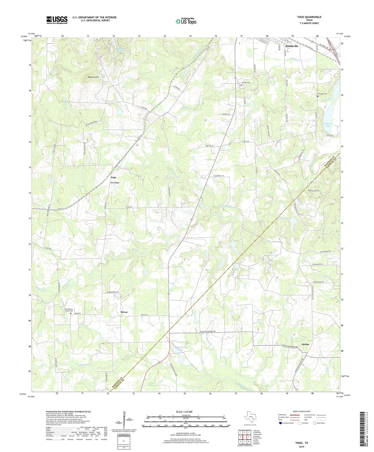
2019 topographic map quadrangle Togo in the state of Texas. Scale: 1:24000. Based on the newly updated USGS 7.5' US Topo map series, this map is in the following counties: Bastrop, Fayette. The map contains contour data, water features, and other items you are used to seeing on USGS maps, but also has updated roads and other features. This is the next generation of topographic maps. Printed on high-quality waterproof paper with UV fade-resistant inks.
Quads adjacent to this one:
West: Rosanky
Northwest: Bastrop
North: Smithville
Northeast: Winchester
East: West Point
Southeast: Muldoon
South: Cistern
Southwest: Jeddo
Contains the following named places: Bartons Creek Church, Colorado, Colorado Cemetery, Czech-Moravian Church, Ellisor Dam, Ellisor Lake, Flower Hill, Fords Prairie, Hickory Creek, Kovar, Lake Creek, Moore Lake, Moore Lake Dam, New Flower Heal Baptist Church, Oak Hill Cemetery, Old Bartons Creek Cemetery, Pea Ridge, Pricklypear Creek, Rod Lake Number 1, Royston Hill, Smithville Division, Smithville High School, Stagners Lake, Stellar, Togo