MyTopo
Torrey Peak Texas US Topo Map
Couldn't load pickup availability
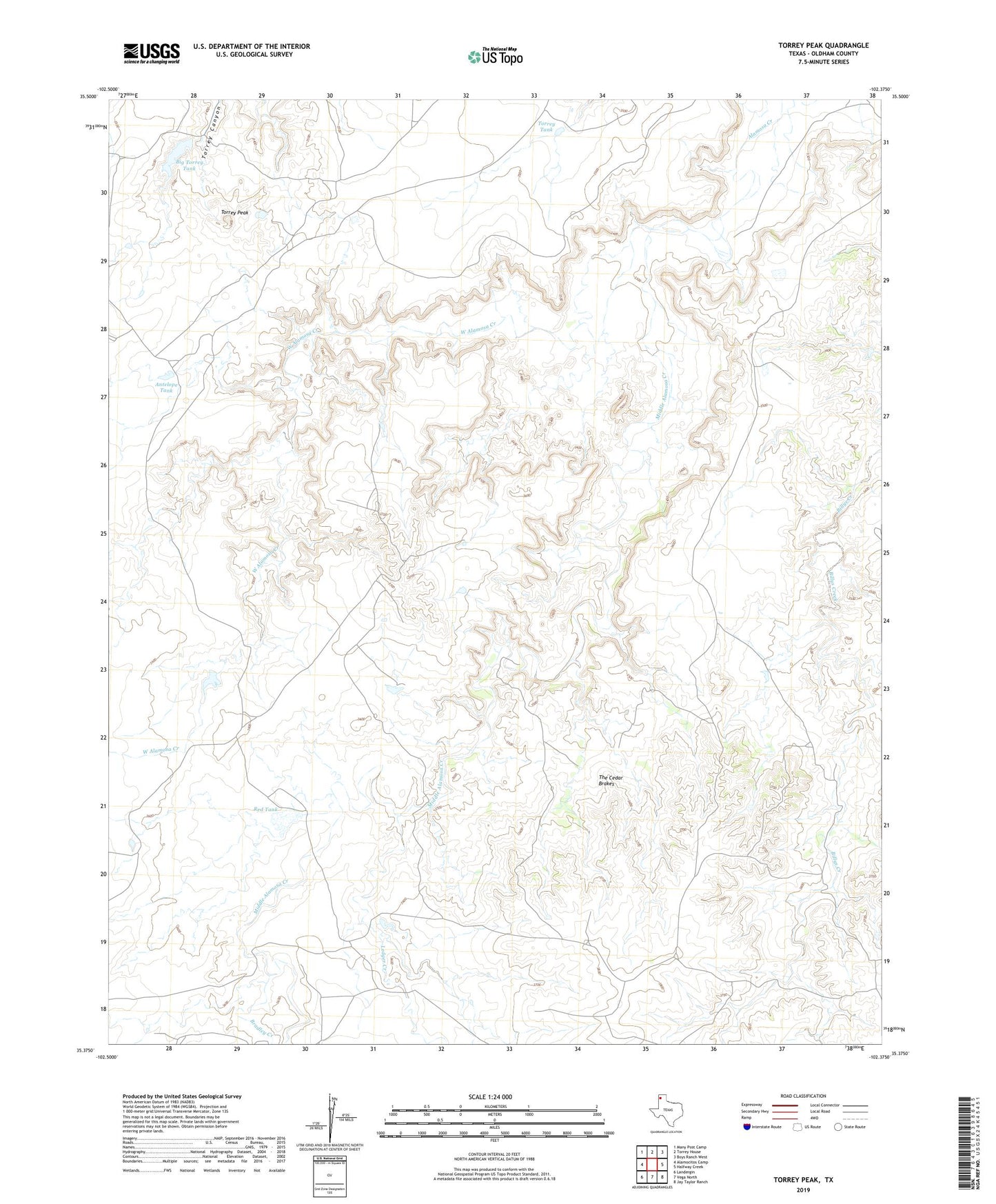
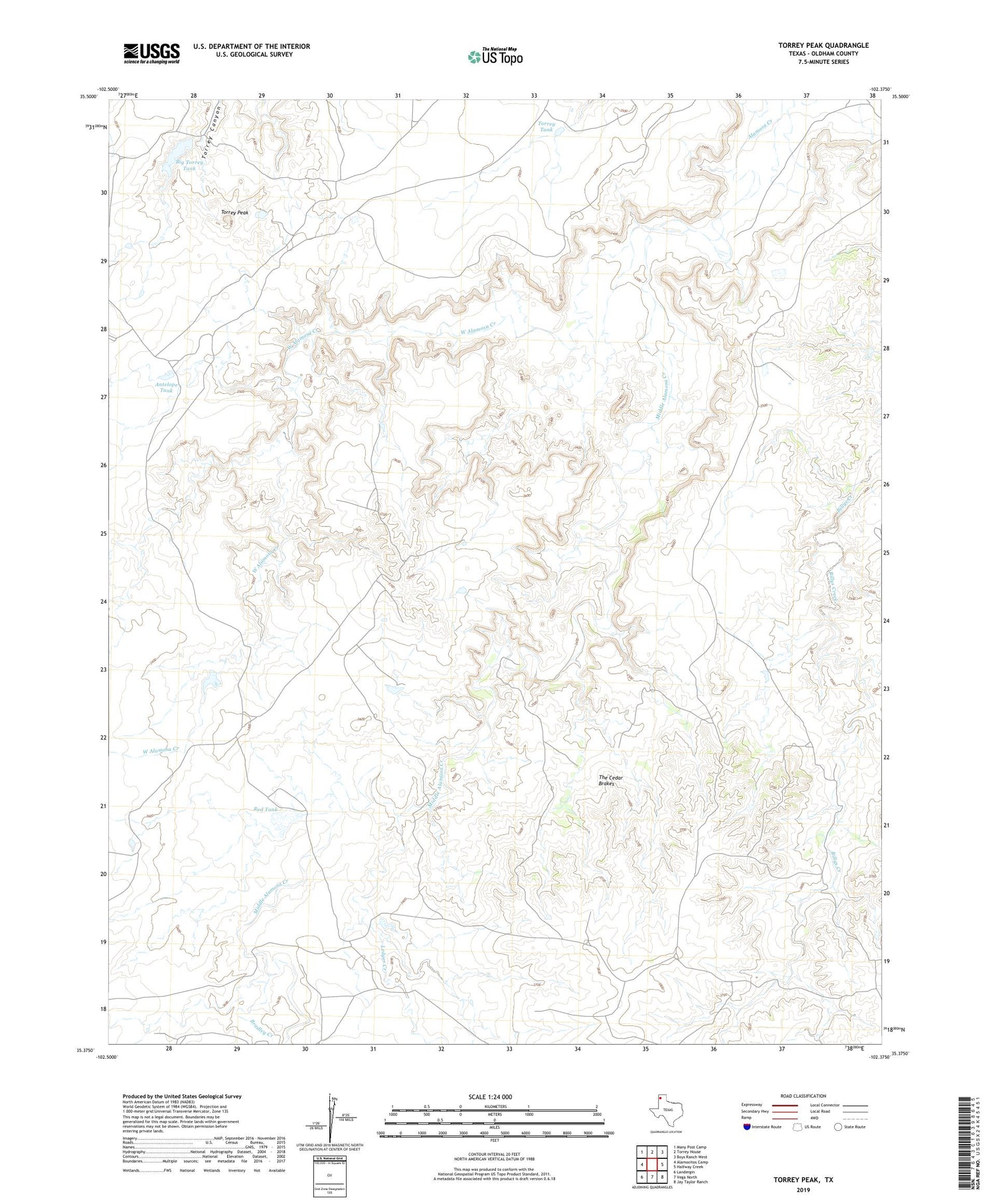
2019 topographic map quadrangle Torrey Peak in the state of Texas. Scale: 1:24000. Based on the newly updated USGS 7.5' US Topo map series, this map is in the following counties: Oldham. The map contains contour data, water features, and other items you are used to seeing on USGS maps, but also has updated roads and other features. This is the next generation of topographic maps. Printed on high-quality waterproof paper with UV fade-resistant inks.
Quads adjacent to this one:
West: Alamocitos Camp
Northwest: Many Post Camp
North: Torrey House
Northeast: Boys Ranch West
East: Halfway Creek
Southeast: Jay Taylor Ranch
South: Vega North
Southwest: Landergin
Contains the following named places: Antelope Tank, Antelope Windmill, Big Cedar Brake Windmill, Big Torra Tank Dam, Big Torrey Tank, Billys Creek Windmill, Bradley Creek, Canyon Windmill, Creek Windmill, East Prong Windmill, Espendiza Windmill, First West Prong Windmill, Ledger Creek, Little Cedar Brake Windmill, Lost Cabin Windmill, Middle Alamosa Creek, Middle Trap Windmill, North Cactus Windmill, Red Tank, Second West Prong Windmill, South Cactus Windmill, The Cedar Brakes, Torrey Peak, Torrey Peak Camp, Torrey Tank, Vega Division, West Alamosa Creek, West Bull Pasture Windmill