MyTopo
Landergin Texas US Topo Map
Couldn't load pickup availability
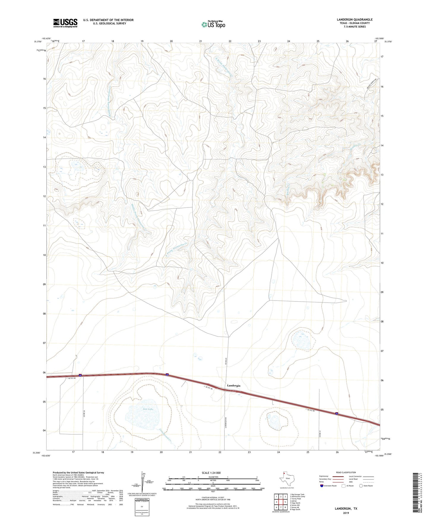
2022 topographic map quadrangle Landergin in the state of Texas. Scale: 1:24000. Based on the newly updated USGS 7.5' US Topo map series, this map is in the following counties: Oldham. The map contains contour data, water features, and other items you are used to seeing on USGS maps, but also has updated roads and other features. This is the next generation of topographic maps. Printed on high-quality waterproof paper with UV fade-resistant inks.
Quads adjacent to this one:
West: Adrian
Northwest: Big George Tank
North: Alamocitos Camp
Northeast: Torrey Peak
East: Vega North
Southeast: Vega South
South: Simms NE
Southwest: Simms NW
This map covers the same area as the classic USGS quad with code o35102c5.
Contains the following named places: Boney Windmill, Chugwater Windmill, Cottonwood Creek, East Camp Windmill, Gist Lake, Landergin, Old Headquarters Windmill, Scharbauer Ranch, Shipping Pasture Windmill