MyTopo
Town Bluff Texas US Topo Map
Couldn't load pickup availability
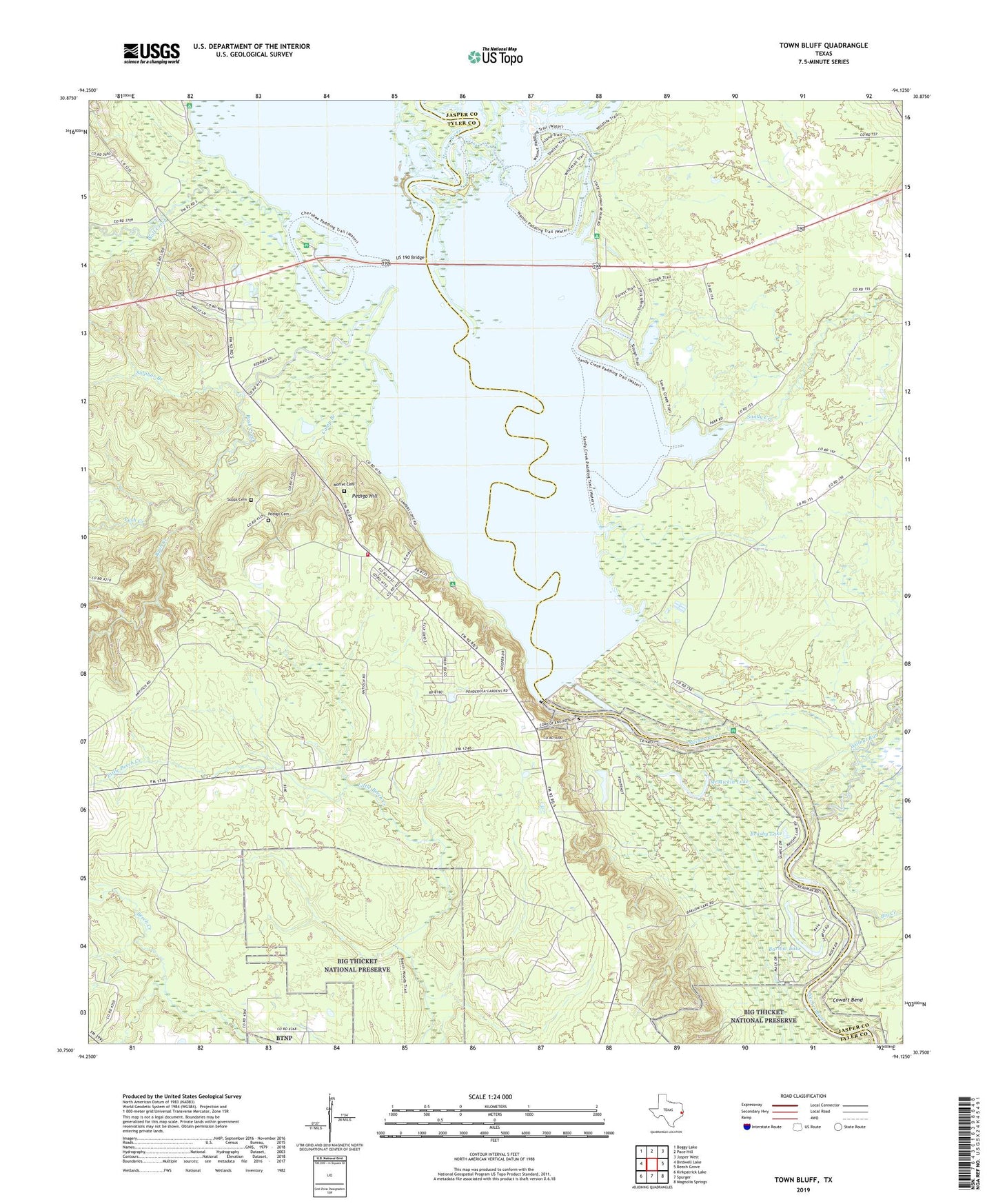
2019 topographic map quadrangle Town Bluff in the state of Texas. Scale: 1:24000. Based on the newly updated USGS 7.5' US Topo map series, this map is in the following counties: Tyler, Jasper. The map contains contour data, water features, and other items you are used to seeing on USGS maps, but also has updated roads and other features. This is the next generation of topographic maps. Printed on high-quality waterproof paper with UV fade-resistant inks.
Quads adjacent to this one:
West: Birdwell Lake
Northwest: Boggy Lake
North: Pace Hill
Northeast: Jasper West
East: Beech Grove
Southeast: Magnolia Springs
South: Spurger
Southwest: Kirkpatrick Lake
Contains the following named places: B A Steinhagen Lake, Barlow Lake, Beech Grove Campground, Big Creek, Brushy Lake, Camp Branch, Cowart Bend, Dam - B Volunteer Fire Department, Fairview Church, Martin Dies Junior State Park, Martin Dies State Park Trail, McMickin Lake, Moffet Cemetery, Pedigo Cemetery, Pedigo Hill, Pole Bridge Creek, Push Creek, Rush Creek, Sandy Creek, Sulphur Branch, Supps Cemetery, Town Bluff, Town Bluff Dam, Tuckers Branch, US 190 Bridge, Walnut Run, Wolf Creek