MyTopo
Birdwell Lake Texas US Topo Map
Couldn't load pickup availability
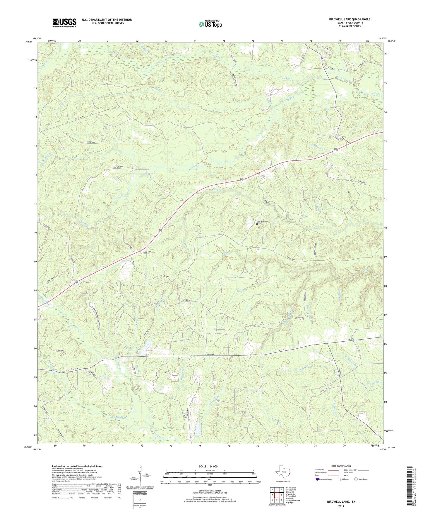
2022 topographic map quadrangle Birdwell Lake in the state of Texas. Scale: 1:24000. Based on the newly updated USGS 7.5' US Topo map series, this map is in the following counties: Tyler. The map contains contour data, water features, and other items you are used to seeing on USGS maps, but also has updated roads and other features. This is the next generation of topographic maps. Printed on high-quality waterproof paper with UV fade-resistant inks.
Quads adjacent to this one:
West: Woodville
Northwest: Colmesneil
North: Boggy Lake
Northeast: Pace Hill
East: Town Bluff
Southeast: Spurger
South: Kirkpatrick Lake
Southwest: Hillister
This map covers the same area as the classic USGS quad with code o30094g3.
Contains the following named places: Allison Lake, Allison Lake Dam, Antioch Church, Birdwell Lake, Birdwell Lake Dam, Boar Branch, Brush Creek, Buzzard Creek, Clear Fork Creek, Dogwood Trail, Double Bridge Branch, Drunkards Branch, Dry Creek, Ebenezer Church, Emille, Hooker Branch, Hopewell Cemetery, Hopewell Church, Little Wolf Creek, Moss Hill Church, New Shady Grove Church, Ratcliff Branch, Red Branch, Reids Branch, Steep Hollow Branch, Still Branch, Tompkins Mill Creek, Victory Baptist Church, Wash Hole Branch, White Oak Branch