MyTopo
Toyahvale Texas US Topo Map
Couldn't load pickup availability
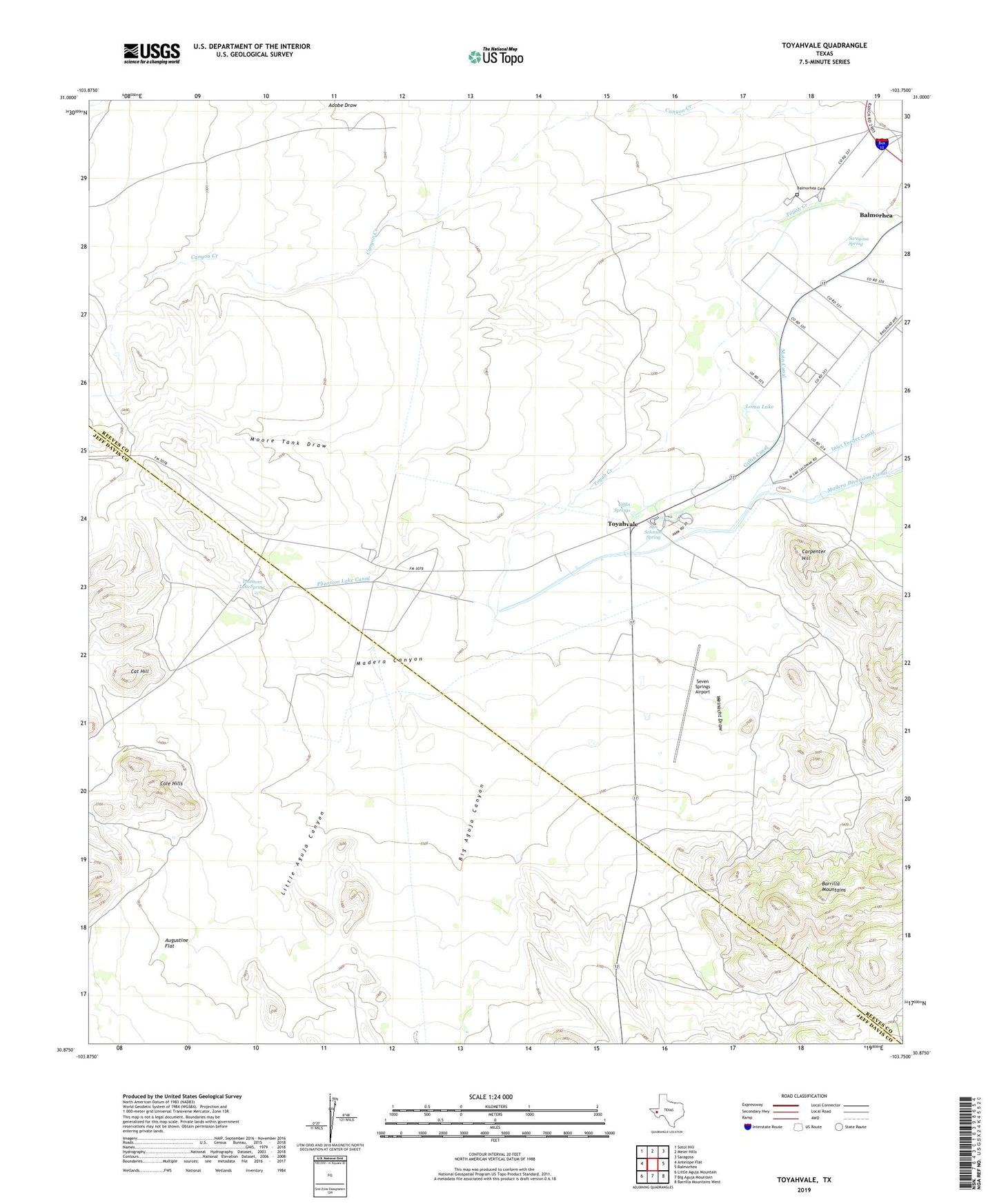
2019 topographic map quadrangle Toyahvale in the state of Texas. Scale: 1:24000. Based on the newly updated USGS 7.5' US Topo map series, this map is in the following counties: Reeves, Jeff Davis. The map contains contour data, water features, and other items you are used to seeing on USGS maps, but also has updated roads and other features. This is the next generation of topographic maps. Printed on high-quality waterproof paper with UV fade-resistant inks.
Quads adjacent to this one:
West: Antelope Flat
Northwest: Sotol Hill
North: Meier Hills
Northeast: Saragosa
East: Balmorhea
Southeast: Barrilla Mountains West
South: Big Aguja Mountain
Southwest: Little Aguja Mountain
Contains the following named places: Augustine Flat, Balmorhea Cemetery, Balmorhea State Park, Big Aguja Canyon, Carpenter Hill, Cat Hill, Cole Hills, Giffin Canal, Giffin Springs, High Windmill, Inlet Feeder Canal, Little Aguja Canyon, Loma Lake, Madera Canyon, Madera Diversion Canal, Main Canal, Moore Tank Draw, Old Place Windmill, Phantom Lake Canal, Phantom Lake Spring, Pueblo Vitoria, Saddleback Ranch Airport, San Solomon Creek, San Solomon Spring, Saragosa Spring, Seven Springs Airport, Toyahvale, Weinacht Draw