MyTopo
Balmorhea Texas US Topo Map
Couldn't load pickup availability
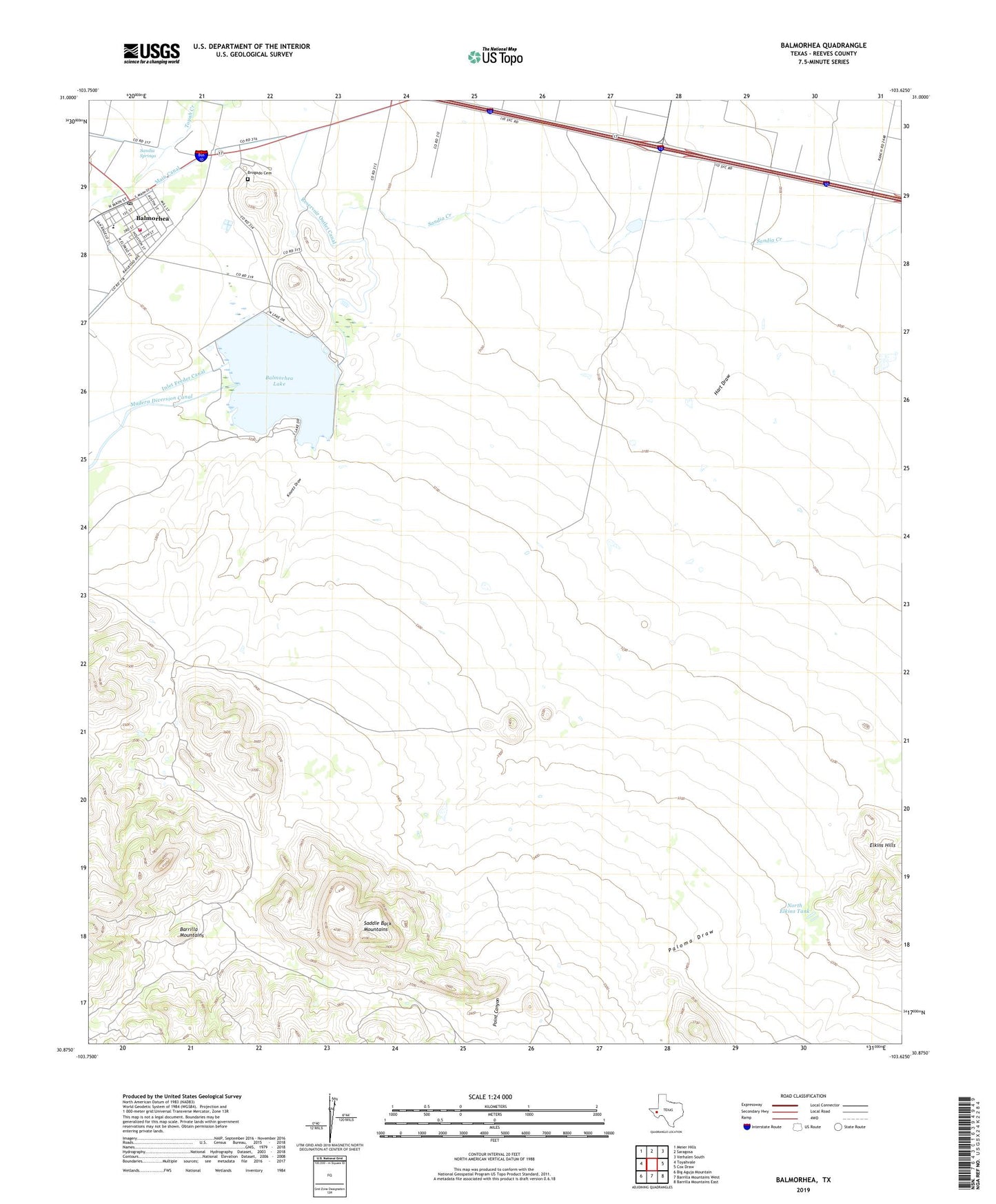
2022 topographic map quadrangle Balmorhea in the state of Texas. Scale: 1:24000. Based on the newly updated USGS 7.5' US Topo map series, this map is in the following counties: Reeves. The map contains contour data, water features, and other items you are used to seeing on USGS maps, but also has updated roads and other features. This is the next generation of topographic maps. Printed on high-quality waterproof paper with UV fade-resistant inks.
Quads adjacent to this one:
West: Toyahvale
Northwest: Meier Hills
North: Saragosa
Northeast: Verhalen South
East: Cox Draw
Southeast: Barrilla Mountains East
South: Barrilla Mountains West
Southwest: Big Aguja Mountain
This map covers the same area as the classic USGS quad with code o30103h6.
Contains the following named places: Bahmorhea School, Balmorhea, Balmorhea City Hall, Balmorhea Lake, Balmorhea Lake Dam, Balmorhea Post Office, Balmorhea Volunteer Emergency Medical Service, Balmorhea Volunteer Fire Department, Brogado Cemetery, City of Balmorhea, Hart Draw, Kountz Draw, Lake Balmorhea, North Elkins Tank, Point Canyon, Reservoir Outlet Canal, Saddle Back Mountains, Saddleback Ranch Number 2 Airport, Sandia Springs