MyTopo
Tunis Texas US Topo Map
Couldn't load pickup availability
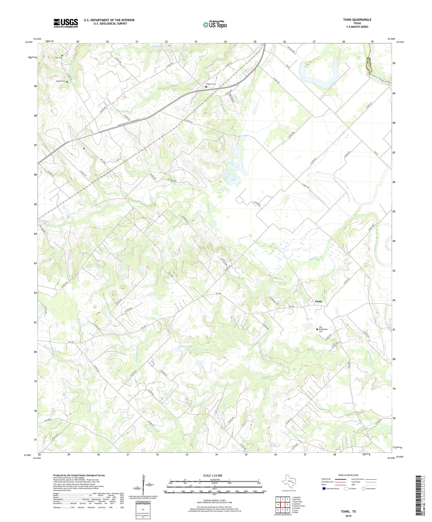
2019 topographic map quadrangle Tunis in the state of Texas. Scale: 1:24000. Based on the newly updated USGS 7.5' US Topo map series, this map is in the following counties: Burleson, Brazos. The map contains contour data, water features, and other items you are used to seeing on USGS maps, but also has updated roads and other features. This is the next generation of topographic maps. Printed on high-quality waterproof paper with UV fade-resistant inks.
Quads adjacent to this one:
West: Caldwell
Northwest: Goodwill
North: Mumford
Northeast: Bryan West
East: Chances Store
Southeast: Snook
South: Lyons
Southwest: Frenstat
Contains the following named places: Black Lake, Carr Cemetery, Cooks Point, Cooks Point School, Cooks Point Volunteer Fire Department, Deep Creek, Draper Cemetery, John the Baptist Church, KHEN-FM (Caldwell), Moelhman Slough, New Jerusalem Church, Old Bethlehem Cemetery, Old Bethlehem Church, Oldham Church, Palmer Lake, Palmer Lake Dam, Parker, Providence Church, Reed Creek, Salem Cemetery, San Salvador Church, Sessums Branch, Spot Taylor School, Tunis, Tunis Census Designated Place, Zion Hill Church