MyTopo
Caldwell Texas US Topo Map
Couldn't load pickup availability
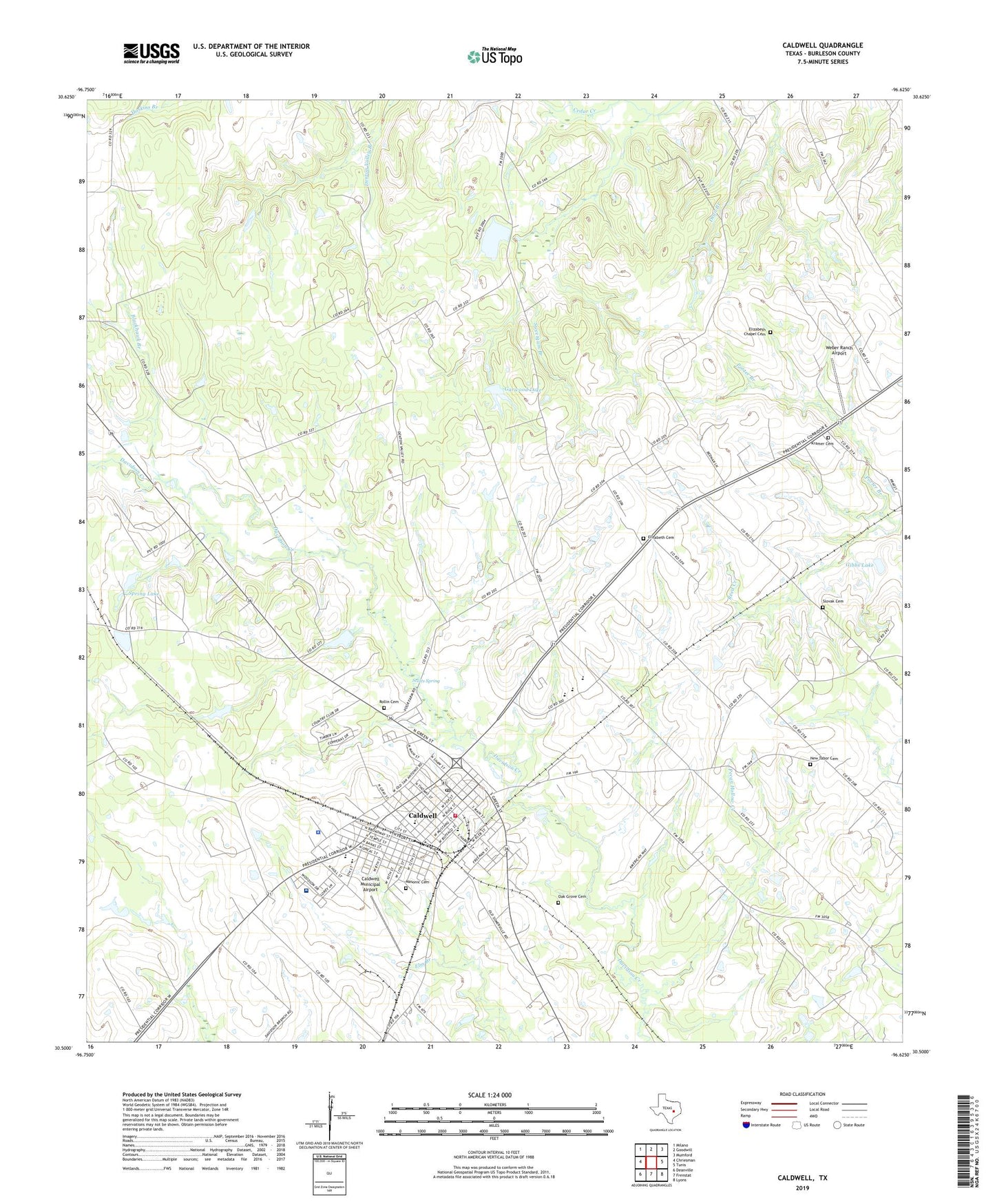
2022 topographic map quadrangle Caldwell in the state of Texas. Scale: 1:24000. Based on the newly updated USGS 7.5' US Topo map series, this map is in the following counties: Burleson. The map contains contour data, water features, and other items you are used to seeing on USGS maps, but also has updated roads and other features. This is the next generation of topographic maps. Printed on high-quality waterproof paper with UV fade-resistant inks.
Quads adjacent to this one:
West: Chriesman
Northwest: Milano
North: Goodwill
Northeast: Mumford
East: Tunis
Southeast: Lyons
South: Frenstat
Southwest: Deanville
This map covers the same area as the classic USGS quad with code o30096e6.
Contains the following named places: Blackhawk Branch, Burleson County Constable's Office Precinct 3, Burleson County Czech Heritage Museum, Burleson County Historical Museum, Burleson County Hospital Heliport, Burleson County Jail, Burleson Saint Joseph Health Center, Caldwell, Caldwell City Hall, Caldwell Elementary School, Caldwell Middle School, Caldwell Municipal Airport, Caldwell Police Department, Caldwell Post Office, Caldwell Volunteer Fire and Rescue Department, Calvary Church, City of Caldwell, Cooks Point Church, Cooks Point Division, Elizabeth Cemetery, Elizabeth Chapel Cemetery, Gallilee Church, Garwood Lake, Garwood Lake Dam, Gibbs Lake, Gibbs Lake Dam, Hus School, Kramer Cemetery, Lake Woodrow Dam, Masonic Cemetery, New Tabor Brethren Church, New Tabor Cemetery, Oak Grove Cemetery, Old City Cemetery, Pecan Hollow Creek, Porter Branch, Reeves-Womack House, Rollin Cemetery, Saint Marys Church, Scotts Spring, Seven Star Church, Slovak Cemetery, Spring Lake, Spring Lake Dam, Sweetgum Branch, Weber Ranch Airport, Woodrow Lake, ZIP Code: 77836