MyTopo
Valera Texas US Topo Map
Couldn't load pickup availability
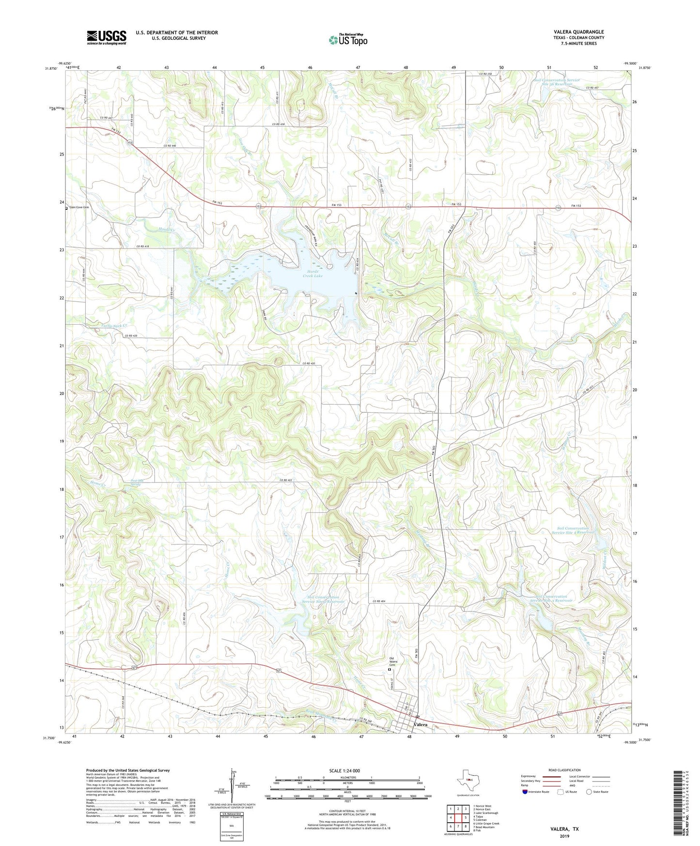
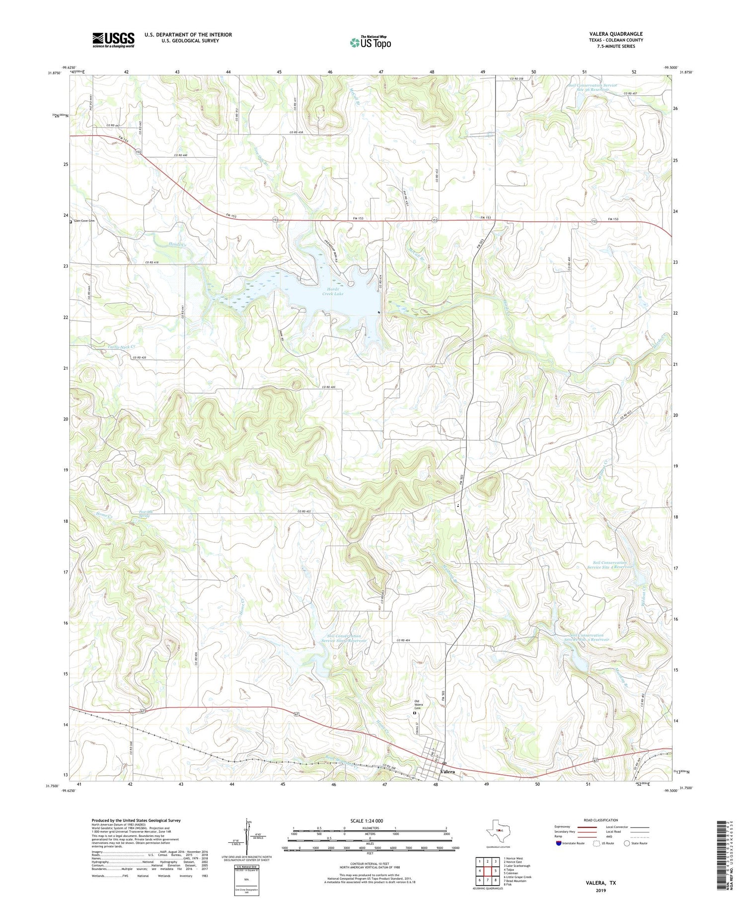
2019 topographic map quadrangle Valera in the state of Texas. Scale: 1:24000. Based on the newly updated USGS 7.5' US Topo map series, this map is in the following counties: Coleman. The map contains contour data, water features, and other items you are used to seeing on USGS maps, but also has updated roads and other features. This is the next generation of topographic maps. Printed on high-quality waterproof paper with UV fade-resistant inks.
Quads adjacent to this one:
West: Talpa
Northwest: Novice West
North: Novice East
Northeast: Lake Scarborough
East: Coleman
Southeast: Fisk
South: Bead Mountain
Southwest: Little Grape Creek
Contains the following named places: Bead Mountain Creek, Centennial School, Flat Rock Park, Friendship Park, Hords Creek Dam, Hords Creek Lake, Lakeside Park, Live Oak Branch, McCall Branch, Old Valera Cemetery, Post Oak Spring, Soil Conservation Service Site 2 Dam, Soil Conservation Service Site 2 Reservoir, Soil Conservation Service Site 3 Dam, Soil Conservation Service Site 3 Reservoir, Soil Conservation Service Site 36 Dam, Soil Conservation Service Site 36 Reservoir, Soil Conservation Service Site 4 Dam, Soil Conservation Service Site 4 Reservoir, Turtle Neck Creek, Valera, Valera Census Designated Place, Valera Post Office, Warner Oil Field