MyTopo
Bead Mountain Texas US Topo Map
Couldn't load pickup availability
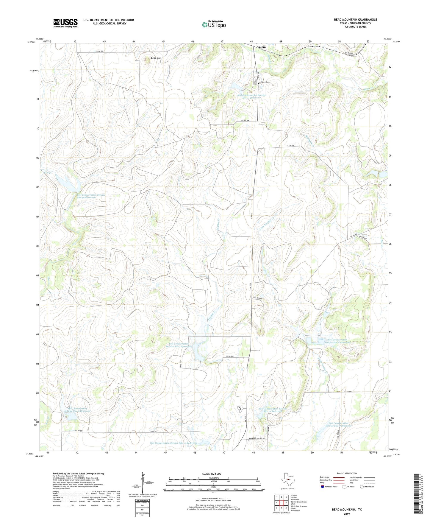
2022 topographic map quadrangle Bead Mountain in the state of Texas. Scale: 1:24000. Based on the newly updated USGS 7.5' US Topo map series, this map is in the following counties: Coleman. The map contains contour data, water features, and other items you are used to seeing on USGS maps, but also has updated roads and other features. This is the next generation of topographic maps. Printed on high-quality waterproof paper with UV fade-resistant inks.
Quads adjacent to this one:
West: Little Grape Creek
Northwest: Talpa
North: Valera
Northeast: Coleman
East: Fisk
Southeast: Gouldbusk
South: Voss
This map covers the same area as the classic USGS quad with code o31099f5.
Contains the following named places: Bead Mountain, Soil Conservation Service Site 10 Dam, Soil Conservation Service Site 10 Reservoir, Soil Conservation Service Site 11 Dam, Soil Conservation Service Site 11 Reservoir, Soil Conservation Service Site 5a Dam, Soil Conservation Service Site 5a Reservoir, Soil Conservation Service Site 6 Dam, Soil Conservation Service Site 6 Reservoir, Soil Conservation Service Site 7 Dam, Soil Conservation Service Site 7 Reservoir, Soil Conservation Service Site 8 Dam, Soil Conservation Service Site 8 Reservoir, Soil Conservation Service Site 9 Dam, Soil Conservation Service Site 9 Reservoir, Talpa Division, Valera Cemetery, Voss Cemetery, ZIP Code: 76884