MyTopo
Vealmoor Texas US Topo Map
Couldn't load pickup availability
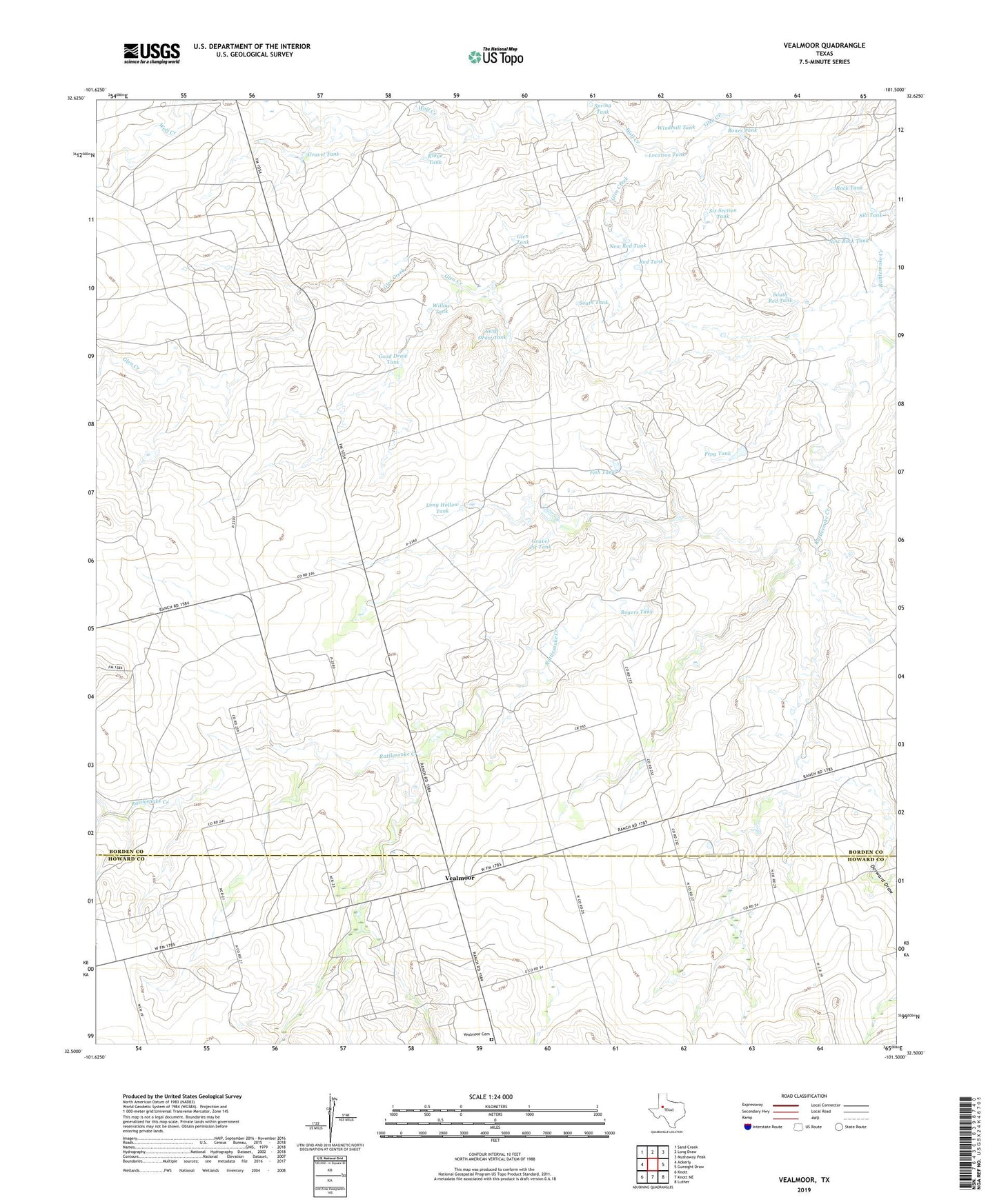
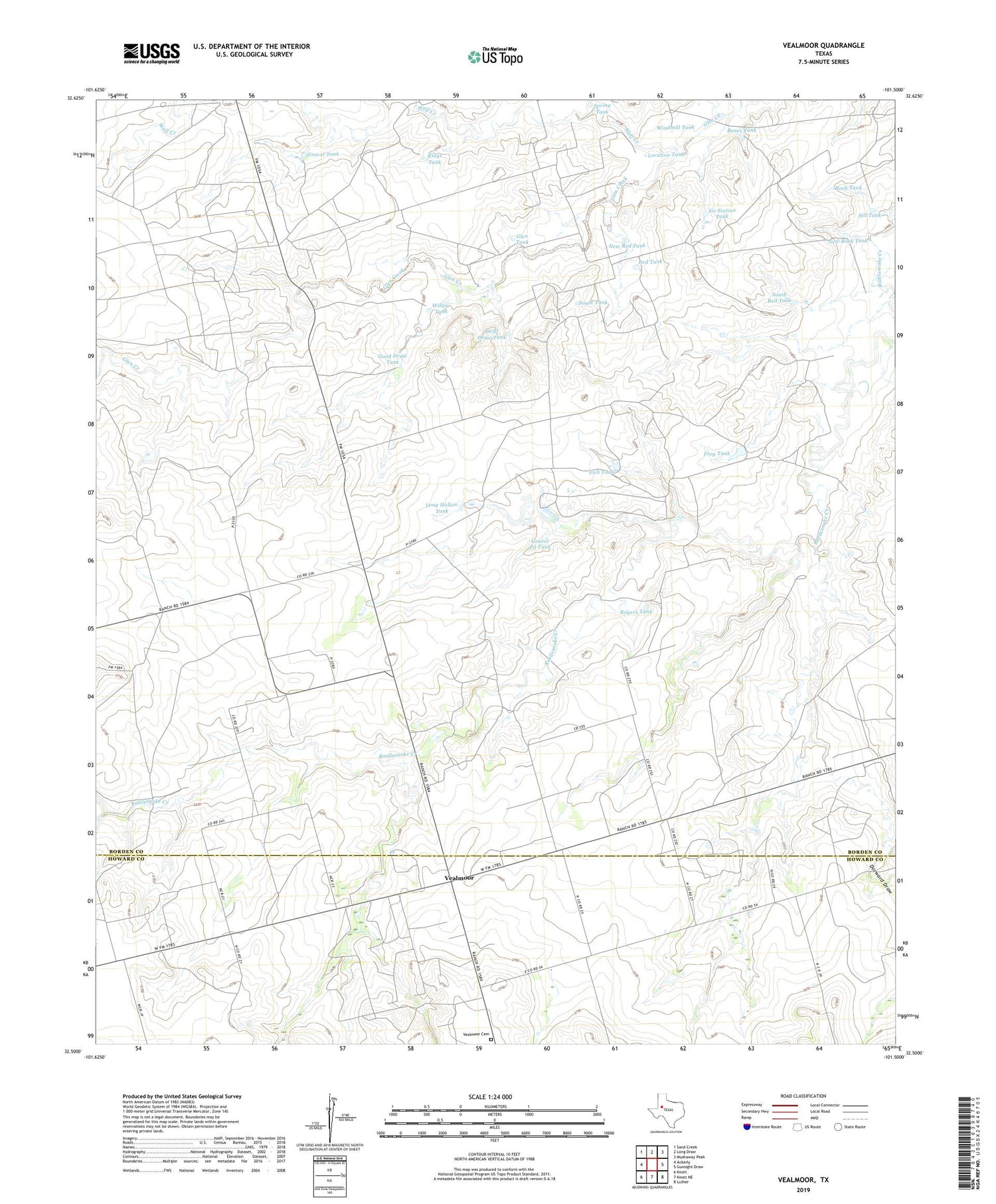
2019 topographic map quadrangle Vealmoor in the state of Texas. Scale: 1:24000. Based on the newly updated USGS 7.5' US Topo map series, this map is in the following counties: Borden, Howard. The map contains contour data, water features, and other items you are used to seeing on USGS maps, but also has updated roads and other features. This is the next generation of topographic maps. Printed on high-quality waterproof paper with UV fade-resistant inks.
Quads adjacent to this one:
West: Ackerly
Northwest: Sand Creek
North: Long Draw
Northeast: Mushaway Peak
East: Gunsight Draw
Southeast: Luther
South: Knott NE
Southwest: Knott
Contains the following named places: Bones Tank, Dorward Draw, Fish Tank, Frog Tank, Glen Tank, Good Draw Tank, Gravel Pit Tank, Gravel Tank, Jo Mill Oil Field, Location Tank, Long Hollow Tank, New Red Tank, New Rock Tank, Red Tank, Ridge Tank, Rock Tank, Rogers Tank, Silt Tank, Six Section Tank, South Red Tank, South Tank, Spring Tank, Swift Draw Tank, Vealmoor, Vealmoor Cemetery, Vealmoor Oil Field, Willow Tank, Windmill Tank, Wolf Creek