MyTopo
Mushaway Peak Texas US Topo Map
Couldn't load pickup availability
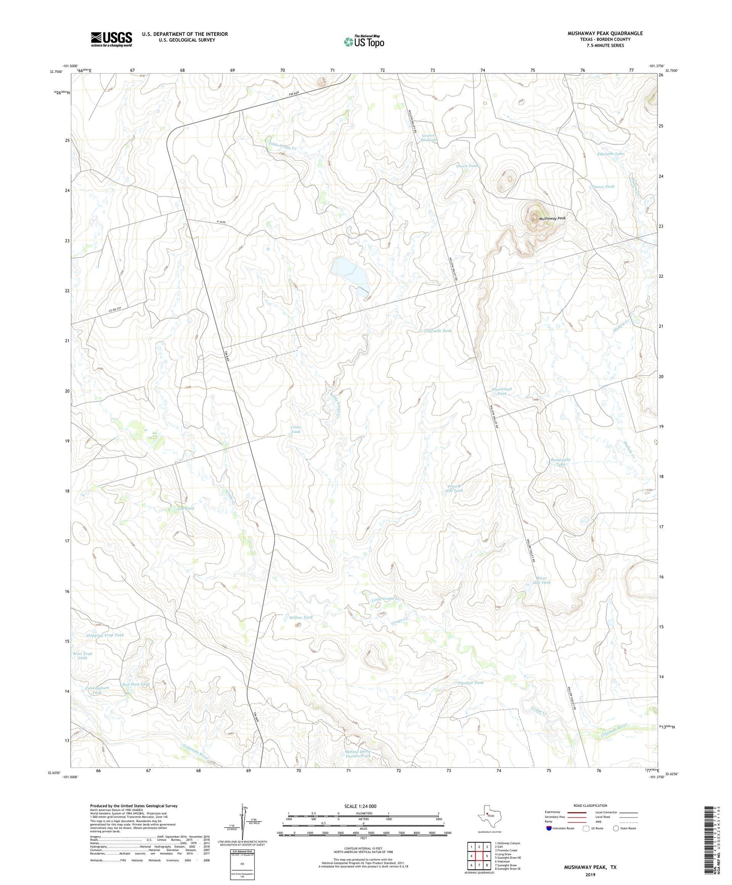
2022 topographic map quadrangle Mushaway Peak in the state of Texas. Scale: 1:24000. Based on the newly updated USGS 7.5' US Topo map series, this map is in the following counties: Borden. The map contains contour data, water features, and other items you are used to seeing on USGS maps, but also has updated roads and other features. This is the next generation of topographic maps. Printed on high-quality waterproof paper with UV fade-resistant inks.
Quads adjacent to this one:
West: Long Draw
Northwest: Holloway Canyon
North: Gail
Northeast: Fivemile Creek
East: Gunsight Draw NE
Southeast: Gunsight Draw SE
South: Gunsight Draw
Southwest: Vealmoor
This map covers the same area as the classic USGS quad with code o32101f4.
Contains the following named places: Behind Horse Pasture Tank, Bombsight Tank, Borden County, Coats Tank, Cunningham Tank, Edwards Lake, Edwards Lake Dam, Fourmile Tank, Gail South Division, Glen Creek, Grape Creek, Gravel Pit Tank, Green Tank, Jog Tank, Little Grape Creek, Mushaway Peak, Pipeline Tank, Prairie Hill Tank, Red Dam Tank, River Hill Tank, Shipping Trap Tank, Smoot Tank, Sourdough Tank, West Trap Tank, Willow Tank