MyTopo
Weimar Texas US Topo Map
Couldn't load pickup availability
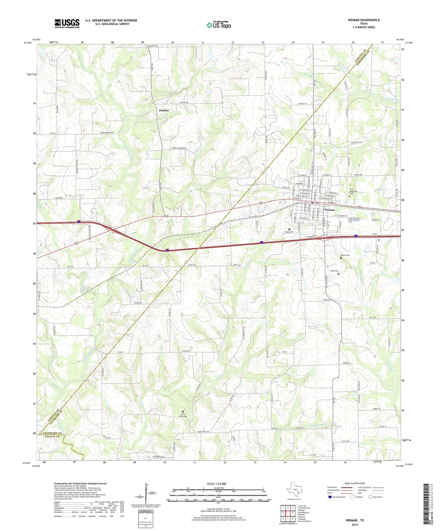
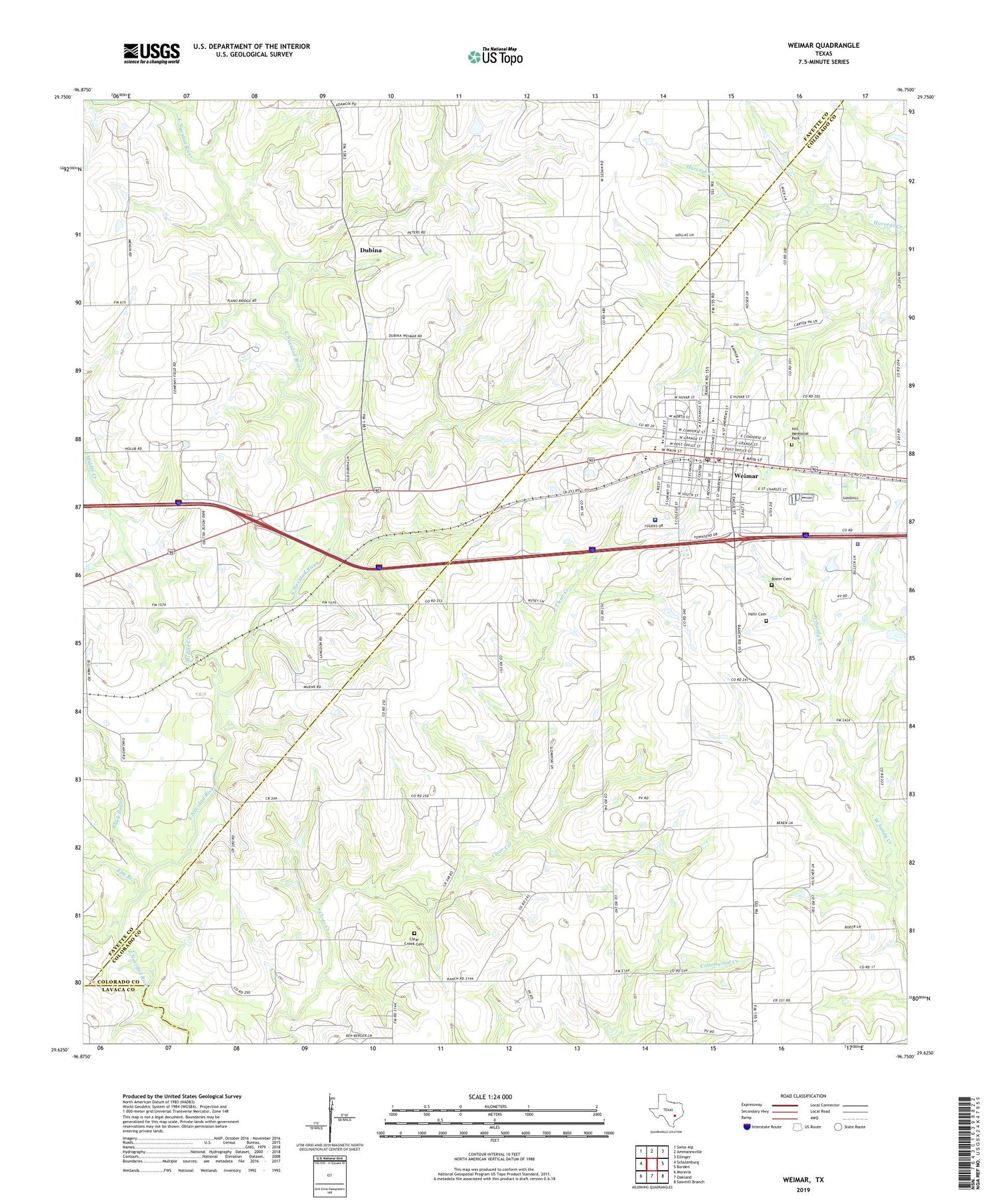
2019 topographic map quadrangle Weimar in the state of Texas. Scale: 1:24000. Based on the newly updated USGS 7.5' US Topo map series, this map is in the following counties: Colorado, Fayette, Lavaca. The map contains contour data, water features, and other items you are used to seeing on USGS maps, but also has updated roads and other features. This is the next generation of topographic maps. Printed on high-quality waterproof paper with UV fade-resistant inks.
Quads adjacent to this one:
West: Schulenburg
Northwest: Swiss Alp
North: Ammannsville
Northeast: Ellinger
East: Borden
Southeast: Sawmill Branch
South: Oakland
Southwest: Moravia
Contains the following named places: Black Bayou, Boeer Cemetery, City of Weimar, Clear Creek Cemetery, Colorado - Fayette Medical Center, Colorado County Constable's Office Precinct 2, Dubina, Elm Branch, Frisco Public Library, Hehr Cemetery, Hill Memorial Park, Maribelle M Davis Library, Middle Creek, New Bielau, New Bielau Community Center, Pleasant Hill Church, Renner Frankford Branch Library, Saint Cyril Church, Saint Michaels School, Schulenburg Division, Simon Pytlovany House, The Heritage Society Museum of Weimar, Trinity Church, Veterans Memorial Baseball Park, Weimar, Weimar City Hall, Weimar Elementary School, Weimar High School, Weimar Junior High School, Weimar Police Department, Weimar Post Office, Weimar Public Library, Weimar Volunteer Fire Department