MyTopo
Oakland Texas US Topo Map
Couldn't load pickup availability
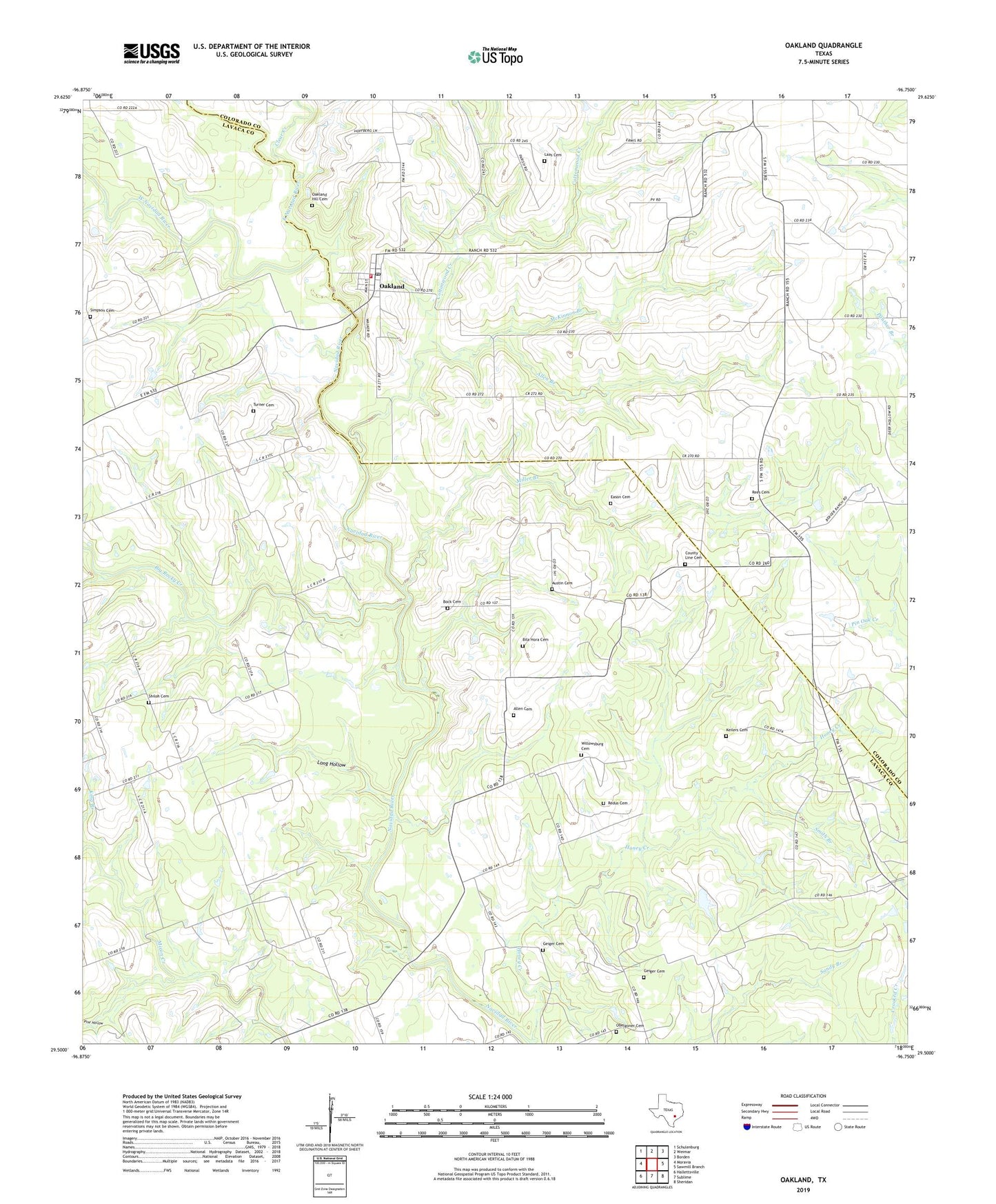
2022 topographic map quadrangle Oakland in the state of Texas. Scale: 1:24000. Based on the newly updated USGS 7.5' US Topo map series, this map is in the following counties: Lavaca, Colorado. The map contains contour data, water features, and other items you are used to seeing on USGS maps, but also has updated roads and other features. This is the next generation of topographic maps. Printed on high-quality waterproof paper with UV fade-resistant inks.
Quads adjacent to this one:
West: Moravia
Northwest: Schulenburg
North: Weimar
Northeast: Borden
East: Sawmill Branch
Southeast: Sheridan
South: Sublime
Southwest: Hallettsville
This map covers the same area as the classic USGS quad with code o29096e7.
Contains the following named places: Allen Branch, Allen Cemetery, Austin Cemetery, Big Rocky Creek, Bila Hora Cemetery, Bock Cemetery, Brown Chapel, Clear Creek, Cottonwood Creek, Eason Cemetery, East Navidad River, Fenner Ranch Airport, Geiger Cemetery, Honey Creek, Honey Creek Cemetery, Keilers Cemetery, King Branch, Laas Cemetery, Long Hollow, McKinnon Branch, Miller Branch, Oakland, Oakland Hill Cemetery, Oakland Post Office, Oakland Volunteer Fire Department, Obelgoner Cemetery, Pine Hollow, Redus Cemetery, Rees Cemetery, Shiloh Cemetery, Shimek Cemetery, Simpson Cemetery, Smith Branch, Turner Cemetery, West Navidad River, Willowsburg Cemetery, ZIP Code: 78951