
MyTopo
West Texas US Topo Map
Couldn't load pickup availability
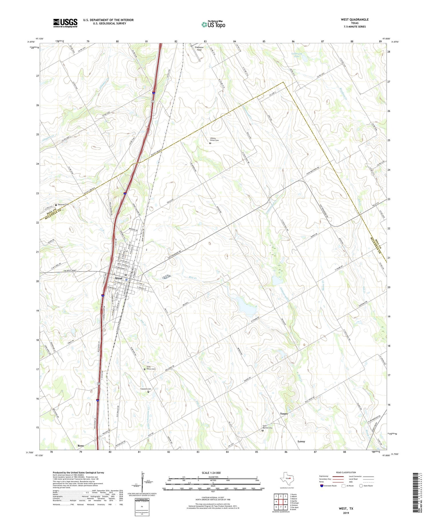
2019 topographic map quadrangle West in the state of Texas. Scale: 1:24000. Based on the newly updated USGS 7.5' US Topo map series, this map is in the following counties: McLennan, Hill. The map contains contour data, water features, and other items you are used to seeing on USGS maps, but also has updated roads and other features. This is the next generation of topographic maps. Printed on high-quality waterproof paper with UV fade-resistant inks.
Quads adjacent to this one:
West: Aquilla
Northwest: Peoria
North: Abbott
Northeast: Malone
East: Penelope
Southeast: Axtell
South: Elm Mott
Southwest: Gholson
Contains the following named places: Air Evac Lifeteam 51, Bold Springs Baptist Church, Church of Christ of West, City of West, Clausner Cemetery, Cottonwood, Cottonwood Creek, First Baptist Church of West, Galbraith Lake, Galbraith Lake Dam, Grade Stabilization Structure 103 Reservoir, Hillcrest Medical Center at West, Liberty Grove Cemetery, McLennan County Constable's Office Precinct 3, National Cemetery, Opportunity Learning Center - West, Saint Martins Cemetery, Saint Martins School, Saint Mary's Cemetery, Saint Peters Church, Soil Conservation Service Grade Stabilization Structure 103, Soil Conservation Service Site 10 Dam, Soil Conservation Service Site 10 Reservoir, Soil Conservation Service Site 9 Dam, Soil Conservation Service Site 9 Reservoir, Tours, West, West Airpark, West Ambulance Service, West City Hall, West Elementary School, West High School, West Middle School, West Police Department, West Post Office, ZIP Code: 76691


