MyTopo
Abbott Texas US Topo Map
Couldn't load pickup availability
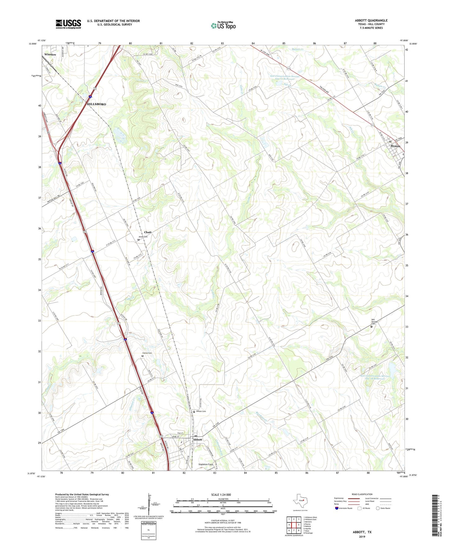
2022 topographic map quadrangle Abbott in the state of Texas. Scale: 1:24000. Based on the newly updated USGS 7.5' US Topo map series, this map is in the following counties: Hill. The map contains contour data, water features, and other items you are used to seeing on USGS maps, but also has updated roads and other features. This is the next generation of topographic maps. Printed on high-quality waterproof paper with UV fade-resistant inks.
Quads adjacent to this one:
West: Peoria
Northwest: Hillsboro West
North: Hillsboro East
Northeast: Mertens
East: Malone
Southeast: Penelope
South: West
Southwest: Aquilla
This map covers the same area as the classic USGS quad with code o31097h1.
Contains the following named places: Abbott, Abbott Cemetery, Abbott City Hall, Abbott Post Office, American Legion Park, Bell Springs Cemetery, Bynum, Bynum City Hall, Bynum Post Office, Chatt, City of Abbott, Fatima Cemetery, Grade Stabilization Structure 5-1 Reservoir, Hillsboro Division, Jessie Cemetery, Panther Field, Soil Conservation Service Grade Stabilization Structure 5-1, Soil Conservation Service Site 72 Dam, Soil Conservation Service Site 72 Reservoir, Soil Conservation Service Site 78 Dam, Soil Conservation Service Site 78 Reservoir, Stapleton Field, Town of Bynum, Winslow, ZIP Code: 76621