MyTopo
Peoria Texas US Topo Map
Couldn't load pickup availability
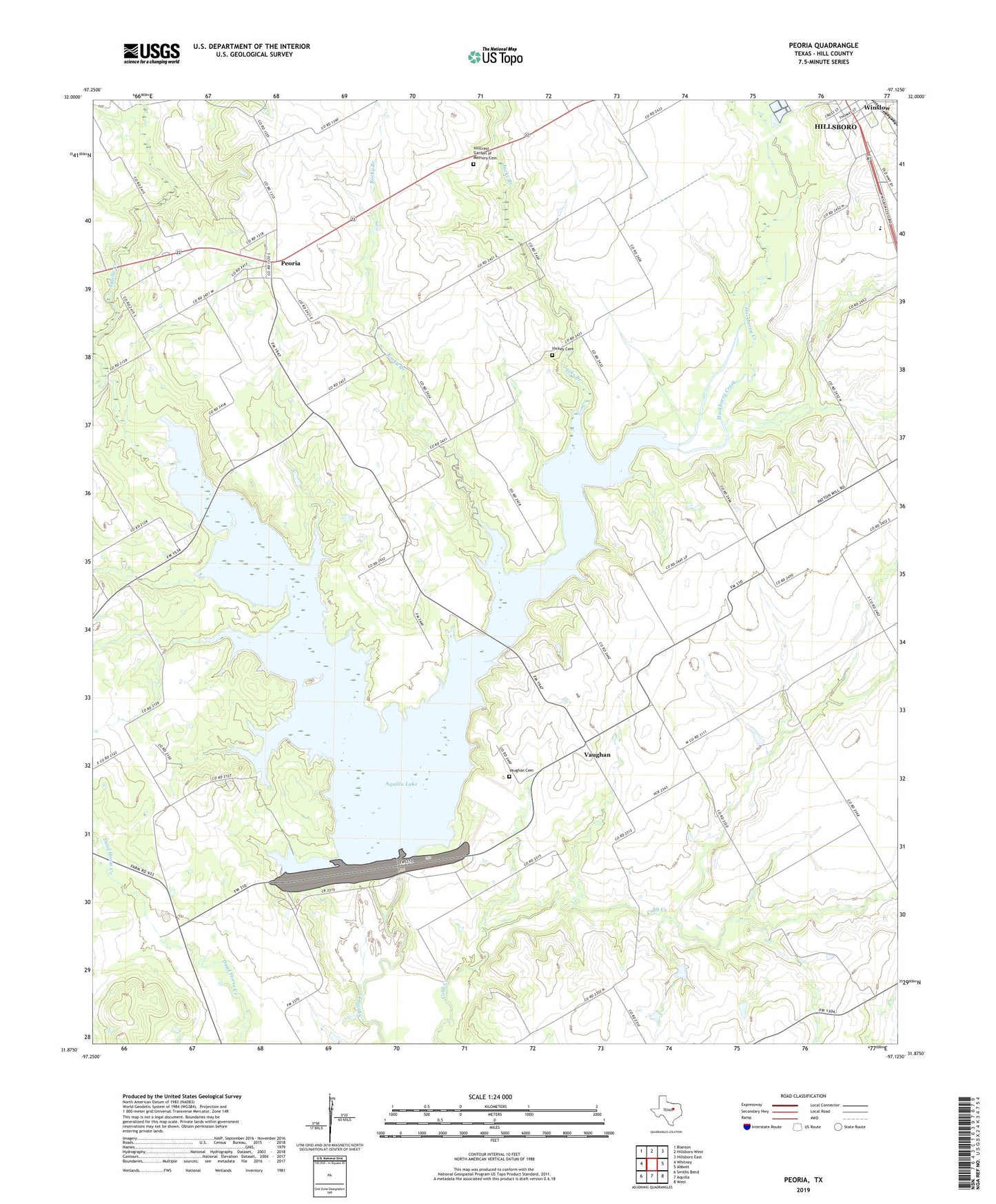
2022 topographic map quadrangle Peoria in the state of Texas. Scale: 1:24000. Based on the newly updated USGS 7.5' US Topo map series, this map is in the following counties: Hill. The map contains contour data, water features, and other items you are used to seeing on USGS maps, but also has updated roads and other features. This is the next generation of topographic maps. Printed on high-quality waterproof paper with UV fade-resistant inks.
Quads adjacent to this one:
West: Whitney
Northwest: Blanton
North: Hillsboro West
Northeast: Hillsboro East
East: Abbott
Southeast: West
South: Aquilla
Southwest: Smiths Bend
This map covers the same area as the classic USGS quad with code o31097h2.
Contains the following named places: Aquilla Dam, Aquilla Lake, Culp School, Hackberry Creek, Hickey Cemetery, Hill County, Hillcrest Garden of Memory Cemetery, Jacks Branch, Little Aquilla Creek, Peoria, Rocky Branch, Union Bluff, Vaughan, Vaughan Cemetery