MyTopo
White Draw NW Texas US Topo Map
Couldn't load pickup availability
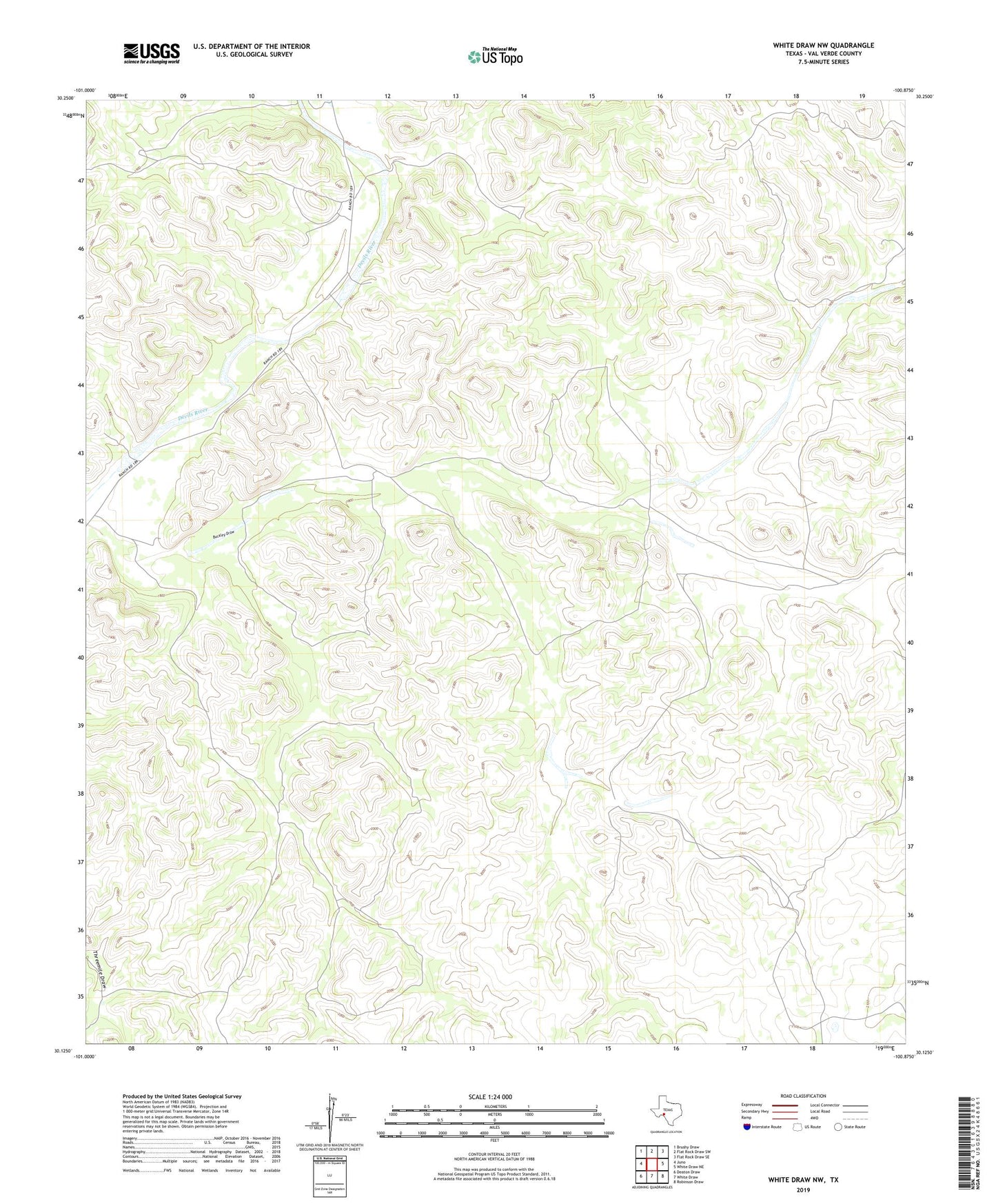
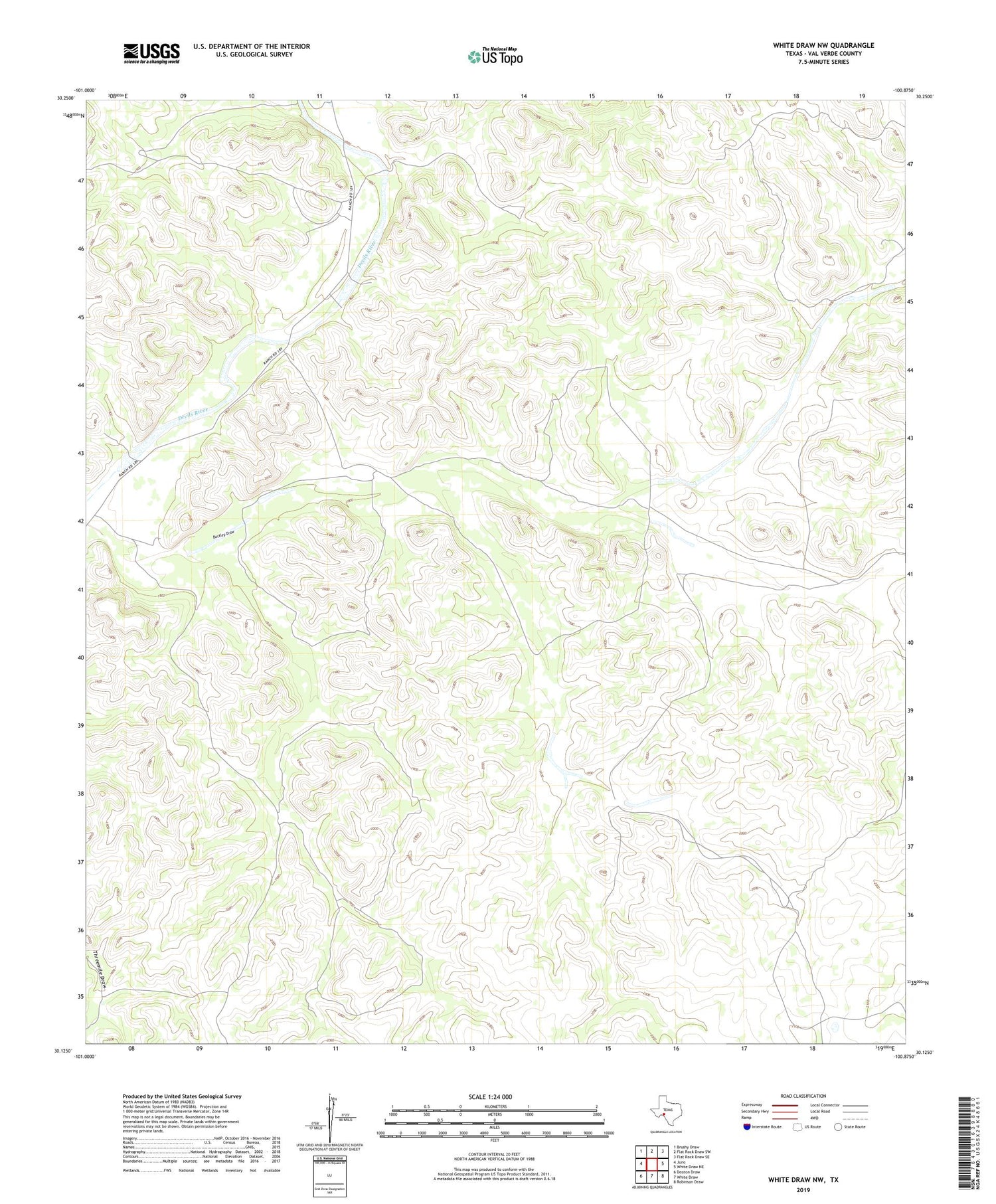
2019 topographic map quadrangle White Draw NW in the state of Texas. Scale: 1:24000. Based on the newly updated USGS 7.5' US Topo map series, this map is in the following counties: Val Verde. The map contains contour data, water features, and other items you are used to seeing on USGS maps, but also has updated roads and other features. This is the next generation of topographic maps. Printed on high-quality waterproof paper with UV fade-resistant inks.
Quads adjacent to this one:
West: Juno
Northwest: Brushy Draw
North: Flat Rock Draw SW
Northeast: Flat Rock Draw SE
East: White Draw NE
Southeast: Robinson Draw
South: White Draw
Southwest: Deaton Draw
Contains the following named places: Boone Windmill, Buckley Draw, Buckley Windmill, Corner Windmill, Divide Well, Drisdale Ranch, Four Section Windmill, House Well Number Two, Little Monroe Windmill, Little Windmill, Monroe Windmill, Murrah Windmill, South Windmill, Taylor Ranch, West Boone Windmill, West Pasture Windmill