MyTopo
White Draw Texas US Topo Map
Couldn't load pickup availability
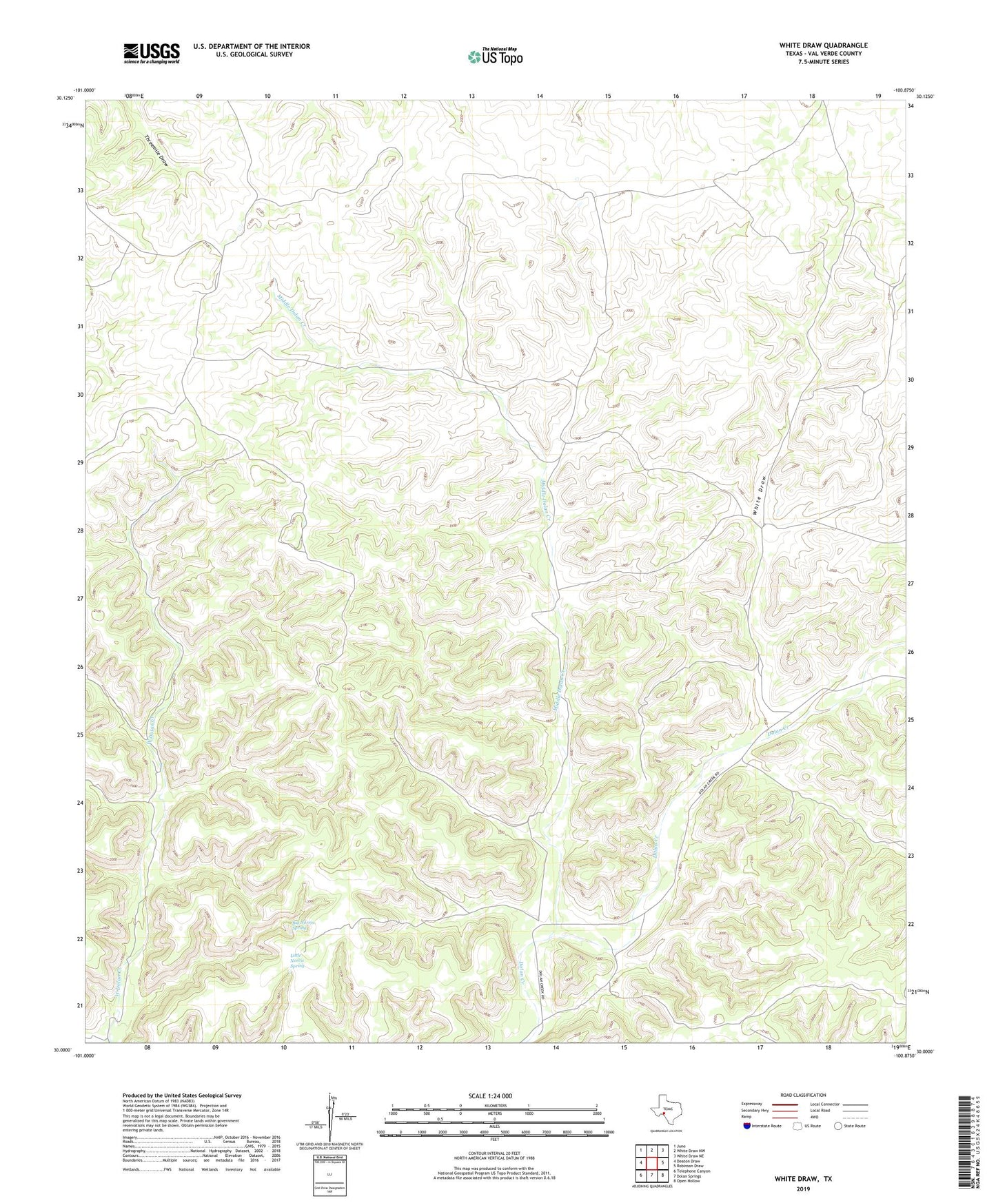
2022 topographic map quadrangle White Draw in the state of Texas. Scale: 1:24000. Based on the newly updated USGS 7.5' US Topo map series, this map is in the following counties: Val Verde. The map contains contour data, water features, and other items you are used to seeing on USGS maps, but also has updated roads and other features. This is the next generation of topographic maps. Printed on high-quality waterproof paper with UV fade-resistant inks.
Quads adjacent to this one:
West: Deaton Draw
Northwest: Juno
North: White Draw NW
Northeast: White Draw NE
East: Robinson Draw
Southeast: Open Hollow
South: Dolan Springs
Southwest: Telephone Canyon
This map covers the same area as the classic USGS quad with code o30100a8.
Contains the following named places: Big Norris Spring, Broke Tank Windmills, Brown Windmill, Carlos Windmill, East Horsely Windmill, East Spring Windmill, Fawcett Ranch, Header Tank Windmill, High Lonesome Ranch, Juana Windmill, Jug Windmill, Little Norris Spring, Lower Newell Windmill, Middle Dolan Creek, Newell Windmill, Oil Well Windmill, Old White Windmill, Spring Windmill, White Draw, White Ranch, White Windmill, Windmill Number Two