MyTopo
Juno Texas US Topo Map
Couldn't load pickup availability
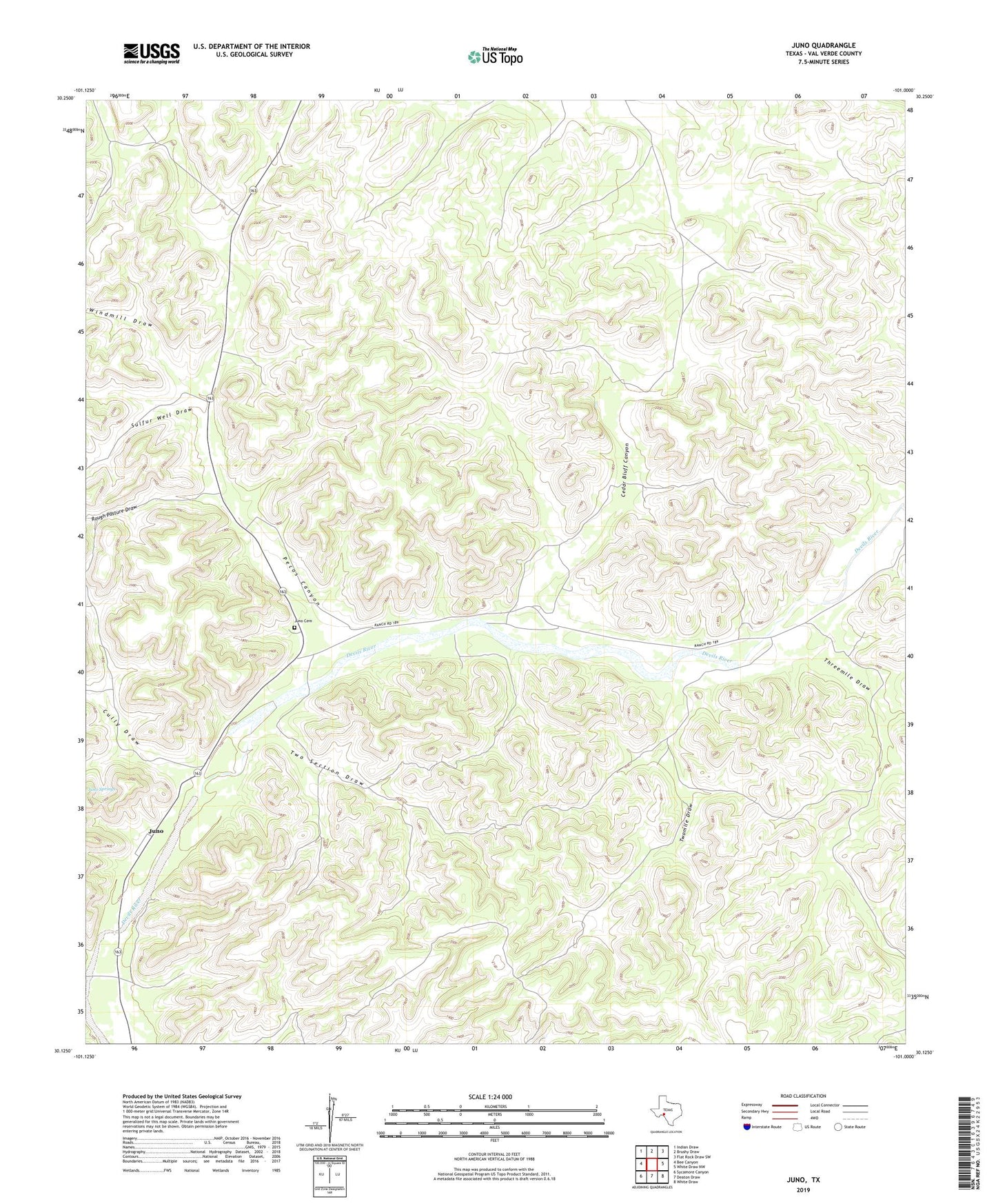
2022 topographic map quadrangle Juno in the state of Texas. Scale: 1:24000. Based on the newly updated USGS 7.5' US Topo map series, this map is in the following counties: Val Verde. The map contains contour data, water features, and other items you are used to seeing on USGS maps, but also has updated roads and other features. This is the next generation of topographic maps. Printed on high-quality waterproof paper with UV fade-resistant inks.
Quads adjacent to this one:
West: Bee Canyon
Northwest: Indian Draw
North: Brushy Draw
Northeast: Flat Rock Draw SW
East: White Draw NW
Southeast: White Draw
South: Deaton Draw
Southwest: Sycamore Canyon
This map covers the same area as the classic USGS quad with code o30101b1.
Contains the following named places: Beaver Lake Ranch, Bull Windmill, Cedar Bluff Canyon, Cedar Bluff Windmill, Cully Draw, Cully Windmill, East Lake Windmill, East Windmill, Hill Trap Windmill, Juno, Juno Cemetery, Middle Pasture Windmill, North Five Windmill, Oil Well Windmill, Pecos Canyon, Pecos Canyon Ranch, Rough Pasture Draw, Sulfur Well Draw, Threemile Draw, Two Section Draw, Two Section Windmill, Twomile Draw, Twomile Windmill, West Lake Windmill, White Well, Windmill Draw, Windy Point Windmill