MyTopo
Whitesboro Texas US Topo Map
Couldn't load pickup availability
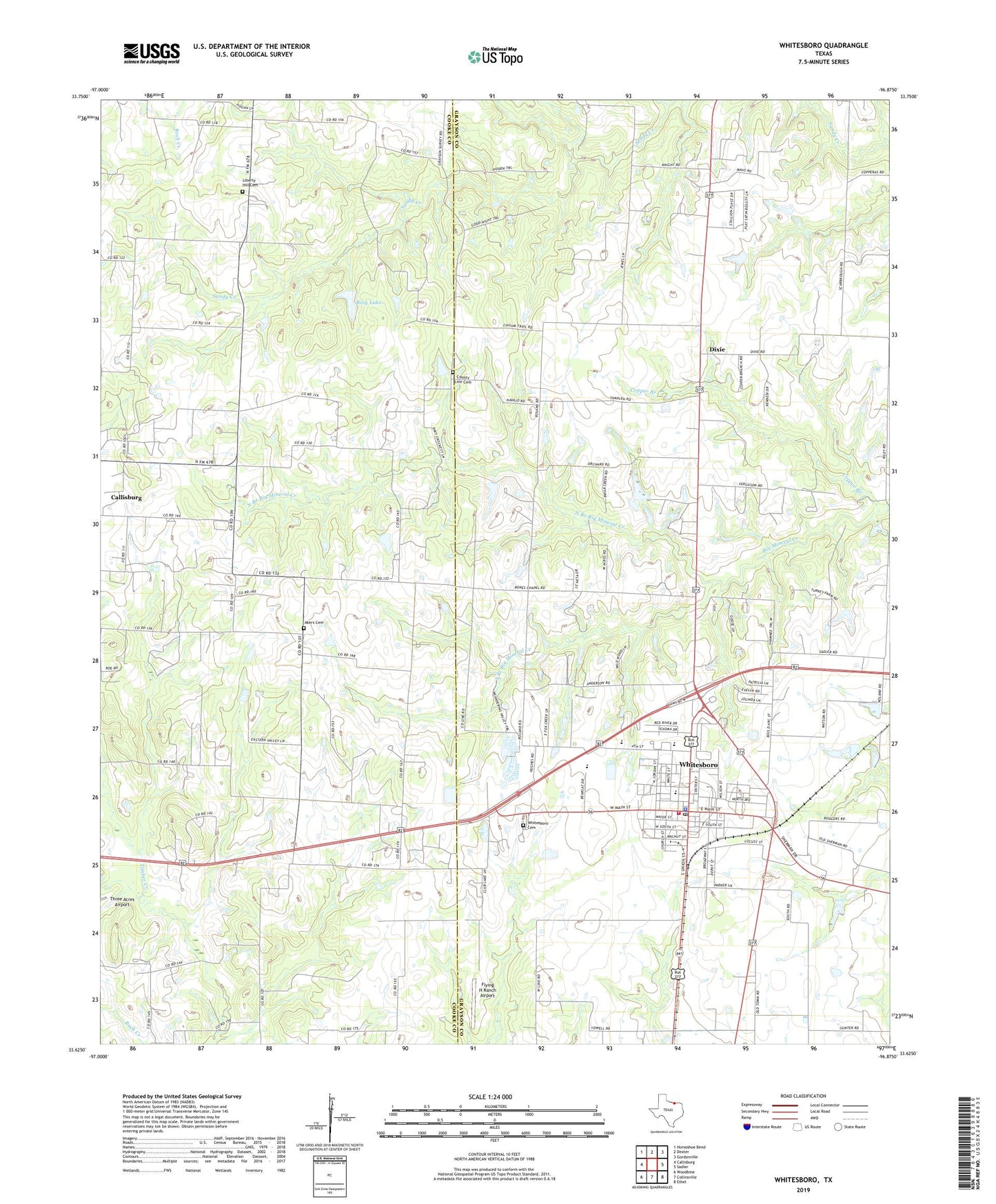
2019 topographic map quadrangle Whitesboro in the state of Texas. Scale: 1:24000. Based on the newly updated USGS 7.5' US Topo map series, this map is in the following counties: Grayson, Cooke. The map contains contour data, water features, and other items you are used to seeing on USGS maps, but also has updated roads and other features. This is the next generation of topographic maps. Printed on high-quality waterproof paper with UV fade-resistant inks.
Quads adjacent to this one:
West: Callisburg
Northwest: Horseshoe Bend
North: Dexter
Northeast: Gordonville
East: Sadler
Southeast: Ethel
South: Collinsville
Southwest: Woodbine
Contains the following named places: Akers Cemetery, Balm, Bing Lake, Bing Lake Dam, Bones Chapel, Boston Farm Cemetery, Cannon Oil Field, Central Baptist Church, City of Whitesboro, Copper Branch, Diamond Cemetery, Dixie, Dixie Cemetery, Eastside Church of Christ, Eskew Cemetery, First Baptist Church, First Presbyterian Church, Flying H Ranch Airport, Grayson County Constable's Office Precinct 3, Harville Lake, Harville Lake Dam, Kimbell - Sims Oil Field, Kimbell Oil Field, K-K Oil Field, Liberty Hill Cemetery, North Branch Big Mineral Creek, North Union Street Church of Christ, Oakwood Cemetery, Shelden Oil Field, South Branch Big Mineral Creek, Southwest Sadler Oil Field, Texas Vital Care Emergency Medical Services, Theodore, Thompson Cemetery, Three Acres Airport, Union Church, United Church, Violott Church, West Sadler Oil Field, West Sandusky Oil Field, Westview Church, Whitesboro, Whitesboro City Hall, Whitesboro Elementary School, Whitesboro Fire Department, Whitesboro High School, Whitesboro Middle School, Whitesboro Oil Field, Whitesboro Police Department, Whitesboro Post Office, ZIP Code: 76273