MyTopo
Callisburg Texas US Topo Map
Couldn't load pickup availability
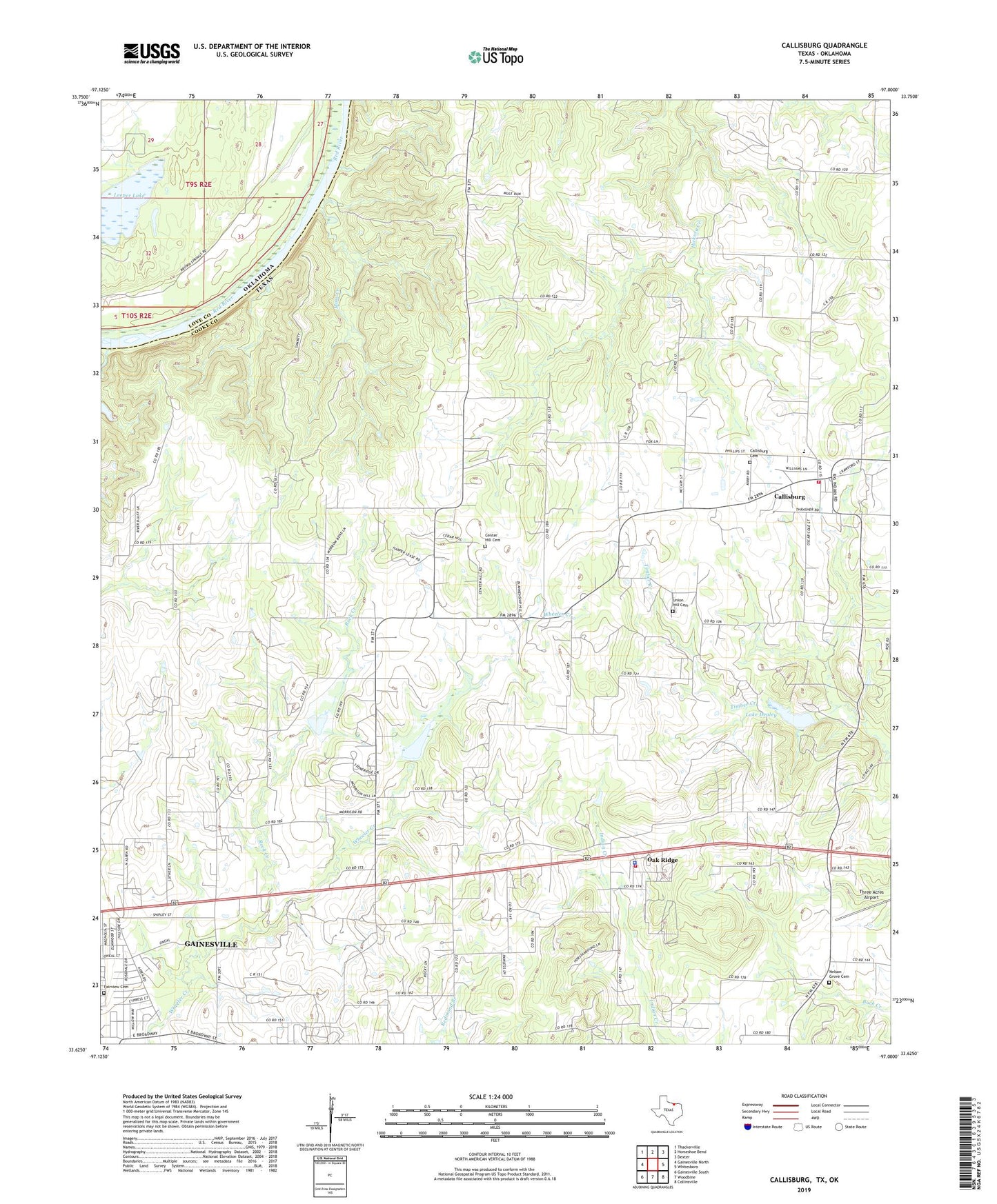
2022 topographic map quadrangle Callisburg in the states of Texas, Oklahoma. Scale: 1:24000. Based on the newly updated USGS 7.5' US Topo map series, this map is in the following counties: Cooke, Love. The map contains contour data, water features, and other items you are used to seeing on USGS maps, but also has updated roads and other features. This is the next generation of topographic maps. Printed on high-quality waterproof paper with UV fade-resistant inks.
Quads adjacent to this one:
West: Gainesville North
Northwest: Thackerville
North: Horseshoe Bend
Northeast: Dexter
East: Whitesboro
Southeast: Collinsville
South: Woodbine
Southwest: Gainesville South
This map covers the same area as the classic USGS quad with code o33097f1.
Contains the following named places: Callisburg, Callisburg Cemetery, Callisburg City Hall, Callisburg Oil Field, Callisburg Volunteer Fire Department, Camp Sweeney, Center Hill Cemetery, City of Callisburg, Custer City, Fairview Cemetery, Gainesville State School for Girls, House of Prayer Assembly of God Church, KGAF-AM (Gainesville), Lake Dealey, Lake Dealey Dam, Leeper Lake, Mass Creek, Nelson Grove Cemetery, Oak Ridge, Oak Ridge Police Department, Oak Ridge Volunteer Fire Department, Rock Creek, Soil Conservation Service Site 11b Dam, Soil Conservation Service Site 11b Reservoir, Soil Conservation Service Site 12 Dam, Soil Conservation Service Site 12 Reservoir, Spring Grove Church, Town of Oak Ridge, Union Hill Cemetery