MyTopo
Horseshoe Bend Texas US Topo Map
Couldn't load pickup availability
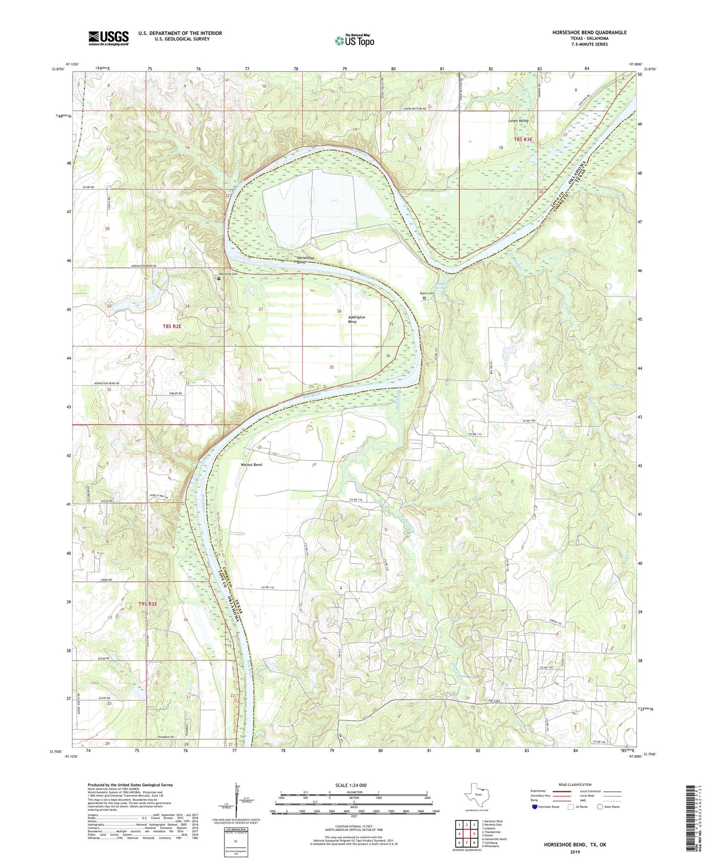
2022 topographic map quadrangle Horseshoe Bend in the states of Texas, Oklahoma. Scale: 1:24000. Based on the newly updated USGS 7.5' US Topo map series, this map is in the following counties: Cooke, Love. The map contains contour data, water features, and other items you are used to seeing on USGS maps, but also has updated roads and other features. This is the next generation of topographic maps. Printed on high-quality waterproof paper with UV fade-resistant inks.
Quads adjacent to this one:
West: Thackerville
Northwest: Marietta West
North: Marietta East
Northeast: Lebanon
East: Dexter
Southeast: Whitesboro
South: Callisburg
Southwest: Gainesville North
This map covers the same area as the classic USGS quad with code o33097g1.
Contains the following named places: Addington Bend, Black Cemetery, Callisburg Division, Coesfield, Corcoran Creek, Decherds Cemetery, Dripping Spring, Hibbit Church, Hickory Creek, Horseshoe Bend, Horseshoe Bend Recreation Area, Love Valley Wildlife Managment Area, Rock Creek, Sycamore Creek, Tuttle Branch, Walnut Bend, Walnut Bend Elementary School, Walnut Bend Oil Field, Walnut Bend School