MyTopo
Woodbine Texas US Topo Map
Couldn't load pickup availability
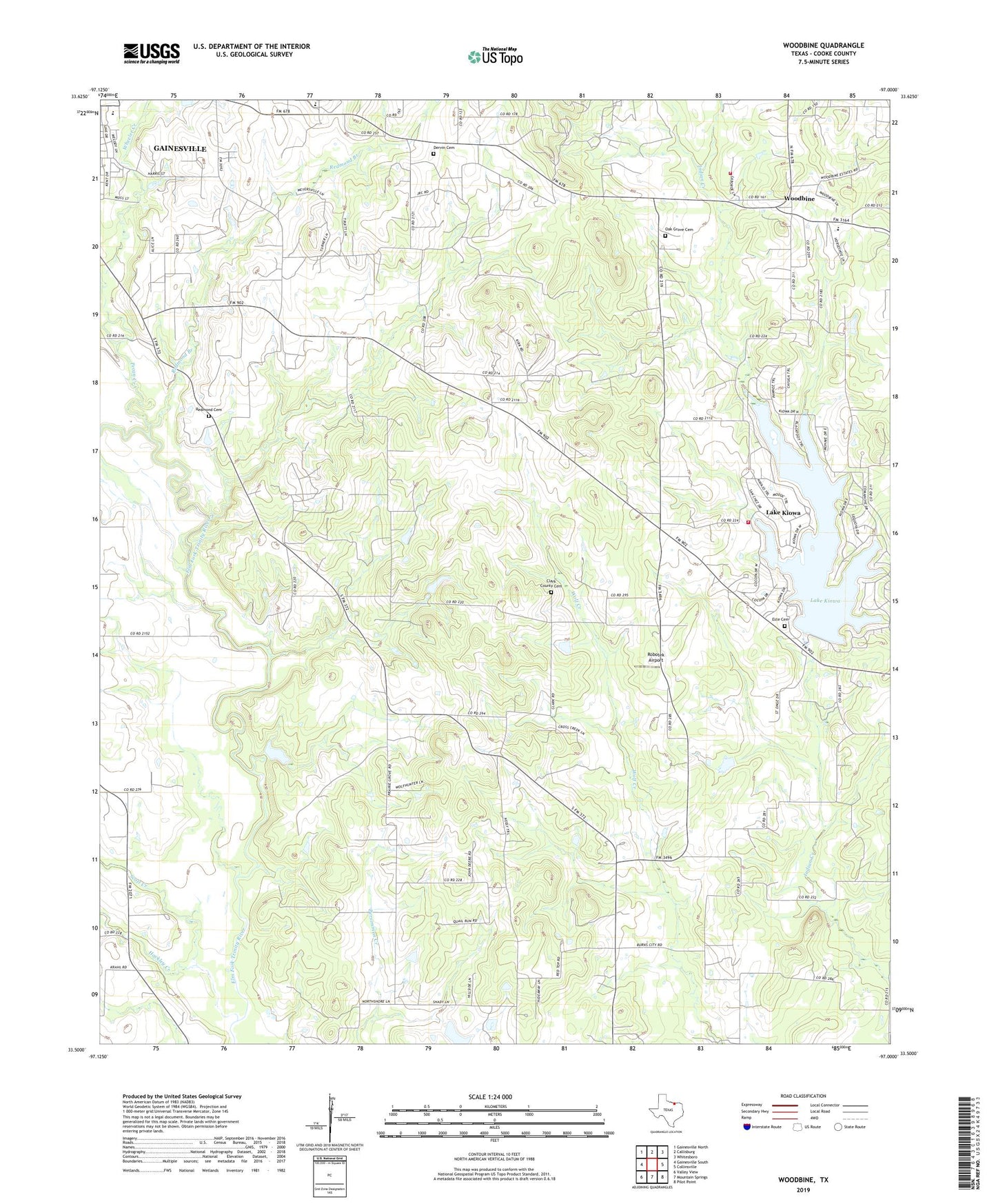
2019 topographic map quadrangle Woodbine in the state of Texas. Scale: 1:24000. Based on the newly updated USGS 7.5' US Topo map series, this map is in the following counties: Cooke. The map contains contour data, water features, and other items you are used to seeing on USGS maps, but also has updated roads and other features. This is the next generation of topographic maps. Printed on high-quality waterproof paper with UV fade-resistant inks.
Quads adjacent to this one:
West: Gainesville South
Northwest: Gainesville North
North: Callisburg
Northeast: Whitesboro
East: Collinsville
Southeast: Pilot Point
South: Mountain Springs
Southwest: Valley View
Contains the following named places: Anderson-Kerr Oil Field, Burns City, Clark County Cemetery, Dervin Cemetery, Dye Church, Edison Elementary School, Este Cemetery, Gainesville Southeast Division, Hackley Creek, Indian Creek Volunteer Fire Department, KDGE-FM (Gainesville), Lake Kiowa, Lake Kiowa Census Designated Place, Lake Kiowa Dam, Lake Kiowa Volunteer Fire Department Station 2, Mount Lebanon Church, New Hope Church, Oak Grove Cemetery, Pecan Creek, Prairie Grove Baptist Church, Prairie Grove Church, Rad Ware Elementary School, Rad Ware School, Redmond Branch, Redmond Cemetery, Robotek Airport, Scott Creek, Shady Grove Church, Site of Fort Fitzhugh, Soil Conservation Service Site 16b Dam, Soil Conservation Service Site 16b Reservoir, Temple Baptist Church, Temple Church, The Wilson Pool, Wheeler Creek, Woodbine