MyTopo
Pilot Point Texas US Topo Map
Couldn't load pickup availability
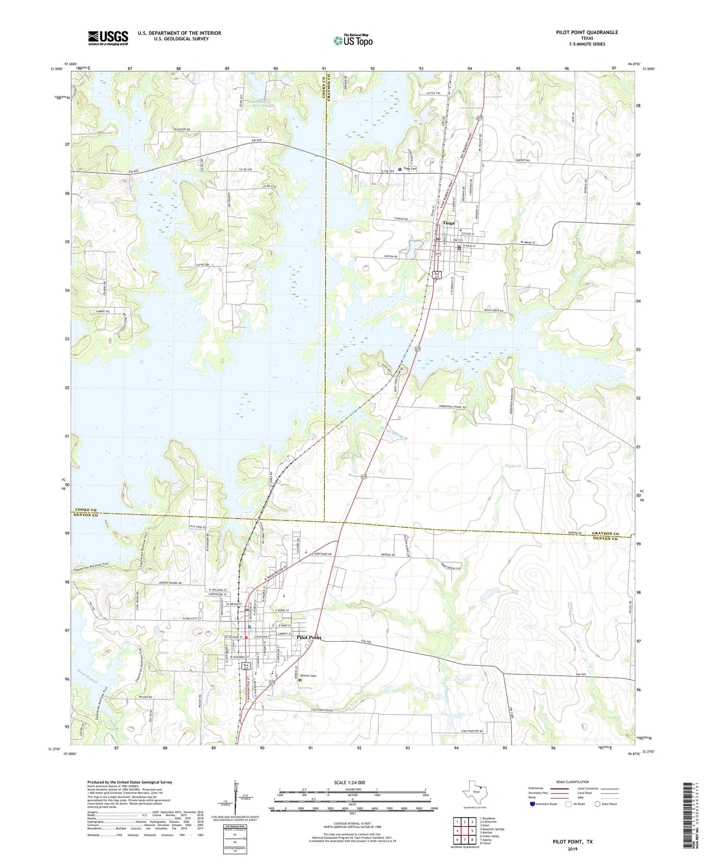
2022 topographic map quadrangle Pilot Point in the state of Texas. Scale: 1:24000. Based on the newly updated USGS 7.5' US Topo map series, this map is in the following counties: Grayson, Denton, Cooke. The map contains contour data, water features, and other items you are used to seeing on USGS maps, but also has updated roads and other features. This is the next generation of topographic maps. Printed on high-quality waterproof paper with UV fade-resistant inks.
Quads adjacent to this one:
West: Mountain Springs
Northwest: Woodbine
North: Collinsville
Northeast: Ethel
East: Marilee
Southeast: Celina
South: Aubrey
Southwest: Green Valley
This map covers the same area as the classic USGS quad with code o33096d8.
Contains the following named places: B and L Ranch Dam, B and L Ranch Lake, Bible Chapel, Buck Creek, Caldwell Lake, Caldwell Lake Dam, Church of the Nazarene, City of Pilot Point, Emberson Chapel Cemetery, Fair Lake, Fair Lake Dam, First Assembly of God Church, First United Methodist Church of Pilot Point, Gee High School, Hammond Lake, Hammond Lake Dam, Indian Creek, Massey Stadium, Pierce Spring Branch, Pilot Point, Pilot Point Church of God in Christ, Pilot Point Commercial Historic District, Pilot Point Community Cemetery, Pilot Point Elementary School, Pilot Point Fire Department, Pilot Point High School, Pilot Point Memorial Cemetery, Pilot Point Police Department, Pilot Point Post Office, Pilot Point Selz Middle School, Robert W Henzler Dam, Robert W Henzler Lake, Saint James Church, Saint Thomas Cemetery, Saint Thomas School, Skinner Cemetery, Tioga, Tioga Cemetery, Tioga City Hall, Tioga Police Department, Tioga Post Office, Tioga School, Tioga Volunteer Fire Department, Tipton Chapel, Town of Tioga, Washington School, Wolf Creek, ZIP Code: 76271