MyTopo
Zapata Texas US Topo Map
Couldn't load pickup availability
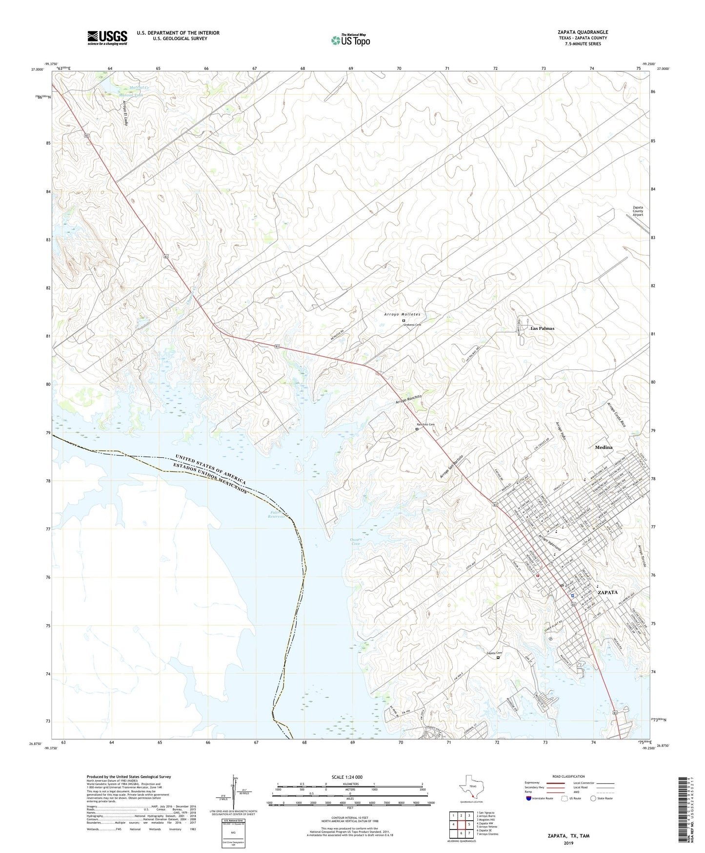
2019 topographic map quadrangle Zapata in the state of Texas. Scale: 1:24000. Based on the newly updated USGS 7.5' US Topo map series, this map is in the following counties: Zapata. The map contains contour data, water features, and other items you are used to seeing on USGS maps, but also has updated roads and other features. This is the next generation of topographic maps. Printed on high-quality waterproof paper with UV fade-resistant inks.
Quads adjacent to this one:
West: Zapata NW
Northwest: San Ygnacio
North: Arroyo Burro
Northeast: Mogotes Hill
East: Arroyo Veleno
Southeast: Arroyo Clareno
South: Zapata SE
Contains the following named places: A F Pierce Colonia, Arroyo El Ladio, Arroyo Molletes, Arroyo Ranchito, Arroyo San Bartolo, Arroyo Valeriano, Black Bass, Buena Vista Colonia, Buoy Number 10, Buoy Number 11, Buoy Number 12, Buoy Number 13, Buoy Number 14, Buoy Number 15, Buoy Number 16, Buoy Number 17, Buoy Number 3, Buoy Number 4, Buoy Number 5, Buoy Number 6, Buoy Number 7, Buoy Number 8, Buoy Number 9, Chapote Creek, Cuellar Colonia, Falcon Estates Colonia, Falcon Shores, Flores Addition Colonia, Guzman Colonia, Lakefront Lodge, Las Palmas, Las Palmas Census Designated Place, Linda Vista, Manuel Medina Addition Colonia, Marcial Tank, Med - One Ambulance Service, Medina, Medina Census Designated Place, Morgan's Lakefront Lodge Colonia, Old Uribano, Oscars Cove, Ranchito Cemetery, Ranchito San Jose Colonia, S Truman Phelps Colonia, United States Border Patrol Station, Urebeno, Urebeno Cemetery, Zapata, Zapata Air Force Station, Zapata Cemetery, Zapata Census Designated Place, Zapata County Fire Department, Zapata County Sheriff's Office, Zapata High School, Zapata Junior High School, Zapata Middle School, Zapata North Elementary School, Zapata Post Office, Zapata South Elementary School